Russian frigate fires flares at Danish helicopter in Baltic Sea near Gedser
What happened
A Russian frigate fired two flares at a Danish Air Force helicopter conducting a routine patrol near Gedser in the Baltic Sea on September 15. One flare passed in close proximity to the aircraft. The Danish crew remained unharmed and the helicopter sustained no damage. Denmark announced it would summon Russia's ambassador to protest the incident. Danish Defense Minister Bruus characterized the action as 'very unprofessional seamanship' and stressed that Russia had shifted its risk calculus in the region, while the Prime Minister described Russia's behavior as 'aggressive and assertive.'
Context and assessment
The Baltic Sea has become an increasingly contested zone as NATO members including Denmark monitor Russian military activity near their territorial waters and airspace. This incident occurred in Denmark's maritime zone off Gedser, a southern point of Zealand overlooking shipping lanes and critical submarine cables. The firing of flares—typically used for countermeasures against missiles—at a helicopter conducting lawful operations represents an unusually direct hostile act between a NATO member and Russia outside active conflict zones. Danish officials' language suggests concern that Russia is testing NATO's tolerance for provocative actions. The incident follows earlier reports of Russian aircraft or helicopter flare activity in the same area the same day, indicating sustained Russian military operations near Denmark's coast.
Sources and confidence
Reported by Telegram channel ClashReport on September 15. Currently single-source reporting limits independent verification; Danish government statements through Defense Minister Bruus and Prime Minister provide official confirmation of the incident and Danish response. Confidence score of 7 reflects official Danish acknowledgment of the event and consistent details, though the underlying military details rely on a single initial source. Corroboration from additional NATO or Danish military statements, or Russian acknowledgment, would increase confidence.
Location
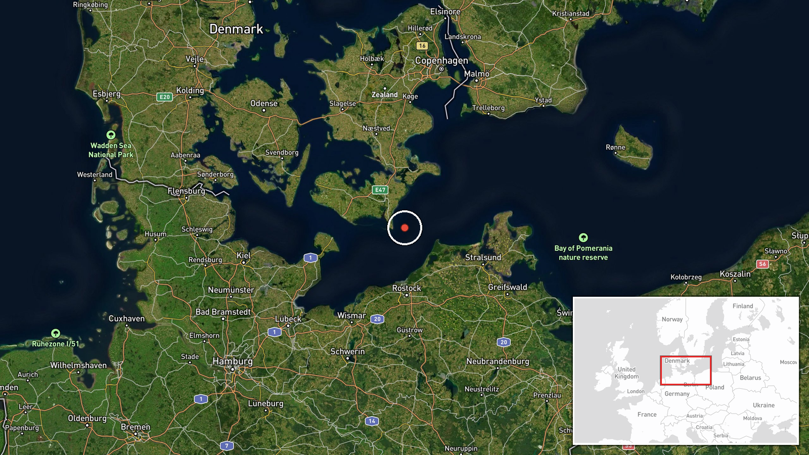
Gedser is located at the southern tip of Zealand, Denmark's largest island, approximately 54.57°N, 12.11°E. The settlement overlooks the Baltic Sea and sits near major maritime chokepoints and submarine cable routes. The coordinates indicate a coastal settlement area; the actual incident occurred in nearby waters during a routine NATO patrol zone.
Related events nearby
- Russian military helicopter or aircraft fired flares at a Danish military helicopter near Gedser, Denmark. Thi2026-09-15 07:40 UTC · Combat Aircraft · Gedser, Denmark
▶ View this event on the live map
Intel Mapper aggregates open-source reports from monitored Telegram and X channels, geolocates them, cross-checks duplicates across sources and assigns a confidence score. Entries are updated as new confirmations arrive. Read how we verify events.