Iran claims air defense destroyed 53rd U.S. MQ-9 Reaper drone over Qeshm Island
What happened
Iran's Islamic Revolutionary Guard Corps (IRGC) claimed on 17 September that its air defense system intercepted and destroyed a U.S. MQ-9 Reaper drone over Qeshm Island in Hormozgan Province at 10:12 AM local time. The IRGC stated this represented the 53rd such U.S. drone destroyed by Iranian forces. The claim has not been independently verified by open-source intelligence or third-party confirmation.
Context and assessment
Qeshm Island, located in the strategic Strait of Hormuz region, sits on a key transit route for global maritime commerce and has hosted Iranian military installations. The reported intercept occurs amid escalating drone and missile activity in the Persian Gulf, following a documented Iranian attack on 16 September involving multiple drones and at least one ballistic missile against a U.S.-contracted vessel near the strait. These incidents suggest intensified Iranian air defense operations or possible increases in U.S. reconnaissance drone flights in disputed airspace. The cumulative claim of 53 destroyed drones, if accurate, would indicate a significant pattern of engagement.
Sources and confidence
Report sourced solely from Telegram channel @ClashReport on 17 September. The single-source basis and lack of corroboration from U.S. military statements, independent satellite imagery, or regional observers limits confidence. Verification would require U.S. acknowledgment of a lost aircraft, satellite imagery evidence, or cross-reporting by multiple independent channels. Iranian claims of drone destruction are routine; independent confirmation remains essential.
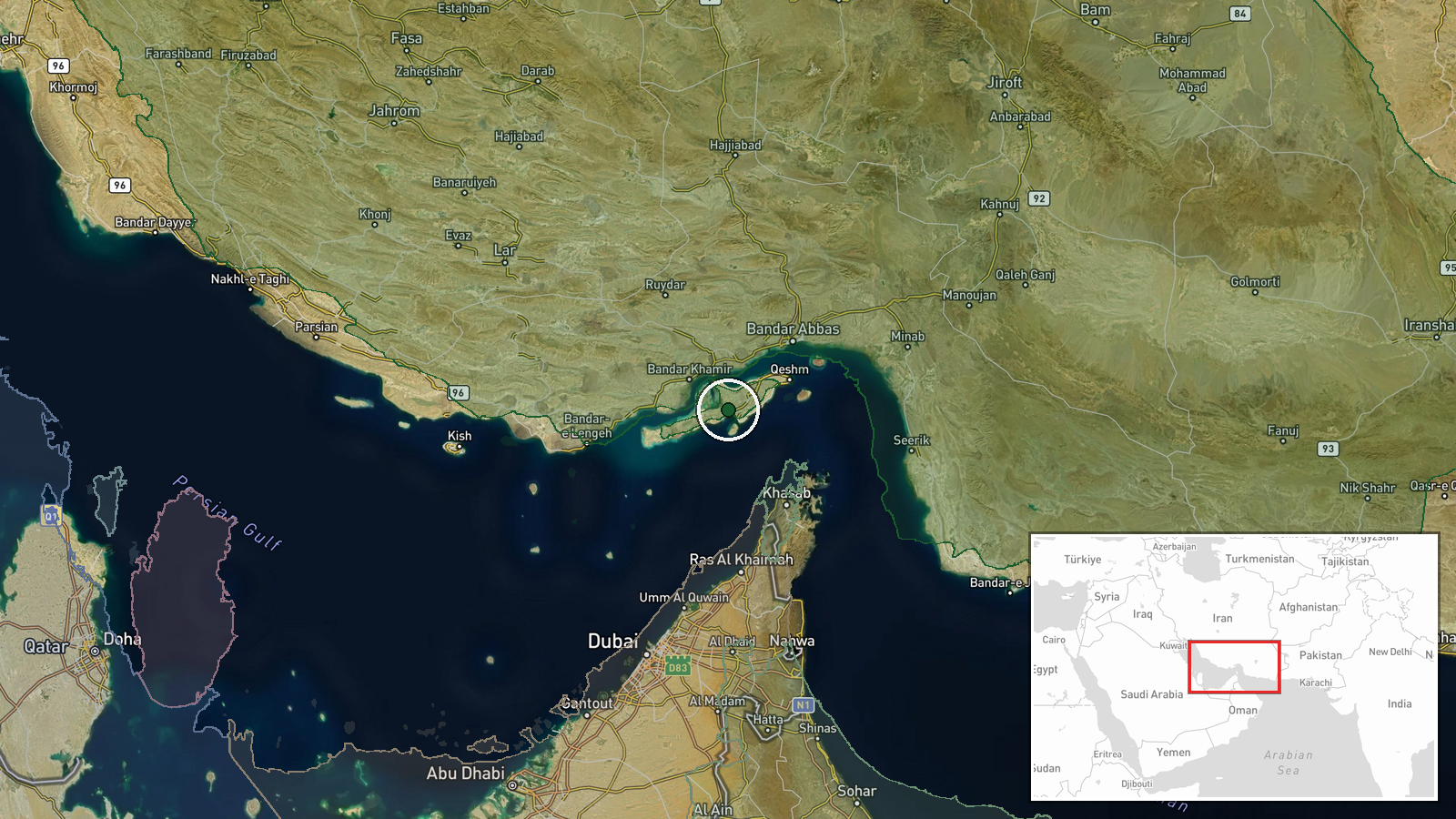
Location
Qeshm Island, the largest Iranian island in the Persian Gulf, is located in Hormozgan Province at approximately 26.77°N, 55.85°E. The island sits roughly 130 kilometers east of the Strait of Hormuz's narrowest point and has hosted Iranian naval and air defense facilities. Geographic precision is assessed as high, with the incident pinned to the settlement-level administrative area.
▶ View this event on the live map
Intel Mapper aggregates open-source reports from monitored Telegram and X channels, geolocates them, cross-checks duplicates across sources and assigns a confidence score. Entries are updated as new confirmations arrive. Read how we verify events.