Tanker struck by unknown projectile in Strait of Hormuz, engine room fire reported
What happened
A tanker operating in the Strait of Hormuz was reportedly struck by an unidentified projectile on 5 October, triggering a fire in the engine room, according to the UK Maritime Trade Operations (UKMTO). The report does not specify the vessel's flag state, cargo type, or extent of damage. UKMTO, the official maritime authority monitoring shipping incidents in the region, confirmed the incident via Telegram. Crew status remains unclear from available reporting.
Context and assessment
The Strait of Hormuz, a chokepoint through which roughly one-fifth of global seaborne oil transits, has faced intermittent maritime security incidents over recent years amid regional tensions. This incident follows a related report of an LPG tanker struck in the same waterway, suggesting a possible pattern of attacks on commercial shipping in the area. The projectile's origin and motive are unknown, complicating attribution. Unidentified maritime strikes in the Hormuz region have previously been linked to various state and non-state actors, though investigation remains preliminary.
Sources and confidence
UKMTO reported the incident via Telegram channel @ClashReport on 5 October. Confidence is moderate (7/10) due to single-source reporting; UKMTO is an authoritative maritime safety body but the incident description remains preliminary. Cross-confirmation from shipping industry sources or additional maritime authorities would strengthen confidence. Photographic or video evidence of damage would substantially raise confidence; contradictory reports or vessel denial would lower it.
Location
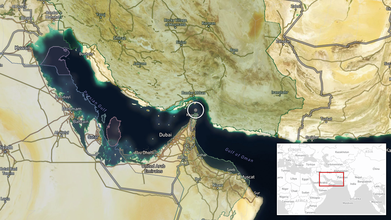
The Strait of Hormuz, located between Iran and Oman at approximately 26.55°N, 56.4°E, is the world's busiest maritime chokepoint. Precision is regional rather than site-specific; the exact coordinates mark the central waterway. The strait is bounded by rocky Iranian coastlines to the north and Omani territory to the south, with multiple shipping lanes and designated traffic separation schemes.
Related events nearby
- UK Maritime Trade Operations confirms LPG tanker struck by unknown projectile in Strait of Hormuz yesterday ev2026-10-05 14:36 UTC · Report · Strait of Hormuz
▶ View this event on the live map
Intel Mapper aggregates open-source reports from monitored Telegram and X channels, geolocates them, cross-checks duplicates across sources and assigns a confidence score. Entries are updated as new confirmations arrive. Read how we verify events.