Houthi drones attack Saudi airports in Jazan and Najran, injuring three
What happened
Unmanned aircraft reportedly struck airports in the Saudi cities of Jazan and Najran on the evening of Monday, 6 October, according to Saudi aviation authorities cited by Reuters. Three people were injured in the attacks, and limited infrastructure damage was reported. The strikes are consistent with Houthi operations against Saudi aviation targets, though no direct claim of responsibility was noted in available reporting.
Context and assessment
Jazan and Najran airports serve as civilian and military aviation hubs in southwestern Saudi Arabia, near the Yemen border. Houthi drone and missile strikes against Saudi infrastructure have intensified in recent years as part of the broader Yemen conflict. This attack occurred the same day Saudi fighter jets struck a reported Houthi ballistic missile depot in Yemen, suggesting a tactical escalation cycle. Such reciprocal strikes typically reflect efforts by both sides to degrade the other's military capability and demonstrate resolve, though they remain limited in scale compared to earlier phases of the conflict.
Sources and confidence
Reuters reported the incident via Telegram channel ClashReport on 6 October. Single-source reporting at initial stage limits independent cross-confirmation. Confidence score of 7.0 reflects Reuters's standing as a major international news agency and official Saudi statement attribution, though no secondary confirmation is evident in available data. Additional reporting from Saudi defense ministry or independent verification would raise confidence.
Location
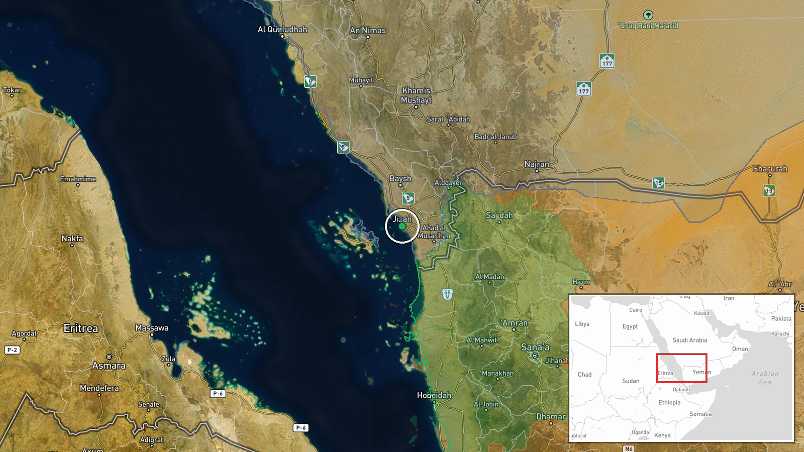
Jazan and Najran are distinct settlements in southwestern Saudi Arabia, roughly 200 km apart. Jazan sits near the Red Sea coast and Yemeni border; Najran lies inland at higher elevation. Both host civil airports with military facilities. Geographic precision is set at settlement level based on named city attribution rather than specific facility coordinates.
Related events nearby
- Saudi Arabian fighter jets struck a ballistic missile depot operated by Houthi forces in Yemen. The specific t2026-10-06 00:03 UTC · Airstrike · Yemen (Houthi-controlled territory)
▶ View this event on the live map
Intel Mapper aggregates open-source reports from monitored Telegram and X channels, geolocates them, cross-checks duplicates across sources and assigns a confidence score. Entries are updated as new confirmations arrive. Read how we verify events.