Ukrainian drones strike Russian supply depot in Crimea's Kyr-Bailary
What happened
Ukrainian forces reportedly destroyed a Russian military supply depot in Kyr-Bailary, Crimea, using unmanned aerial strike systems on August 31, 2026. The General Staff of the Armed Forces of Ukraine announced the operation via Telegram, describing the target as critical logistics infrastructure. No independent verification of damage assessment or casualties was immediately available from other sources.
Context and assessment
Kyr-Bailary, located in central Crimea, sits within territory occupied by Russian forces since 2014. Supply depots represent high-value targets in the ongoing conflict, as disrupting Russian logistics networks can constrain military operations across southern Ukraine and occupied territories. Ukraine has conducted repeated drone campaigns against rear-area Russian infrastructure, particularly ammunition and fuel storage facilities. Such strikes aim to degrade Russia's ability to sustain operations and resupply frontline forces, though the strategic impact depends on depot size, contents, and redundancy in Russian supply chains.
Sources and confidence
Report sourced solely to Ukraine's General Staff Telegram channel (@GeneralStaffZSU), with no cross-confirmation from independent observers, Russian statements, or international monitoring agencies at time of publication. Single-source military claims warrant standard caution. Confidence rating of 8.0 reflects the official Ukrainian channel's general reliability but absence of corroboration. Independent satellite imagery or Russian acknowledgment would increase confidence; continued silence from Moscow would modestly lower it.
Location
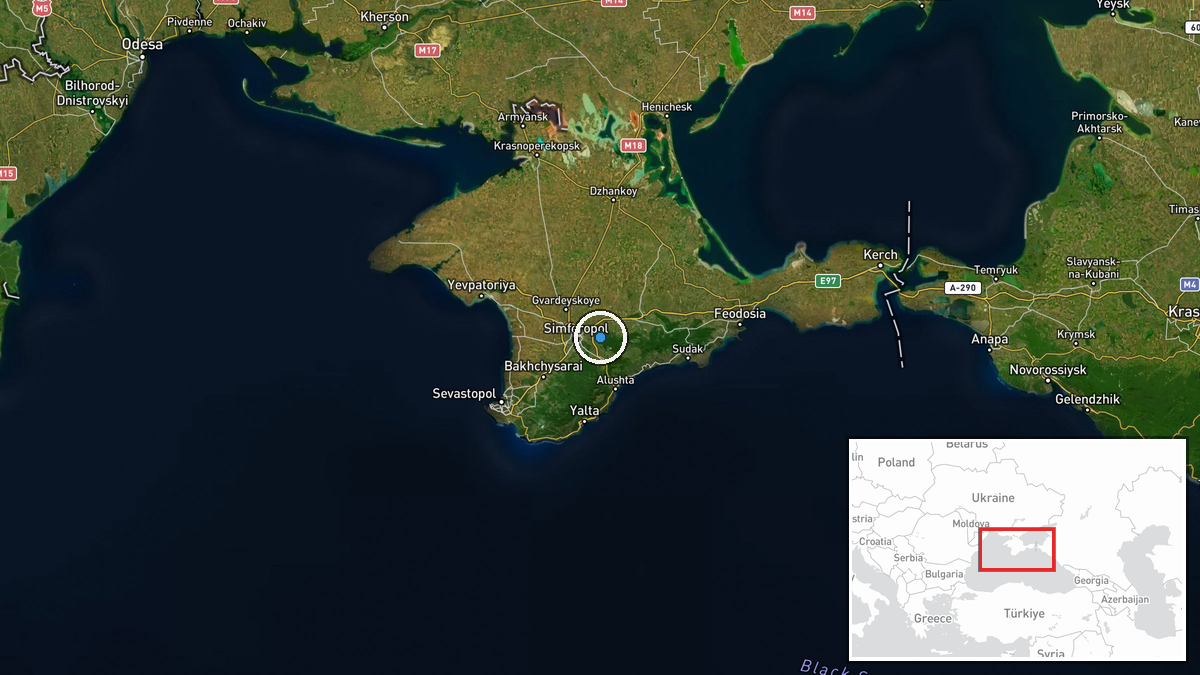
Kyr-Bailary is a settlement in central Crimea approximately 40 kilometers north-northwest of Sevastopol and roughly 60 kilometers south of Simferopol. The settlement sits in the interior plateau region of the peninsula. Geographic precision is assessed at settlement level based on the named location provided by Ukrainian military sources.
Related events nearby
- Ukraine conducted UAS strikes on 31 Aug–1 Sept 2026 targeting UAV storage, preparation, and launch facilities 2026-09-01 07:11 UTC · UAS Strike · Hvardiiske, Crimea, Russia-occupied
▶ View this event on the live map
Intel Mapper aggregates open-source reports from monitored Telegram and X channels, geolocates them, cross-checks duplicates across sources and assigns a confidence score. Entries are updated as new confirmations arrive. Read how we verify events.