Ukraine strikes Russian command post in Pologi, Zaporizhzhia Oblast
What happened
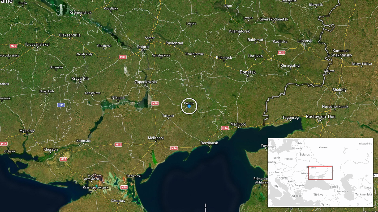
Ukraine's General Staff reported a UAS strike against a Russian command and observation post in Pologi, Zaporizhzhia Oblast, during the night of 31 August to 1 September 2026. The strike targeted a command-observation point (КП) operated by Russian forces in the settlement. Pologi sits in occupied territory in southeastern Zaporizhzhia Oblast, an area that has seen sustained Ukrainian drone operations against Russian rear positions.
Context and assessment
Pologi lies in the southern portion of Zaporizhzhia Oblast near the frontline zone and represents a node in Russian command infrastructure supporting operations across the region. The strike is part of a broader Ukrainian campaign against Russian C2 facilities and unmanned systems logistics. On the same night, Ukrainian forces struck Russian drone storage and preparation sites in Makiivka, Donetsk Oblast, while on 31 August they destroyed a drone control point near Huliaipole in the same oblast. This pattern suggests a coordinated effort to disrupt Russian drone operations and command networks. Command posts, which coordinate unit movements and fire control, are high-value targets; their degradation can impair Russian operational effectiveness across affected sectors.
Sources and confidence
Reported by Telegram channel @GeneralStaffZSU (Ukrainian General Staff). Single source reporting means confidence cannot yet be independently verified by cross-confirmation. Confidence score of 8.0 reflects the official nature of the source and consistency with contemporaneous Ukrainian operational reporting patterns. Verification through satellite imagery, Russian acknowledgment, or independent channels would increase confidence.
Location
Pologi is a settlement in Zaporizhzhia Oblast in southeastern Ukraine, located at approximately 47.48°N, 36.26°E. The town sits in Russian-controlled territory in the southern part of the oblast, roughly 50 km south of the regional administrative center Zaporizhzhia. The area is characterized by open steppe terrain with sparse settlements.
Related events nearby
- Ukrainian forces destroyed an enemy drone control point near Huliaipole in Zaporizhzhia Oblast. The strike tar2026-08-31 09:11 UTC · UAS Strike · Huliaipole, Zaporizhzhia Oblast, Ukraine
- Ukrainian General Staff reports 173 combat clashes on 31 Aug 2026. Russia conducted 66 airstrikes, deployed 6,2026-08-31 19:08 UTC · Combat · Pokrovsk, Donetsk Oblast, Ukraine
- Ukraine struck multiple UAV storage, preparation, and launch facilities in Donetsk city during the night of 312026-09-01 07:10 UTC · UAS Strike · Makiivka, Donetsk Oblast, Russia-controlled
▶ View this event on the live map
Intel Mapper aggregates open-source reports from monitored Telegram and X channels, geolocates them, cross-checks duplicates across sources and assigns a confidence score. Entries are updated as new confirmations arrive. Read how we verify events.