Ukrainian forces strike North Crimean Canal railway bridge in Crimea
What happened
Ukrainian Defense Forces reportedly struck the railway bridge spanning the North Crimean Canal in occupied Crimea on the night of 6-7 September 2026, according to a statement from Ukraine's General Staff. The bridge, located near Vladislavivka, serves as a key logistics corridor for Russian military operations in the peninsula. The General Staff stated the structure is used by Russian forces to maintain military supply lines. The report was released via Telegram on 7 September.
Context and assessment
The North Crimean Canal bridge is a critical piece of infrastructure for Russian logistics in Crimea, supplying forces across the peninsula and supporting operations in southern Ukraine. Since Russia's 2022 invasion, Ukraine has systematically targeted Crimean transportation networks to degrade Russian operational capacity. The strike coincides with a contemporaneous Ukrainian attack on a reconnaissance post at Perekop, suggesting a coordinated operational focus on disrupting Russian command and supply infrastructure in the occupied territory. Damage to this bridge would complicate Russian efforts to maintain forces in Crimea and reinforce positions in southern Ukraine, potentially constraining Moscow's ability to sustain offensive operations in the region.
Sources and confidence
Reported exclusively by Ukraine's General Staff via official Telegram channel on 7 September 2026. Single-source reporting limits independent verification of strike results. Confidence score of 8.0 reflects the credibility of official Ukrainian military sources but absence of corroborating reports. Cross-confirmation from Russian sources, satellite imagery, or independent observers would substantially increase confidence. Alternative reporting or damage assessments would similarly strengthen the assessment.
Location
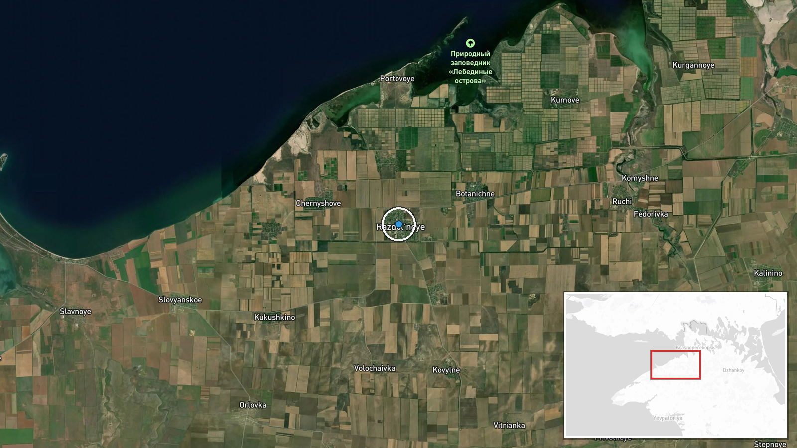
The North Crimean Canal railway bridge is located near Vladislavivka in occupied Crimea, approximately 45.77°N, 33.49°E. The canal itself runs northwest from the Azov Sea toward central Crimea, forming a critical freshwater supply and transport route. The bridge crosses the canal in relatively flat terrain characteristic of northern Crimea's steppe landscape, positioned along one of the peninsula's main north-south transportation corridors.
Related events nearby
- Ukrainian Defense Forces struck an automated reconnaissance post 'Grenadier' in Perekop, Crimea on the night o2026-09-07 10:21 UTC · Security · Perекop, Crimea, Russia (Occupied)
▶ View this event on the live map
Intel Mapper aggregates open-source reports from monitored Telegram and X channels, geolocates them, cross-checks duplicates across sources and assigns a confidence score. Entries are updated as new confirmations arrive. Read how we verify events.