Ukraine confirms destruction of four Russian UAV storage sites in occupied Crimea
What happened
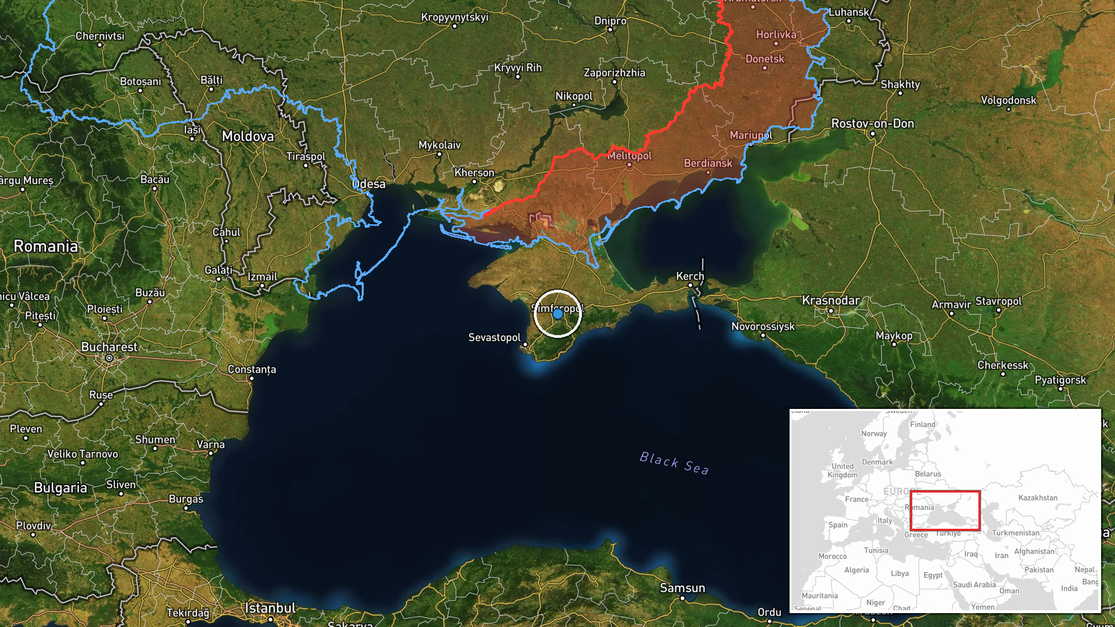
Ukrainian military sources reported on October 13, 2026, that Ukrainian forces destroyed four unmanned aerial vehicle storage facilities in the Hvardiiske area of Russian-occupied Crimea. The General Staff of the Armed Forces of Ukraine posted the confirmation on Telegram, noting that secondary detonations were observed at the impact sites, indicating ordnance or fuel ignition within the damaged structures. The timing and method of the strikes remain unspecified in available reporting.
Context and assessment
Hvardiiske lies in central Crimea and has served as a logistics hub for Russian air operations in the peninsula. UAV storage facilities represent key infrastructure for sustained Russian aerial operations against Ukrainian territory, particularly the use of Shahed and other kamikaze drone variants that have intensified since 2022. Destruction of such sites directly degrades Russian strike capacity. This operation fits an established Ukrainian pattern of targeting Russian logistics and air infrastructure in occupied Crimea, where supply lines are vulnerable to long-range strikes. The reported secondary detonations suggest significant ordnance stockpiles at the site, indicating the facility's operational importance to Russian air forces.
Sources and confidence
Reported solely by the General Staff of the Armed Forces of Ukraine via official Telegram channel. No independent cross-confirmation from other Ukrainian military branches, allied intelligence, or open-source imagery available in provided data. Confidence score of 8.0 reflects official Ukrainian military attribution and corroborating secondary detonations, though geographic precision remains low. Cross-confirmation through satellite imagery or third-party sources would substantially increase confidence.
Location
Hvardiiske (also transliterated Guardiyske) is located in central Crimea at approximately 45.0°N, 34.1°E. The settlement sits inland from the Black Sea coast and serves as a regional transport node. Precision is classified as regional rather than exact facility-level due to available source data; the four storage sites may be distributed across multiple locations in the broader Hvardiiske administrative area.
Related events nearby
- Ukrainian air monitoring: 2+ Russian jet-powered Shahed (Geran-3) drones from Black Sea toward Chornomorske.2026-10-15 11:18 UTC · Drone Transit · Chornomorske, Ukraine
▶ View this event on the live map

Intel Mapper aggregates open-source reports from monitored Telegram and X channels, geolocates them, cross-checks duplicates across sources and assigns a confidence score. Entries are updated as new confirmations arrive. Read how we verify events.