Ukraine's General Staff reports strike on Nebo-U radar near Magra, Krasnodar Krai, with fire at site
What happened
Ukraine's General Staff reported on its Telegram channel that Ukrainian Defense Forces struck a Nebo-U long-range radar station near the settlement of Magra in Krasnodar Krai, Russia, and that a fire broke out in the area of the facility. The post places the strike overnight into 16 October 2026; the event is logged at 09:30 UTC that day. The original Ukrainian text names the system as 55Ж6У, using the Cyrillic letter Ж, while the English summary renders it as 55Zh6U. The post describes the Nebo-U as a long-range three-coordinate meter-band radar built to detect and track aircraft, cruise missiles and ballistic missiles, and it gives an approximate station value of about 100 million US dollars. The report offers no casualty figures, no damage assessment, and no outcome beyond the fire.
Context and assessment
Krasnodar Krai lies in southern Russia on the Black Sea coast and borders the Caucasus foothills, a region that is far from the front line yet hosts ports, air bases and air defence infrastructure. A Nebo-U radar is a sensor rather than a weapon: by detecting aircraft and missiles at long range, it gives defenders warning time and allows them to track incoming threats. Striking one would, if confirmed, degrade early warning over southwestern Russia and the approaches from the Black Sea. The event follows a Sochi port attack reported the previous evening, at 22:35 UTC on 15 October, in which Ukraine reportedly used British-made drone boats after a long sea transit. The two incidents share a region and a close time window, which suggests a sustained effort against targets in the Krasnodar area. The shared geography alone does not establish a single campaign or common planning, and the reporting on the Sochi event is itself a single account. What the pattern may indicate is a willingness to reach deeper into Russian rear areas, with radar and naval logistics among the target types, but that reading rests on a small number of reports.
Sources and confidence
The event rests on a single Telegram channel, the General Staff of the Ukrainian Armed Forces, which is an official military source with an established posting record but is also a party to the conflict. No second outlet, satellite image, Russian statement or local official account is cited in the data. The confidence score of 8.1 reflects a credible official origin balanced against the absence of independent corroboration. Confidence would rise with geolocated imagery showing damage to the radar site, a fire signature in satellite data, or a Russian Ministry of Defence or regional statement. It would fall if imagery showed no damage, if the site proved to be a different facility, or if the claim went unconfirmed over time.
Location
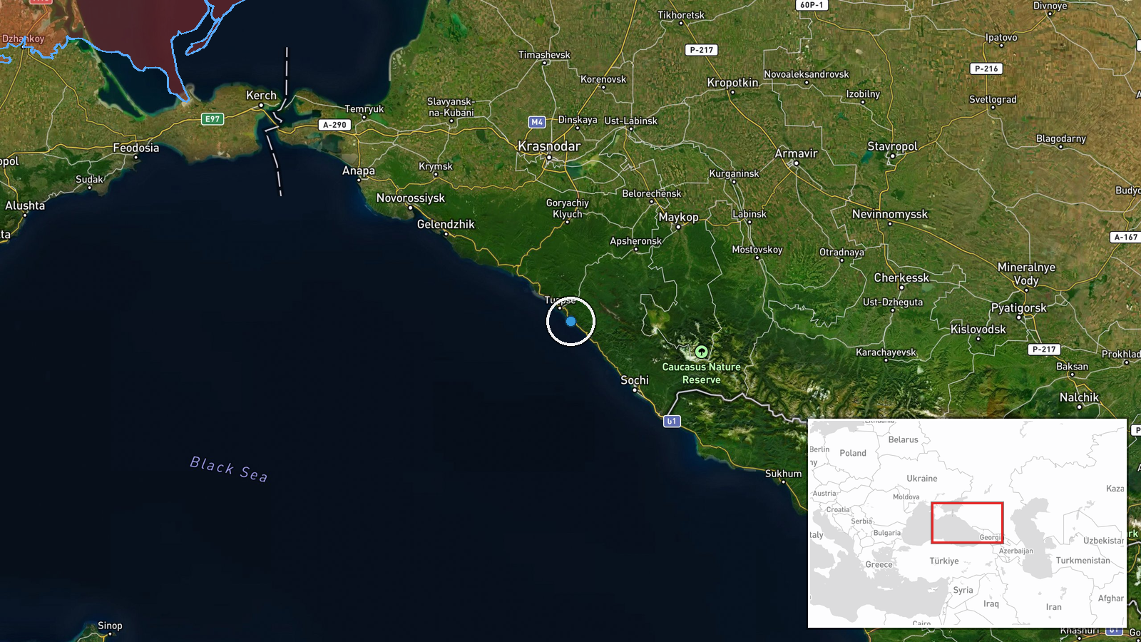
The location is settlement-level, placed at Magra in Krasnodar Krai at approximately 44.02 N, 39.16 E, with high location confidence. The coordinates reflect the village rather than the exact radar site, so the precise position of the station within or near the settlement is not established. The area sits in the northwestern foothills of the Greater Caucasus, with hilly terrain, river valleys and forest cover, a few tens of kilometres inland from the Black Sea coast. Those features can shape radar line of sight and access roads, but the data does not identify specific landmarks near the site.
Related events nearby
- Ukraine reportedly used British-made drone boats in a surprise attack on Sochi's Black Sea port after a long s2026-10-15 22:35 UTC · UAS Strike · Sochi port, Krasnodar Krai, Russia
▶ View this event on the live map

Intel Mapper aggregates open-source reports from monitored Telegram and X channels, geolocates them, cross-checks duplicates across sources and assigns a confidence score. Entries are updated as new confirmations arrive. Read how we verify events.