Ukraine reports strikes on Russian materiel warehouses in occupied Donetsk Oblast, 16-17 October
What happened
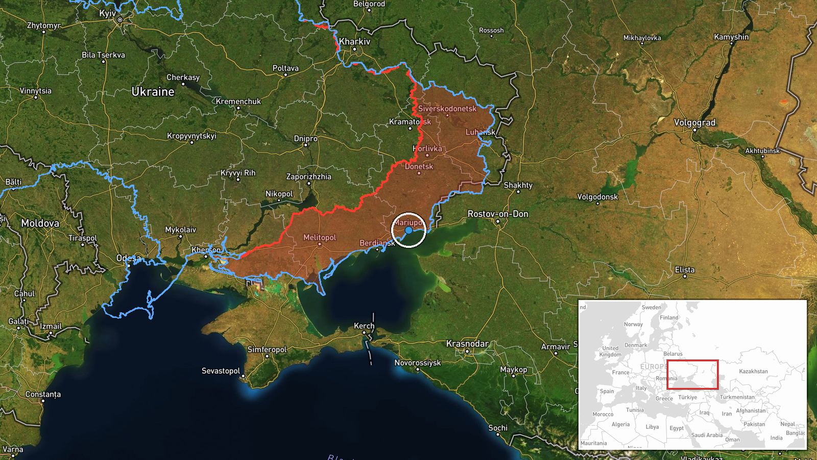
The Ukrainian General Staff's Telegram channel, @GeneralStaffZSU, reported that Defense Forces units struck warehouses of materiel-technical means (МТЗ) used by the Russian army in temporarily occupied Donetsk Oblast. The post places the strikes in the areas of Novoandriivka, Mykilske and Mariupol on 16 October and overnight into 17 October 2026. The message is brief and gives no exact facility addresses, damage assessments, or casualty figures. It closes by saying operations against key Russian targets will continue until the aggression ends. The original Ukrainian wording uses 'уражено', meaning hit or struck, which signals a claim of impact rather than an independent description of results.
Context and assessment
Donetsk Oblast has been a central supply corridor for Russian forces for much of the war, and depots for fuel, ammunition, spare parts and vehicles are typically spread across rear areas that feed front-line units. Mariupol, on the Azov coast, has long served as a logistics and transport hub, which helps explain why it appears in the same report as smaller settlements. The event sits within a busy day of reporting. Earlier on 16 October, Ukrainian forces reportedly struck two telecom towers with enemy antenna equipment near Olenivka in Crimea, indicating a pattern of strikes on communications and support infrastructure away from the immediate front. On 17 October, the General Staff also reported 13 Russian attacks in 24 hours on the Huliaipole axis and 30 on the Pokrovsk axis, showing active ground combat across several sectors. Operationally, if the claim is accurate, strikes on depots could aim to reduce the stockpiles available to units in those sectors, though the scale and effect cannot be judged from this post alone.
Sources and confidence
All information comes from a single channel, the official Telegram account of the Ukrainian General Staff. No other outlet, imagery provider, or independent observer in the dataset confirms the strikes. The confidence score of 8.0 reflects a clear, specific official claim with named areas and dates, but it is held below the top range because the source is a party to the conflict and no corroboration is attached. Confidence would rise with geolocated satellite or social media imagery showing damage at named sites, confirmation from independent or Russian-side reporting, or a more detailed General Staff follow-up. It would fall if imagery showed no damage or if the targets proved to be civilian facilities.
Location
The location is recorded at regional precision with low location confidence. The coordinates (47.0807, 37.54513) correspond to the Novoandriivka area, the first settlement named in the post, while Mykilske and Mariupol are not pinned separately. The setting is Donetsk Oblast, mostly open steppe with agricultural land, road and rail corridors, and the Azov Sea coastal lowlands to the south. Mariupol lies on the Azov coast to the southwest of the plotted point, so the true target locations could be spread across a wide area.
Related events nearby
- Ukrainian forces struck two telecom towers with enemy antenna equipment near Olenivka, Crimea, on October 15–12026-10-16 14:30 UTC · Combat · Olenivka, Crimea, Russia
- WSJ reports a Russian officer defected to Ukraine after feeding Ukrainian forces locations of hundreds of his 2026-10-16 18:10 UTC · Report · Donetsk Front (location not reported), Ukraine
- Ukrainian General Staff reports 13 Russian attacks in 24 hours on the Huliaipole axis, around Vozdvyzhivka, Ri2026-10-17 05:08 UTC · Combat · Vozdvyzhivka, Zaporizhzhia Oblast, Ukraine
- Ukrainian General Staff reports 30 Russian attacks on the Pokrovsk axis as of 08:00 on 17.10.2026, across ten 2026-10-17 05:08 UTC · Combat · Near Pokrovsk, Donetsk, Ukraine (front line, estim
▶ View this event on the live map

Intel Mapper aggregates open-source reports from monitored Telegram and X channels, geolocates them, cross-checks duplicates across sources and assigns a confidence score. Entries are updated as new confirmations arrive. Read how we verify events.