RSF claims capture of Al-Barka in Sudan's Blue Nile State; claim unverified
What happened
On 20 October 2026, the Rapid Support Forces (RSF) posted a claim on its Telegram channel, @RSFSudan, stating that its forces had liberated the strategic Al-Barka area in Blue Nile State, Sudan. The Arabic-language post is a short statement carrying the group's media hashtags and contains no supporting material. A related RSF statement with the same timestamp says the group holds full control of the Al-Barka area and a military camp, reports seizing vehicles and weapons, and asserts that hundreds of Sudanese Armed Forces (SAF) and foreign fighters were killed. These assertions have not been independently confirmed. The location is recorded as Al-Barka, New Funj, in Blue Nile State.
Context and assessment
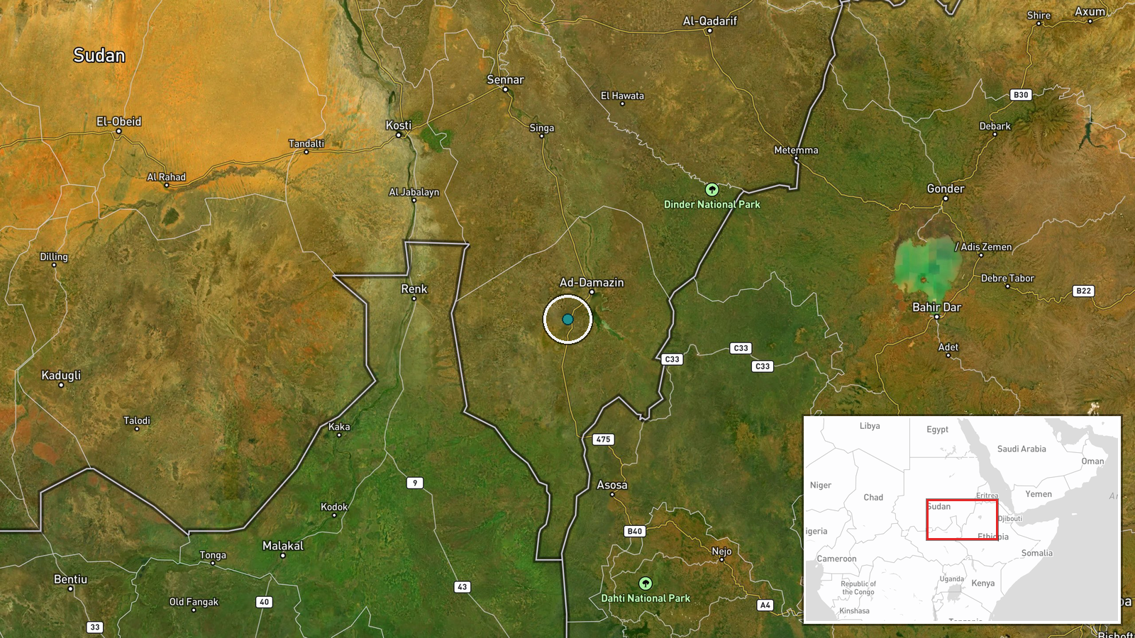
Blue Nile State lies in southeastern Sudan along the border with Ethiopia and has been a contested frontier in the wider war between the RSF and the SAF. Control of its towns and road corridors matters for supply routes, for movement toward the Ethiopian border, and for the security of the state capital, Damazin, and the Roseires area. Several events on the same day point to heightened activity. A drone strike near a displacement site in Wad El Mahi reportedly killed at least 31 civilians, mostly women and children, and the UN condemned it, though attribution is inferred rather than confirmed. Separately, security operatives reportedly arrested three civilians in southern Roseires amid rising rights concerns over tribal-linked detentions in Damazin and Roseires. Taken together, these reports suggest a period of intensified fighting alongside pressure on local communities. If the Al-Barka claim holds, it would indicate an effort to seize a military camp rather than only to hold ground, though that remains unverified and should be treated cautiously.
Sources and confidence
All information on this event comes from a single channel, the RSF's own Telegram account, and no independent outlet, government, or monitoring body has confirmed it. This is why the confidence score is low at 3.5, since the claim is a party's self-report with no corroborating material. The related statement comes from the same source. Confidence would rise with independent corroboration such as geolocated video or satellite imagery showing control of the camp, confirmation or denial from SAF or Sudanese government channels, or reporting from UN or established conflict monitors. It would fall if the SAF or local witnesses contradict the account, or if imagery shows the camp still under other control.
Location
The location is approximate and recorded at settlement precision, with coordinates of 11.5765 north and 34.1525 east for Al-Barka. The platform's location confidence is normal, and the reference to New Funj suggests the place is identified by a local name tied to the wider area. Al-Barka is reported to sit in Blue Nile State in southeastern Sudan, near the Ethiopian border and within the Blue Nile river basin, a region of farmland, seasonal watercourses, and road links to Damazin and Roseires.
Related events nearby
- RSF claims full control of the Al-Barka area and military camp in Blue Nile State, seizing vehicles and weapon2026-10-20 21:20 UTC · Statement · Al-Barka, Blue Nile State (New Funj), Sudan
- Drone strike near a displacement site in Wad El Mahi, Blue Nile killed at least 31 civilians, mostly women and2026-10-20 14:03 UTC · UAS Strike · Wad El Mahi, Blue Nile State, Sudan
- Security operatives arrested three civilians in southern Roseires, Blue Nile, amid rising rights concerns over2026-10-20 13:45 UTC · Police Operation · Roseires, Blue Nile State, Sudan
▶ View this event on the live map

Intel Mapper aggregates open-source reports from monitored Telegram and X channels, geolocates them, cross-checks duplicates across sources and assigns a confidence score. Entries are updated as new confirmations arrive. Read how we verify events.