Myanmar junta forces reportedly land again on Ngapi Island amid heavy fighting
What happened
A Burmese-language post on the Telegram channel of Burma News International (BNI), dated 19 October 2026 at 08:06 UTC, reports that junta forces have once again advanced onto Ngapi Island in Ayeyarwady Region, Myanmar. The post describes intense fighting and heavy casualties. The wording refers to numerous casualties, but it gives no figures for killed or wounded, does not name the units involved, and does not say which side suffered the losses. The word 'again' indicates that this was not the first military push onto the island, though the post does not describe earlier attempts. The item is a short news update linking to a fuller BNI article. Its details have not been independently verified at the time of writing.
Context and assessment
Ngapi Island lies in the coastal waters of the Ayeyarwady delta, an area where the military has historically sought control of waterways, shorelines and settlements. Control of islands and coastal ground matters for moving troops by boat, interdicting supply routes and holding positions that can be contested repeatedly, which fits the word 'again' in the report. The most relevant related event is from the previous day, when intense fighting was reported along the Rakhine-Ayeyarwady border and weapons were seized during clashes. That suggests the coastal and delta fringe is an active theatre where armed groups and junta forces are contesting ground and equipment. A separate report of nationwide displacement, linked to junta conscription calls, indicates mounting pressure on the civilian population and possibly growing military manpower needs. Taken together, these reports may point to an operational effort to reassert control across the south-west coast. However, because the Ngapi report rests on a single source, its scale and tactical purpose cannot be established from the available data.
Sources and confidence
The event rests on a single Telegram channel, BNI (Burma News International), which publishes Burmese-language reporting from Myanmar. No second outlet in the data confirms the landing, the fighting or the casualty claims. The confidence score of 6.6 reflects one source, no cross-confirmation, a vague casualty description and a location assigned only at region level. Confidence would rise with independent local media reports, geolocated photographs or video of the island, or statements from the military or resistance groups. It would fall if imagery showed no activity or if the channel later corrected or withdrew the report.
Location
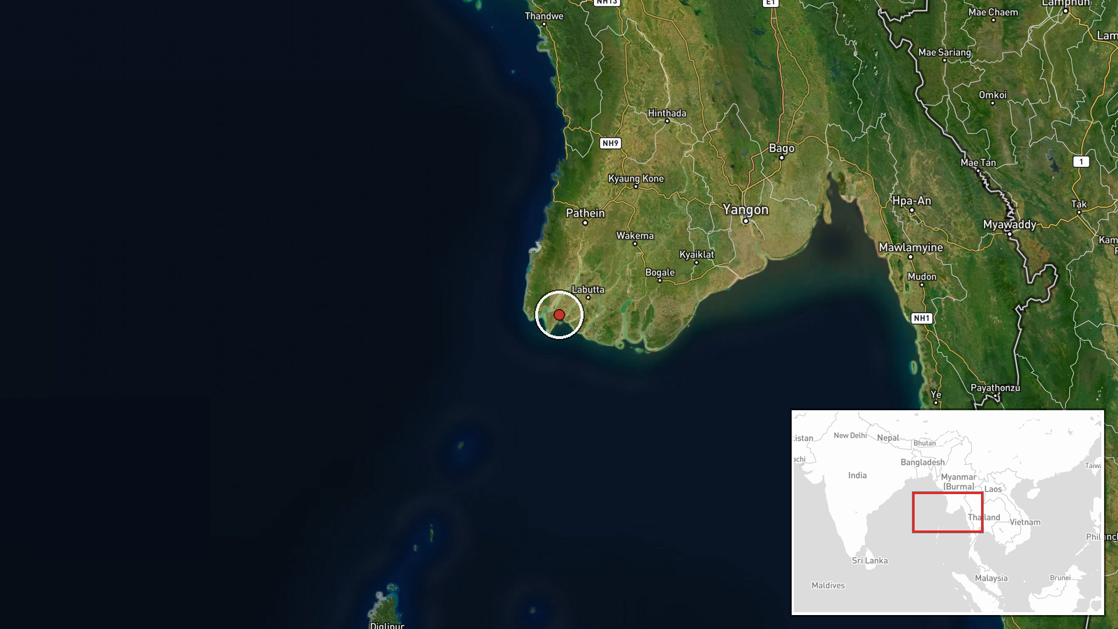
The location was assigned at region level rather than to a specific settlement or facility. The coordinates, approximately 16.0 N and 94.5 E, are a generalised point within Ayeyarwady Region and not a verified position on the island, and the location confidence field is empty. The island lies in a low-lying coastal delta setting, where tidal channels and mangrove-fringed shorelines typically complicate landings and resupply. Precise placement should be treated as approximate until a named township or landmark is confirmed.
Related events nearby
- After junta conscription calls, many young people are leaving Myanmar due to lack of domestic security.2026-10-19 01:55 UTC · Displacement · Myanmar (nationwide)
▶ View this event on the live map

Intel Mapper aggregates open-source reports from monitored Telegram and X channels, geolocates them, cross-checks duplicates across sources and assigns a confidence score. Entries are updated as new confirmations arrive. Read how we verify events.