Myanmar junta reportedly reinforces forces in Sagaing and Kachin ahead of dry season
What happened
A report published on a single Telegram channel, @bnionline, dated 19 October 2026 at 08:11 UTC, says the Myanmar military has moved to add forces in Sagaing Region and Kachin State as the monsoon season ends and the dry season approaches. The original Burmese headline uses the phrase for strengthening or adding strength (အင်အားဖြည့်) to both areas and links to a video, which the event record does not describe in detail. The post does not give troop numbers, unit designations, specific towns, or routes of movement. The location was recorded only at regional level, so the record cannot confirm where any movement took place within either region. The wording describes a deployment rather than a clash, and no casualties or combat outcomes are reported.
Context and assessment
Sagaing and Kachin are both areas where the military has faced sustained armed opposition since the February 2021 coup. Sagaing contains many People's Defence Force groups formed in opposition to the junta, while Kachin is largely controlled in its territory by the Kachin Independence Army, which has fought the military over long periods. Both regions lie far from the central government in Naypyidaw, and their road and river links strongly shape how troops and supplies move. Seasonal timing matters: monsoon rains through roughly June to October limit ground movement and some air operations, while the drier months generally allow larger operations, resupply and mobility. A reinforcement report issued at the close of the rains is therefore consistent with preparation for the coming months, though this is an inference rather than something the source states. The event record lists no related events, so this report cannot be placed within a recent pattern using the dataset alone. Corroboration from other outlets would be needed to show whether it reflects a wider buildup.
Sources and confidence
The event rests on a single channel, the Telegram account @bnionline, and no other source in the record has repeated the claim, so cross-confirmation is absent. The confidence score of 6.5 reflects that single-channel status together with a general, non-specific claim that is hard to verify from text and a linked video alone. Confidence would rise if regional outlets, local monitors or satellite-based observers reported specific troop or equipment movements with dates and places, or if the linked footage showed identifiable units and locations. It would fall if the original footage could not be traced or if similar claims appeared to be recycled from earlier reports.
Location
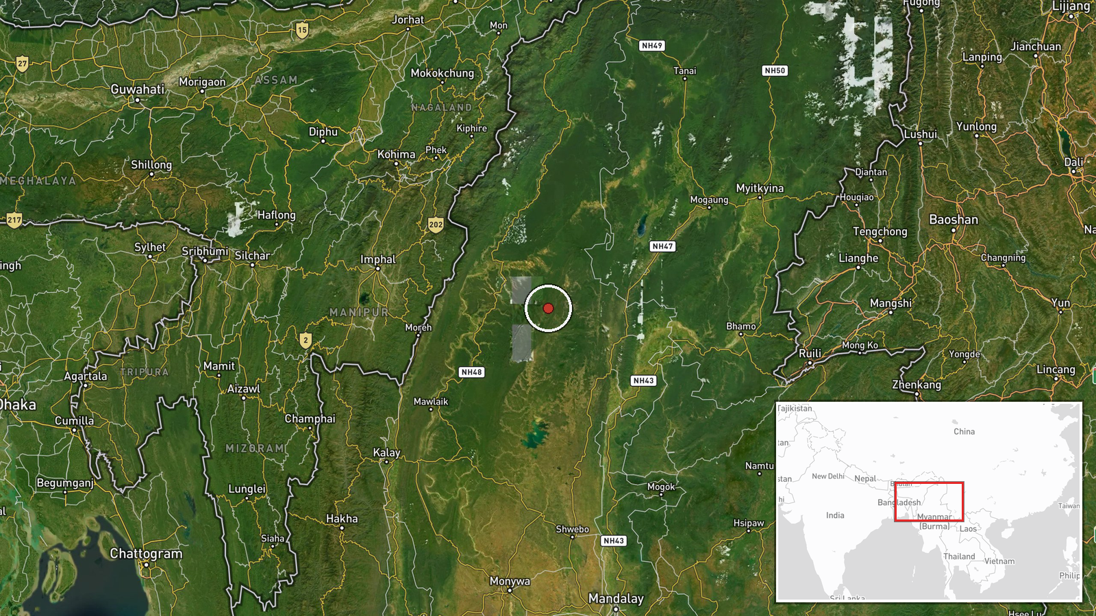
Coordinates were assigned at region level with high location confidence, so the pin marks the broader Sagaing Region rather than a town, base or road. The point lies in the northern half of the region, in dry hill and valley country west of the Irrawaddy River, which runs through the wider area. Kachin State lies to the north and borders China, and the mountainous frontier between the two regions shapes overland movement.
▶ View this event on the live map

Intel Mapper aggregates open-source reports from monitored Telegram and X channels, geolocates them, cross-checks duplicates across sources and assigns a confidence score. Entries are updated as new confirmations arrive. Read how we verify events.