BNI reports military movements expanding across Myanmar; specific locations not given
What happened
BNI, a Burmese-language outlet, published an item stating that military movements are expanding across Myanmar, based on its own analysis. The item was shared on BNI's Telegram channel and links to a news page on bnionline.net. The report does not name a specific town, unit or troop number, and the article body could not be accessed, so the claim rests on the headline and summary alone. The event is logged as a deployment attributed to the Myanmar junta, dated 19 October 2026 at 14:06 UTC. The wording is general, describing movements expanding nationally rather than a single engagement. Nothing in the record indicates casualties, clashes or territorial change, and the details remain unverified.
Context and assessment
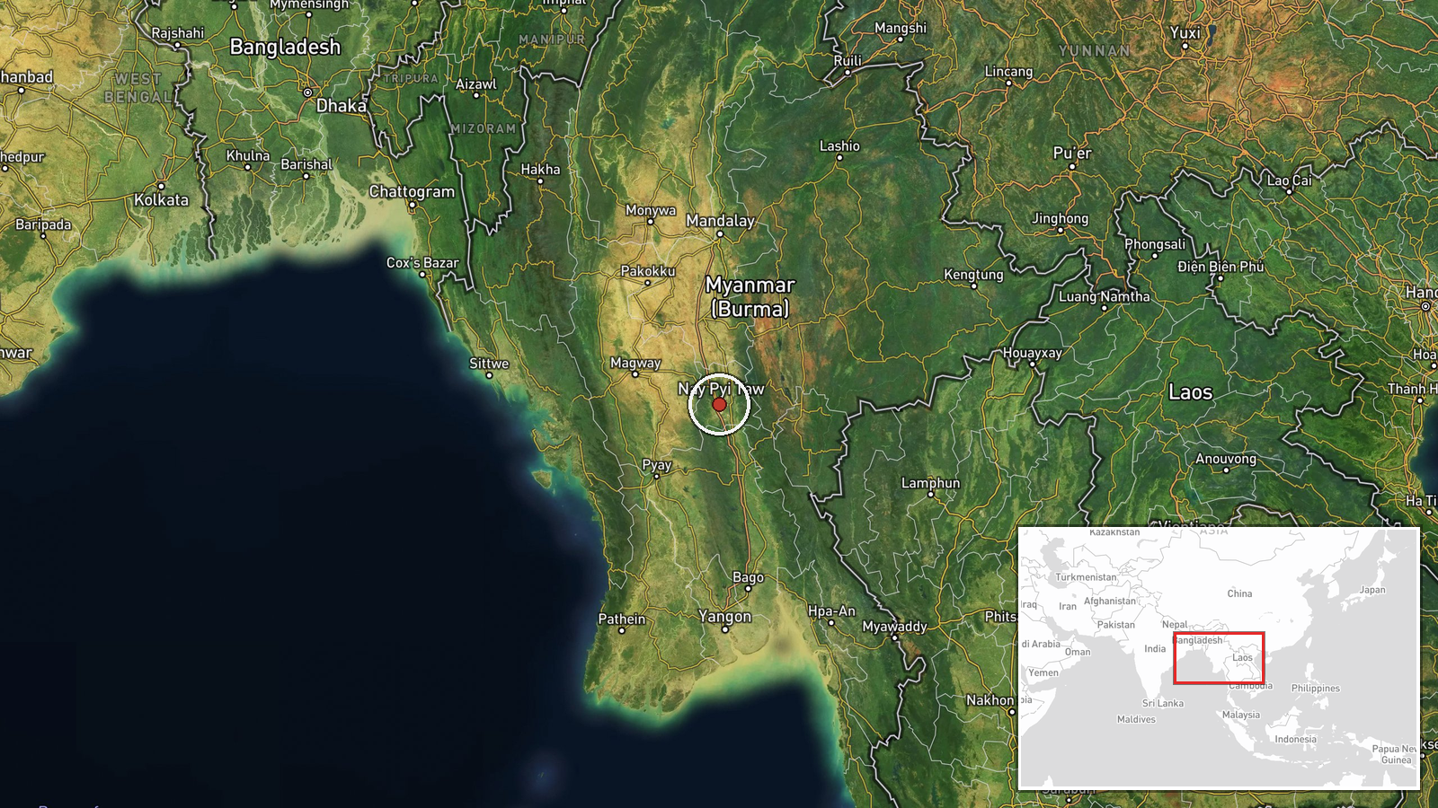
Myanmar has been in armed conflict since the military seized power in February 2021. The junta and its armed forces contest control with the National Unity Government, People's Defense Force units and several ethnic armed organizations. The coordinates for this entry fall in central Myanmar near Naypyidaw, the administrative capital and seat of the junta, so reported movements there would matter for the regime's own security posture. Related events logged the same day point to a broader picture of strain and consolidation. A report from Arakan Army areas describes fighters operating an armored vehicle reportedly captured from Tatmadaw forces, suggesting battlefield equipment is changing hands. The junta also extended martial law administration by 90 days in most townships, its leader invited the Karen National Union, CNF and ABSDF to peace talks, and a former NUG/PDF-aligned officer reportedly defected to the junta. Taken together, these items may indicate reinforcement of control in key areas, redeployment across several fronts, or preparation for pressure on resistance groups. Because the deployment report lacks specifics, these readings remain hypotheses rather than established operational facts.
Sources and confidence
The report rests on one Telegram channel, @bnionline, linked to a BNI article whose body text was not accessible. No independent outlet has been identified confirming the same movements, so cross-confirmation is absent. The score of 6.0 reflects a single-channel source, a headline-level claim without named places or units, and the unreadable full text, partly offset by corroborating context from same-day events. Confidence would rise if the full article named locations, units or dates, or if independent media, local monitors or imagery documented the movements. It would fall if the article proved to be commentary without field reporting.
Location
The location is recorded only as Myanmar, with no settlement or facility reported, so precision is regional and location confidence is low. The coordinates, roughly 19.76 north and 96.08 east, sit near Naypyidaw and likely reflect a regional or capital-area centroid rather than a reported site. The surrounding terrain is dry-zone lowland, with the Irrawaddy basin to the west and upland hill ranges to the east. Treat the point as an approximation only.
Related events nearby
- Arakan Army fighters are operating an armored vehicle captured from Tatmadaw forces, reportedly a Chinese WMA-2026-10-19 05:00 UTC · Tank · Myanmar (location not reported)
- A former NUG/PDF-aligned officer, Bo Naga, defected to the junta and pledged to fight the NUG and PDF forces.2026-10-19 13:56 UTC · Statement · Naypyidaw, Myanmar
- Myanmar junta extends martial law administration by 90 days in most townships, excluding Kyaukme, Kyaukphyu an2026-10-19 10:13 UTC · Statement · Naypyidaw, Myanmar
- Junta leader Min Aung Hlaing invited KNU, CNF and ABSDF to peace talks. ABSDF called the NCA a ploy; CNF rejec2026-10-19 01:13 UTC · Statement · Naypyidaw, Myanmar
- Karenni joint forces approved and enacted a military law framework (KSIP) for their multi-force armed structur2026-10-19 07:55 UTC · Statement · Kayah State, Myanmar
▶ View this event on the live map

Intel Mapper aggregates open-source reports from monitored Telegram and X channels, geolocates them, cross-checks duplicates across sources and assigns a confidence score. Entries are updated as new confirmations arrive. Read how we verify events.