Junta troops reportedly advancing along Mon-Karen border, locals express security concerns
What happened
A Telegram post from the Burmese-language outlet BNI Online, published on 20 October 2026 at 14:11 UTC, reports that Myanmar junta troops are advancing along the Mon-Karen border in southeastern Myanmar. The Burmese wording refers to a moving column of troops, which is why the event is classified as a convoy movement. The post says the advance is causing security concerns among local residents. It does not give troop numbers, unit names, villages reached, or casualties, and it describes no clashes. The accompanying link points to a BNI Online news article, which was not independently reviewed for this entry. The phrasing indicates a reported deployment in progress rather than a confirmed attack.
Context and assessment
The Mon-Karen border has been a zone of shifting control since the 2021 coup, with Karen and Mon armed groups, People's Defence Forces and the military all active across parts of Mon and Karen states. Troop movement here matters because the area lies along routes linking the Andaman coast, the Thai border crossings and the Salween corridor. Control of these roads affects supply, trade and the movement of displaced civilians. A related item from the same morning adds context. At 07:30 UTC, Dr. Cynthia Maung, whose clinic operates from Mae Sot across the border in Thailand, called for protection of civilians and health workers amid ongoing fighting in Myanmar. Her appeal suggests that humanitarian actors were already reporting pressure on civilians in the region before this advance was reported. Taken together, the two items may indicate a renewed push in an area where displacement and attacks affecting medical care have been recurring concerns. Operationally, a convoy advance could signal resupply, reinforcement of a fixed position, or preparation to hold a road, but the available data does not establish which. These readings are hypotheses, not findings.
Sources and confidence
The report rests on a single Telegram channel, @bnionline, tied to the BNI Online outlet, with no second outlet, wire service, or official statement independently confirming the movement. The Mae Sot statement is a separate item that corroborates only a general climate of fighting. The confidence score of 6.6 reflects a credible regional source with a direct link, offset by single-channel sourcing and the absence of named units, places, or visual evidence. Confidence would rise with independent local reporting, imagery placing columns on specific roads, or statements from authorities or humanitarian groups. It would fall if the movement proves to be routine resupply or a non-combat rotation.
Location
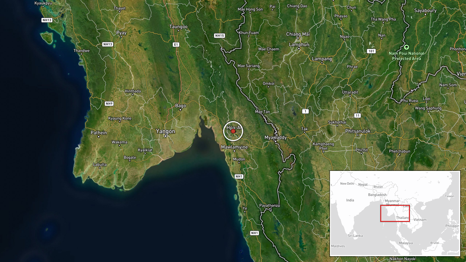
The location is a region-level approximation rather than a specific settlement or facility. The coordinates, 16.9 N and 97.6 E, sit within Mon State near the boundary with Kayin (Karen) State, so the point should not be read as the position of any force. The area lies inland from the Gulf of Martaban, with the Thanlwin (Salween) River and its tributaries shaping routes toward the Thai frontier. The terrain is mixed hill and lowland forest, which tends to channel road movement into a limited number of corridors.
Related events nearby
- Dr. Cynthia Maung calls for protection of civilians and health workers amid ongoing fighting in Myanmar.2026-10-20 07:30 UTC · Statement · Mae Sot, Tak Province, Thailand
▶ View this event on the live map

Intel Mapper aggregates open-source reports from monitored Telegram and X channels, geolocates them, cross-checks duplicates across sources and assigns a confidence score. Entries are updated as new confirmations arrive. Read how we verify events.