Fighting reportedly reaches within about 4 miles of Sittwe, Rakhine State, per DVB
What happened
Burmese broadcaster DVB Digital reported in a Burmese-language news bulletin dated 18 October 2026 that fighting has reached within about four miles, roughly six kilometres, of Sittwe, the capital of Myanmar's Rakhine State. The item, posted to DVB's Telegram channel, is brief. Its headline states that combat has reportedly arrived within that distance of the town, and the body contains no further detail on positions, casualties, or which forces are involved. The summary attributes the fighting to the Arakan Army, but the original wording does not name any party. That attribution is the map's classification and should not be read as something the report itself states. The event is logged at 12:40 UTC on 18 October 2026.
Context and assessment
Sittwe matters for more than its population. It is the administrative seat of Rakhine State, a Bay of Bengal port at the mouth of the Kaladan River, and a transport hub for the state's northern and central townships. Large displaced populations, including Rohingya and Rakhine communities living in camps on the outskirts since the 2012 violence, make the town a humanitarian focal point as well as a political one. The Arakan Army has contested much of Rakhine since its late 2023 offensive and has pressed toward the state's principal towns. No related events are linked to this record, so this report cannot be placed within a sequence of confirmed incidents on the map, and any reading of a wider pattern rests on background knowledge rather than mapped data. Operationally, a reported distance of a few miles would be consistent with artillery or drone reach, with probing of outer positions, or with fighting along access roads. The report does not indicate which of these applies, and a distance figure alone does not establish that ground forces have closed on the town.
Sources and confidence
The item rests on a single Telegram channel, DVB Digital, and no independent outlet, local observer, or imagery in the record corroborates it. The confidence score of 6.5 reflects that single-channel basis, the vague wording that gives no positions or named forces, and the approximate location. Confidence would rise with independent reporting from Myanmar-language or English outlets, statements from local residents or humanitarian groups, or geolocated video showing combat near the town. It would fall if corroborating sources failed to appear over the following days, if military or armed group statements contradicted the account, or if the four-mile figure proved to refer to a different measurement or area.
Location
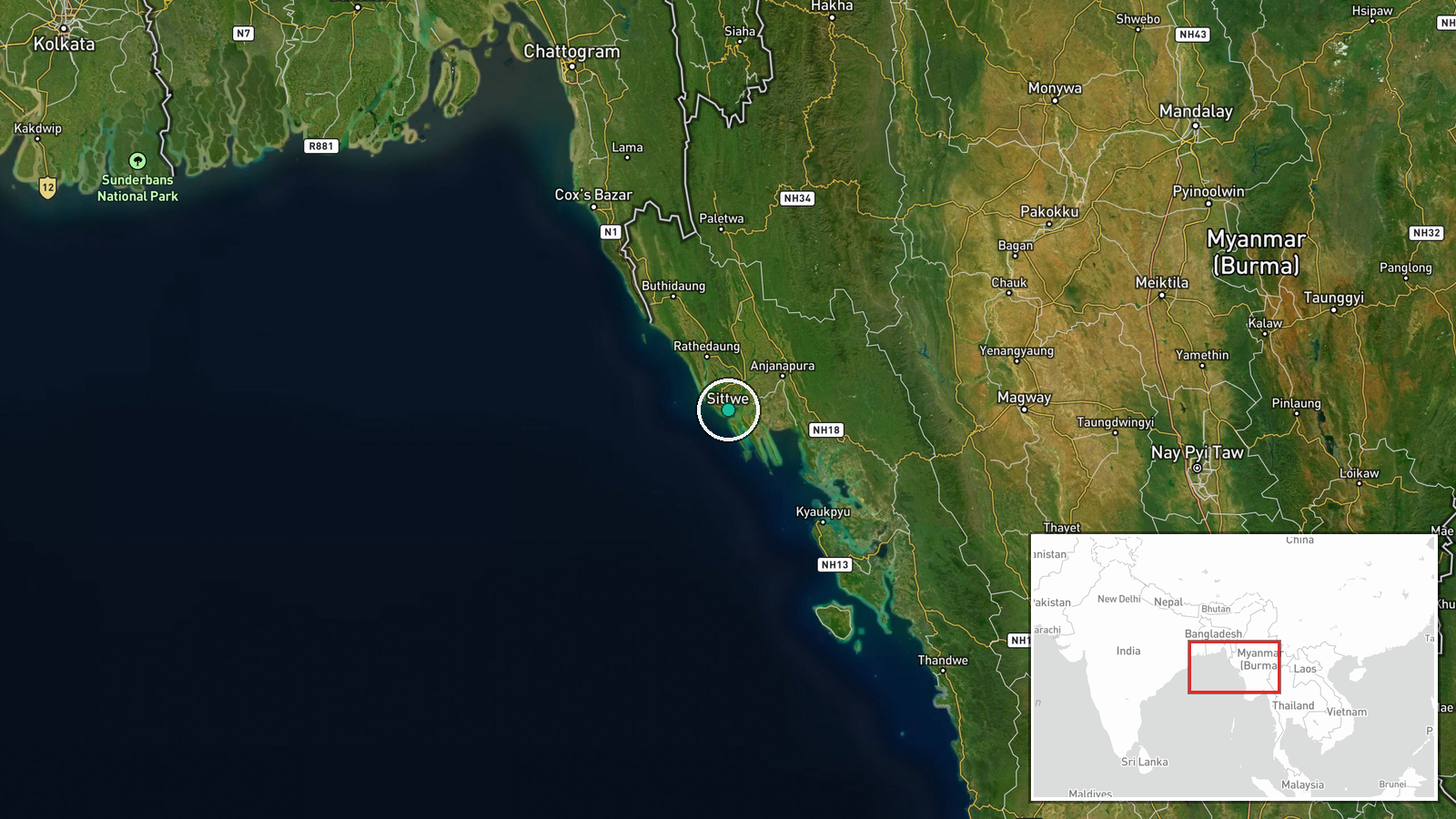
The coordinates place the event at the approximate centre of Sittwe town, and the geographic precision is recorded as regional, so the point does not mark where fighting was reported. Sittwe sits on a low, flat deltaic coastline where the Kaladan and Mayu rivers meet the Bay of Bengal. Surrounding terrain includes paddy fields, creeks, and mangrove stands, and the town has a port and an airport on its edges.
▶ View this event on the live map

Intel Mapper aggregates open-source reports from monitored Telegram and X channels, geolocates them, cross-checks duplicates across sources and assigns a confidence score. Entries are updated as new confirmations arrive. Read how we verify events.