KIA reportedly attacks Myanmar military in Bhamo Township after alleged monastery burning
What happened
Telegram channel @dvbtvnews reported that the Kachin Independence Army attacked Myanmar military forces in Bhamo Township, Kachin State, after troops had reportedly set fire to a monastery. The original Burmese text refers to a pagoda building (ဘုရားကျောင်း) being burned, so the exact type of structure should be treated as provisional. The post, dated 20 October 2026 at 01:55 UTC, is a brief Burmese-language message with no casualty figures, unit designations, or timing details beyond the attack itself. The report does not state how many fighters or soldiers were involved, whether anyone was injured or killed, or whether fighting continued after the initial post. It is also unclear whether the burning was the direct trigger or a earlier event cited as justification.
Context and assessment
Bhamo lies in northern Kachin State along the Irrawaddy River, close to the Chinese border, and has been a recurring front in the wider conflict between the Myanmar military and ethnic armed organisations since the 2021 coup. Control of river towns and road links in this area matters for supply, movement and local taxation, and fighting around religious buildings tends to carry added political weight because it can inflame local communities and drive civilian displacement. The one related event in the dataset comes from Namkham in Shan State, about a day earlier, where a report said the TNLA administration was reportedly collecting fees from fuel-powered vehicles that had already paid tax. That item concerns a different armed group in a different state, so it does not establish a direct link, but it illustrates the parallel governance and revenue disputes that armed groups along the northern border are pursuing. Operationally, an attack framed as a response to a specific act against a religious site may indicate a retaliatory motive rather than a planned offensive. Without further reporting, it is not possible to say whether this was a one-off clash or part of a sustained push.
Sources and confidence
Only one channel, the Telegram account @dvbtvnews, is listed, so there is no independent cross-confirmation at this stage. The confidence score of 6.5 reflects a single-source report that has not yet been matched by local media, Kachin-affiliated statements, or military communications. Confidence would rise if other outlets or KIA channels confirmed the clash and its location, or if verified imagery of the burned structure or the fighting emerged. It would fall if the attack cannot be placed in Bhamo Township, or if other accounts do not support the monastery or pagoda claim.
Location
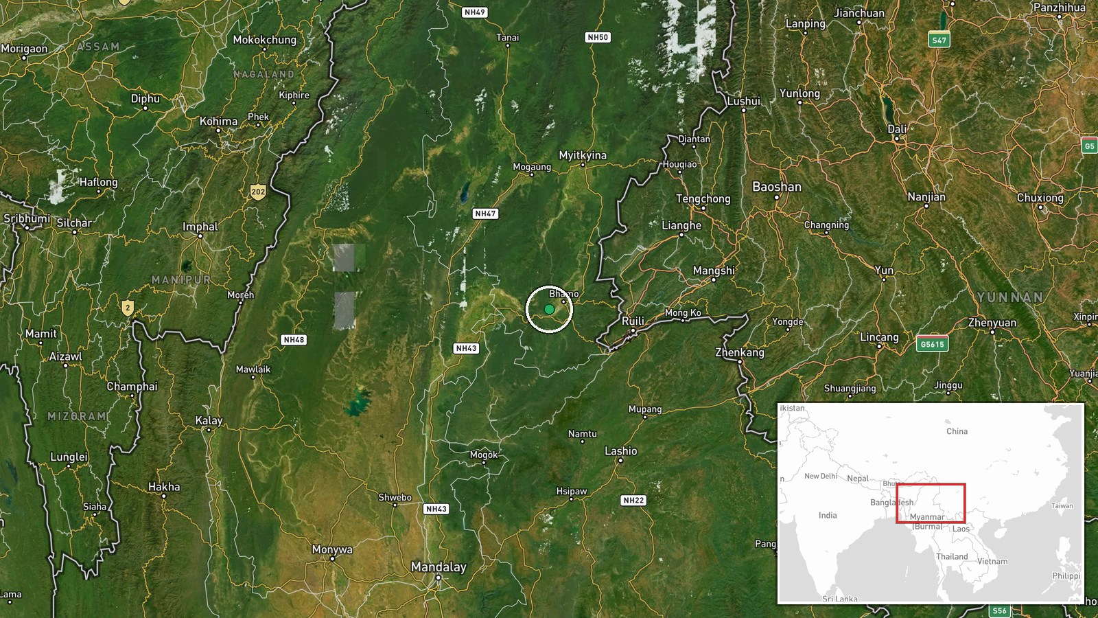
The location is recorded at settlement precision, meaning the coordinates point to Bhamo Township rather than a specific village, street or facility, so the marker should be read as approximate. The township sits in northern Kachin State, a mountainous and forested region bordering China, with the Irrawaddy River and its floodplain running through the Bhamo area. Nearby features include the river corridor and surrounding hill country, which shape road access and the movement of troops and supplies.
Related events nearby
- TNLA Namkham administration office reportedly collecting fees from fuel-powered vehicles that had already paid2026-10-19 05:06 UTC · Report · Namkham, Namkham Township, Shan State, Myanmar
▶ View this event on the live map

Intel Mapper aggregates open-source reports from monitored Telegram and X channels, geolocates them, cross-checks duplicates across sources and assigns a confidence score. Entries are updated as new confirmations arrive. Read how we verify events.