Russian Shahed drone reported heading toward Dnipro
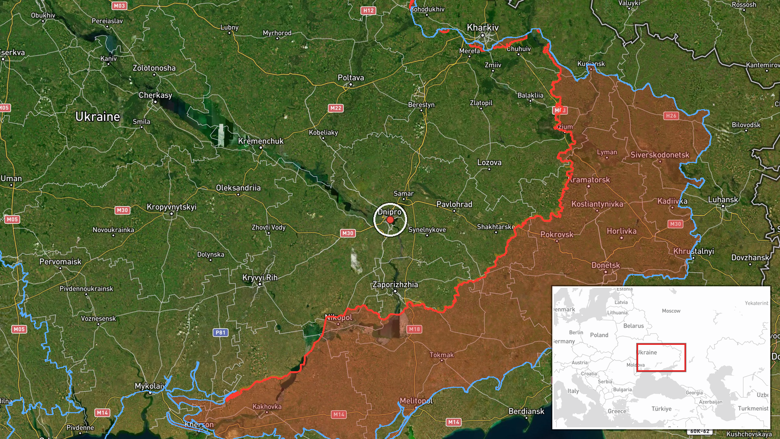
What happened
Ukrainian air monitoring channels reported a single Russian Shahed-type drone in transit toward Dnipro on October 13 at 13:27 UTC. The report came from the official Telegram channel of Ukraine's air command (@kpszsu). No impact or air defense response was noted in the initial alert. The drone was detected while airborne and heading in the direction of the city.
Context and assessment
Dnipro, Ukraine's fourth-largest city and a major industrial and administrative hub in central-eastern Ukraine, has been a recurring target for Russian drone and missile strikes throughout the conflict. The sighting on October 13 occurred amid what appears to be an active Russian drone operation, as a second Shahed variant was simultaneously reported heading toward Pavlohrad, roughly 80 kilometers south. This pattern suggests a coordinated multi-target strike wave. Recent Russian operations in the region have combined aerial attacks with ground advances in nearby Zaporizhzhia Oblast, indicating sustained pressure along multiple axes. Such operations typically target infrastructure, military facilities, or civilian areas to degrade Ukrainian capabilities and morale.
Sources and confidence
Single source: Ukraine's official air command Telegram channel (@kpszsu). No independent cross-confirmation from other monitoring networks is noted in available data. The confidence score of 8.0 reflects the official Ukrainian source and high location precision, though the single-source reporting and lack of follow-up impact confirmation prevent higher certainty. Confirmation of drone impact, interception, or transit completion would strengthen confidence.
Location
Dnipro city center, Dnipropetrovsk Oblast, central-eastern Ukraine (48.46°N, 35.05°E). The city sits on the Dnieper River, approximately 330 kilometers southeast of Kyiv. Its position as a major urban and industrial center in territory controlled by Ukraine makes it a strategic target. Nearby Pavlohrad, simultaneously targeted, lies 80 kilometers to the south.
Related events nearby
- Ukrainian air monitoring: 1 Russian Shahed-type drone heading toward Dnipro.2026-10-13 13:39 UTC · Drone Transit · Dnipro, Ukraine
- Ukrainian air monitoring: 1 Russian jet-powered Shahed (Geran-3) drone heading toward Pavlohrad.2026-10-13 13:28 UTC · Drone Transit · Pavlohrad, Ukraine
- Russian forces advanced (~6 km²) in the Tsvitkove, Zaporizhzhia Oblast, Ukraine sector per DeepState frontline2026-10-12 18:20 UTC · Combat · Tsvitkove, Zaporizhzhia Oblast, Ukraine sector, Uk
- Ukraine reportedly conducted first attack using domestically produced ballistic missiles already in mass produ2026-10-12 18:17 UTC · Ballistic Missile · Near Pokrovske, Dnipropetrovsk, Ukraine (front lin
▶ View this event on the live map

Intel Mapper aggregates open-source reports from monitored Telegram and X channels, geolocates them, cross-checks duplicates across sources and assigns a confidence score. Entries are updated as new confirmations arrive. Read how we verify events.