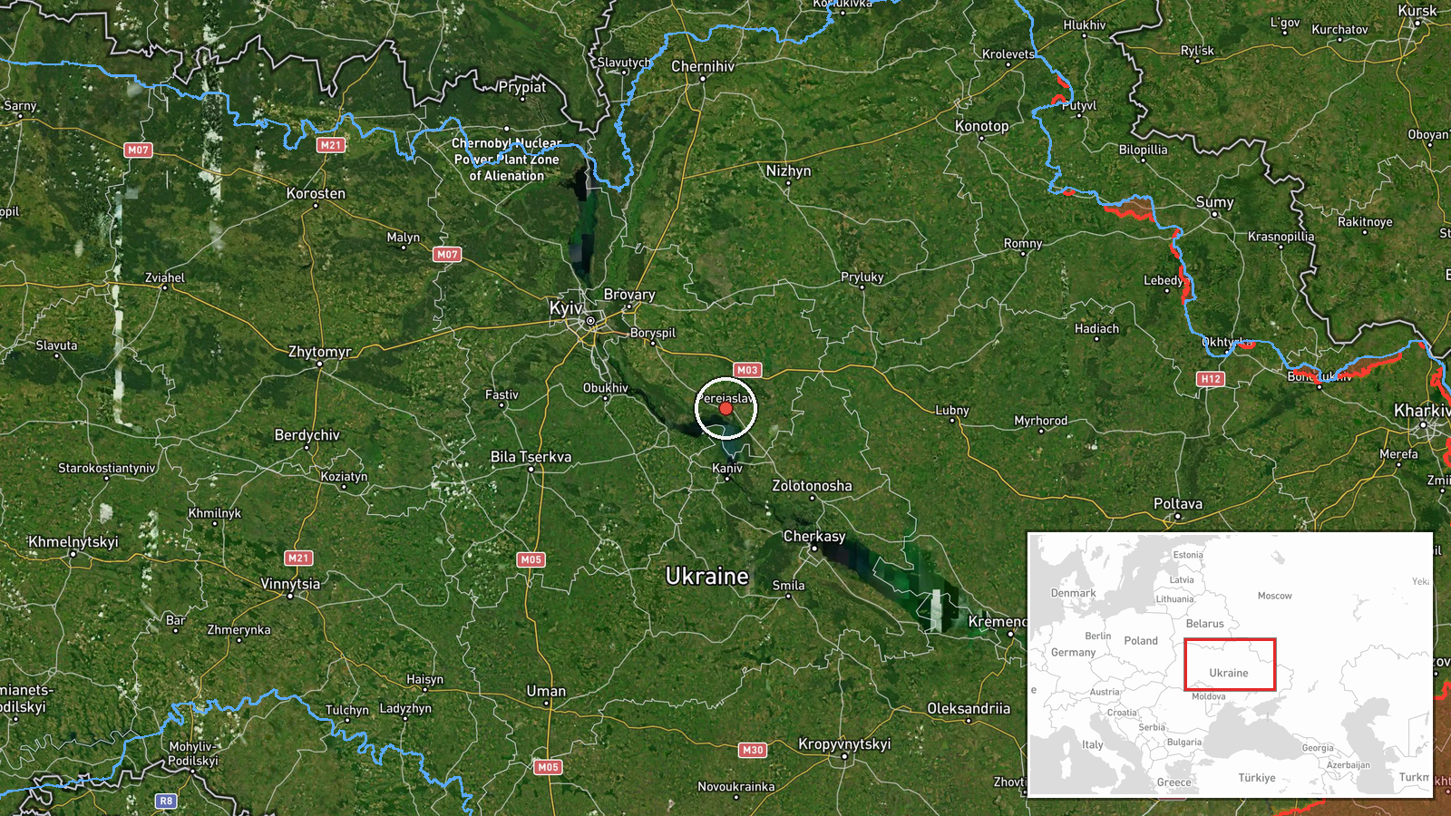
Russian Geran-3 drone tracked toward Pereiaslav in central Ukraine
What happened
Ukrainian air monitoring detected one Russian jet-powered Shahed (Geran-3) unmanned aerial vehicle heading toward Pereiaslav on October 13 at 13:32 UTC. The report was posted by the Kyiv regional military administration's Telegram channel. No details were provided regarding interception, impact, or casualties. The drone transit occurred as part of sustained Russian air operations across Ukraine.
Context and assessment
Pereiaslav lies approximately 50 kilometers southeast of Kyiv in the Kyiv region, a civilian administrative center and transport hub historically targeted in Russia's air campaign. The detection occurs within a pattern of intense Russian drone activity documented on October 13—Ukrainian forces reportedly engaged over 9,500 kamikaze drones and absorbed 90 airstrikes over a 24-hour period. A similar Geran-3 detection near Obukhiv, closer to Kyiv, was reported minutes later the same morning. The Geran-3 is a long-range air-launched cruise missile designed for penetrating air defenses over extended distances, indicating sustained Russian efforts to strike rear-area infrastructure and civilian targets.
Sources and confidence
Report sourced exclusively from Telegram channel @kpszsu (Kyiv regional military administration). Single-source detection with no cross-confirmation from other Ukrainian monitoring channels visible in available data. Confidence score of 8.0 reflects institutional credibility of the source and alignment with concurrent Russian air operations documented by Ukrainian General Staff. Score would increase with additional independent radar or witness confirmation.
Location
Pereiaslav is a settlement in Kyiv Oblast, central Ukraine, located at coordinates 50.067°N, 31.450°E. Situated roughly 50 km southeast of Kyiv city center on the Dnipro River's right bank, it serves as a regional administrative and transport node. The precision level is settlement-based, reflecting Ukrainian air monitoring's typical geographic reporting granularity.
Related events nearby
- Ukrainian air monitoring: 1 Russian jet-powered Shahed (Geran-3) drone heading toward Obukhiv.2026-10-13 13:36 UTC · Drone Transit · Obukhiv, Ukraine
- Ukrainian General Staff reports 203 combat engagements in past 24 hours (as of 08:00 13 Oct 2026). Russia cond2026-10-13 05:04 UTC · Report · Ukraine
- Ukrainian air monitoring: 1 Russian jet-powered Shahed (Geran-3) drone over Kharkivskyi Masyv, Kyiv.2026-10-13 14:20 UTC · Drone Transit · Kharkivskyi Masyv, Kyiv, Ukraine
- Ukrainian air monitoring: 1 Russian jet-powered Shahed (Geran-3) drone from Kyiv Oblast toward Velyka Dymerka.2026-10-13 14:46 UTC · Drone Transit · Velyka Dymerka, Ukraine
- Ukrainian Foreign Minister Sybiha confirms receipt of US intelligence and attributes delayed air raid alerts d2026-10-13 11:14 UTC · Statement · Kyiv, Ukraine
▶ View this event on the live map

Intel Mapper aggregates open-source reports from monitored Telegram and X channels, geolocates them, cross-checks duplicates across sources and assigns a confidence score. Entries are updated as new confirmations arrive. Read how we verify events.