Russian Shahed drones spotted transiting Beryslav district in Kherson region
What happened
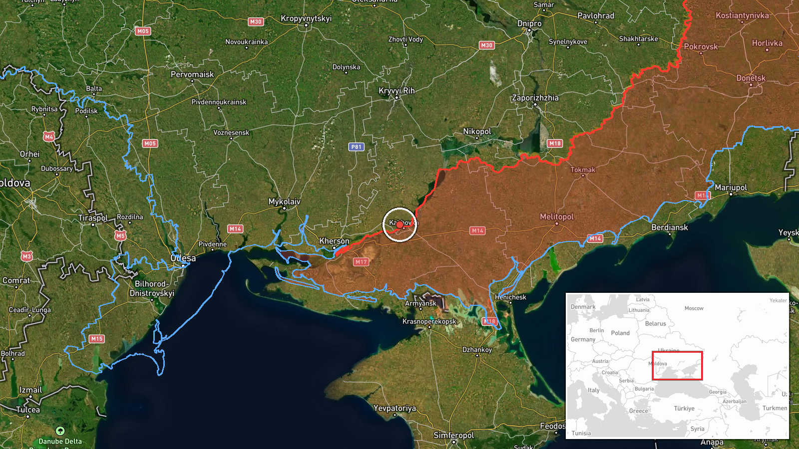
Ukrainian air monitoring reportedly detected two or more Russian jet-powered Shahed (Geran-3) loitering munitions passing through Beryslav district in Kherson region on the morning of 15 October, heading northwest. The observation was logged by the Ukrainian Air Force command's Telegram channel. Beryslav lies on the Dnipro River in the southern part of Kherson region, roughly 50 kilometres northeast of the Russian-held city of Melitopol.
Context and assessment
Shahed drones represent a sustained Russian air campaign tool typically used against energy infrastructure, military facilities, and urban targets across Ukrainian territory. The northwest trajectory from Beryslav suggests the drones were transiting toward central or western Ukraine rather than staging a local strike. Such transit observations are routinely reported by Ukrainian monitoring services and reflect the frequency of these operations. The Beryslav area remains contested terrain near the Dnipro's course, making it a regular corridor for incoming Russian air threats. Continued drone transits indicate Russia maintains the capability and intent to conduct standoff strikes despite Ukrainian air defences.
Sources and confidence
The report originates from a single source: the official Telegram channel of Ukraine's air force command (@kpszsu), which maintains public monitoring of air activity. No cross-confirmation from other channels is noted. Confidence remains moderate (8.0/10) due to single-source reporting and lack of corroboration, though the air force channel is a reliable institutional source. Confirmation via secondary reports or attack impact assessment would raise confidence.
Location
Beryslav district is located in central-southern Kherson region at approximately 46.84°N, 33.43°E. The settlement sits on the western bank of the Dnipro River and serves as a district administrative centre. The area lies roughly 50 km from the southern frontline near Melitopol and has seen periodic Russian strikes and military activity.
Related events nearby
- Ukrainian air monitoring: 1 Russian Shahed-type drone passing Nikopol district, heading north.2026-10-15 02:43 UTC · Drone Transit · Nikopol district, Ukraine
▶ View this event on the live map

Intel Mapper aggregates open-source reports from monitored Telegram and X channels, geolocates them, cross-checks duplicates across sources and assigns a confidence score. Entries are updated as new confirmations arrive. Read how we verify events.