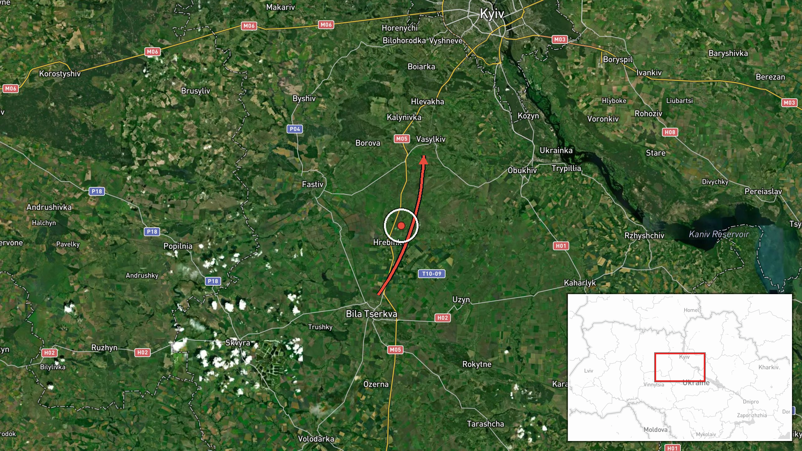
Russian jet-powered Shahed drone tracked over Kyiv Oblast heading toward Vasylkiv
What happened
Ukrainian air monitoring detected one Russian jet-powered Shahed (Geran-3) unmanned aerial vehicle transiting the airspace near Bila Tserkva on 15 October 2026 at approximately 14:10 UTC, reportedly heading toward the settlements of Vasylkiv or Obuhiv in Kyiv Oblast. The drone transit was recorded by the Telegram channel of the Kyiv Civil Military Administration (KPSZSU). The observation comes amid sustained Russian drone operations across the region throughout the day.
Context and assessment
Vasylkiv lies approximately 40 kilometres southwest of Kyiv and hosts significant infrastructure including an airfield and industrial facilities, making it a recurring Russian target. The Shahed Geran-3 is a jet-powered cruise drone with extended range and endurance compared to earlier variants. The sighting follows multiple other Shahed transits detected on the same date over nearby areas including Vyshneve, Zhuliany airfield, and Fastiv, suggesting a coordinated Russian drone operation targeting multiple objectives across Kyiv Oblast. Such concentrated activity may indicate an effort to saturate Ukrainian air defences or strike infrastructure supporting Kyiv's war effort.
Sources and confidence
Report sourced solely from the Kyiv Civil Military Administration's official Telegram channel (@kpszsu), which regularly publishes air monitoring data. The single-source reporting and lack of cross-confirmation from other Ukrainian channels or independent observers accounts for the confidence score of 8.0. Confirmation from additional monitoring sources or impact reports would strengthen confidence; retraction or correction by KPSZSU would lower it.
Location
Vasylkiv (50.18°N, 30.31°E) is a city in Kyiv Oblast approximately 40 km southwest of central Kyiv, situated on the Stuhna River. The settlement is a known industrial and transportation hub. Bila Tserkva, the reference point for the drone's transit, lies roughly 20 km further southwest. Geographic precision is marked as settlement-level with high confidence.
Related events nearby
- Ukrainian air monitoring: 1 Russian jet-powered Shahed (Geran-3) drone from Kyiv Oblast toward Chabany.2026-10-15 06:20 UTC · Drone Transit · Chabany, Ukraine
- Ukrainian air monitoring: 1 Russian jet-powered Shahed (Geran-3) drone from Kyiv Oblast toward Vyshneve.2026-10-15 14:16 UTC · Drone Transit · Vyshneve, Ukraine
- Ukrainian air monitoring: 1 Russian jet-powered Shahed (Geran-3) drone heading toward Vyshneve.2026-10-15 13:58 UTC · Drone Transit · Vyshneve, Ukraine
- Ukrainian air monitoring: 1 Russian jet-powered Shahed (Geran-3) drone heading toward Obukhiv.2026-10-15 14:58 UTC · Drone Transit · Obukhiv, Ukraine
- Ukrainian air monitoring: 1 Russian jet-powered Shahed (Geran-3) drone heading toward Zhuliany, Kyiv.2026-10-15 13:59 UTC · Drone Transit · Zhuliany, Kyiv, Ukraine
▶ View this event on the live map

Intel Mapper aggregates open-source reports from monitored Telegram and X channels, geolocates them, cross-checks duplicates across sources and assigns a confidence score. Entries are updated as new confirmations arrive. Read how we verify events.