Russian jet-powered Shahed drone reported over Lopatyn in Lviv Oblast
What happened
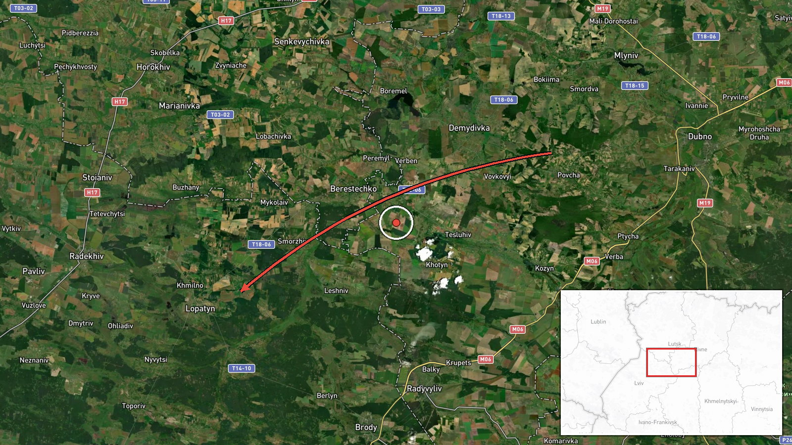
Ukrainian air monitoring reported a single Russian jet-powered Shahed (Geran-3) drone transiting toward Lopatyn in Lviv Oblast on 15 October at 16:58 UTC. The drone reportedly originated from Rivne Oblast to the north. The report came from the Ukrainian general staff's air monitoring channel. No interception or impact was mentioned in the available reporting.
Context and assessment
This sighting is part of a sustained pattern of Russian drone activity across northwestern Ukraine on 15 October, with multiple Shahed drones tracked over Volyn and Lviv oblasts throughout the day. Earlier sightings the same afternoon detected similar drones heading toward Lutsk and transiting Volyn Oblast. The Shahed-136/Geran-3 is a loitering kamikaze drone typically employed against infrastructure, military positions, or populated areas. The concentration of observed drone traffic in this northwestern corridor may indicate a coordinated strike operation or sustained reconnaissance pressure on Ukrainian-held territory in the region.
Sources and confidence
Reported solely by the official Telegram channel of the Ukrainian general staff air monitoring service (@kpszsu). Single-source reporting limits independent cross-confirmation, though Ukrainian air monitoring channels are generally reliable for tracking Russian air activity. The confidence score of 8.0 reflects the credibility of the Ukrainian source but the absence of secondary confirmation. Additional reports from air defense systems or visual confirmation would strengthen confidence.
Location
Lopatyn is a settlement in Lviv Oblast in western Ukraine, located approximately 35 kilometres north-northwest of the regional capital Lviv and near the border with Poland. The settlement sits in relatively open terrain typical of the western Ukrainian lowlands. Geographic precision is rated high based on the named settlement identifier.
Related events nearby
- Ukrainian air monitoring: 1 Russian jet-powered Shahed (Geran-3) drone heading toward Lutsk.2026-10-15 17:23 UTC · Drone Transit · Lutsk, Ukraine
- Ukrainian air monitoring: 1 Russian jet-powered Shahed (Geran-3) drone heading toward Lutsk.2026-10-15 16:34 UTC · Drone Transit · Lutsk, Ukraine
- Ukrainian air monitoring: 1 Russian jet-powered Shahed (Geran-3) drone heading toward Lutsk.2026-10-15 16:31 UTC · Drone Transit · Lutsk, Ukraine
- Ukrainian air monitoring: 2+ Russian jet-powered Shahed (Geran-3) drones over Volyn Oblast.2026-10-15 16:28 UTC · Drone Transit · Volyn Oblast, Ukraine
- Ukrainian air monitoring: 1 Russian jet-powered Shahed (Geran-3) drone heading toward Lutsk.2026-10-15 12:34 UTC · Drone Transit · Lutsk, Ukraine
▶ View this event on the live map

Intel Mapper aggregates open-source reports from monitored Telegram and X channels, geolocates them, cross-checks duplicates across sources and assigns a confidence score. Entries are updated as new confirmations arrive. Read how we verify events.