Ukrainian monitors report 2+ jet-powered Shahed (Geran-3) drones inbound over Klyuchi from the sea
What happened
On 16 October 2026 at about 01:07 UTC, the Telegram channel @kpszsu, the Ukrainian air monitoring account, reported two or more Russian jet-powered Shahed-type drones, designated Geran-3, over the location labeled Klyuchi. The original post, in Ukrainian, says jet-powered UAVs were heading toward the south of Mykolaiv oblast from the sea, which is a transit description rather than a confirmed impact report. The post does not describe any strike, damage, casualties, or interception. The event is recorded as a drone transit, attributed to Russia, and rests on this single channel's wording.
Context and assessment
Mykolaiv oblast lies on Ukraine's southern coast, where the Black Sea approaches and the approaches to Odesa and the Dnipro-Buh estuary are close. Drones arriving from the sea there typically follow routes that test air defense coverage and can reach port, energy, and logistics infrastructure. The jet-powered Geran-3 variant is faster than the earlier piston-engined Shahed models, which reduces the time available for interception and makes early warning more important. No related events were recorded for this window, so this report cannot be placed within a verified sequence of nearby attacks. A single transit report does not establish intent. It may reflect a route probe, a diversion, or part of a larger raid that was not captured here. Any follow-up reporting on impacts or interceptions in the same area would clarify which of these is more likely.
Sources and confidence
Only one source is recorded: the Telegram channel @kpszsu. No independent outlet, official statement, or second monitoring channel is attached to this event, so cross-confirmation is absent. The confidence score of 8.0 reflects a source that has a clear operational role in air monitoring and a specific, plausible report, but it is held below the top of the scale because it is unverified and single-channel. Confidence would rise with corroboration from additional monitoring accounts, regional military administration statements, or wreckage and impact reports. It would fall if later reporting showed the drones did not enter Ukrainian airspace or if the channel issued a correction.
Location
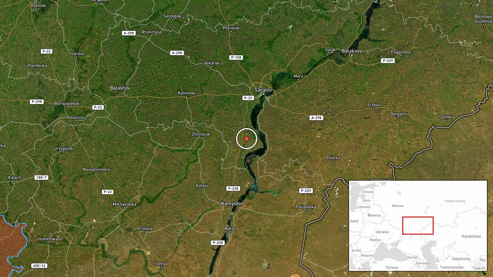
The event is tagged as Klyuchi, Ukraine, with settlement-level precision and high location confidence. However, the stored coordinates, about 50.97 N and 45.70 E, do not fall within Mykolaiv oblast, which is near 47 N and 31 to 32 E. The original post refers to southern Mykolaiv oblast. The point should be treated as unreliable until it is reviewed against the original wording, and it may reflect a geocoding error with a settlement that shares the name Klyuchi. Mykolaiv oblast's southern side borders the Black Sea and the Dnipro-Buh estuary, which is the setting the source describes.
▶ View this event on the live map

Intel Mapper aggregates open-source reports from monitored Telegram and X channels, geolocates them, cross-checks duplicates across sources and assigns a confidence score. Entries are updated as new confirmations arrive. Read how we verify events.