Single Russian Shahed-type drone reported heading toward Lypovets from the north, Vinnytsia Oblast
What happened
Ukraine's air monitoring channel on Telegram, @kpszsu, reported one Russian Shahed-type drone heading toward Lypovets, a settlement in Vinnytsia Oblast, from the north. The original Ukrainian post, roughly translated, reads 'UAV toward Lypovets from the north.' The report classifies the event as a drone transit, not a confirmed strike. The timestamp is 16 October 2026 at 01:43 UTC. The report does not state the drone's variant, altitude, speed, or whether it hit anything. Because the wording is brief and the account is the only named source, this should be read as an alert about a reported track rather than a confirmed impact or casualty event.
Context and assessment
Lypovets matters mainly as a point on a corridor that recent reports have repeatedly described. Between 15 and 16 October 2026, the same monitoring feed logged a sequence of drone transits across Vinnytsia Oblast. These included single jet-powered Shahed-type drones identified as Geran-3 heading toward Illintsi, Voronovytsya, and Pogrebyshche, a drone from Odesa Oblast entering Vinnytsia Oblast, and a group of two or more Geran-3 aircraft from Vinnytsia Oblast toward Lypovets about sixteen minutes before this report. The pattern shows drones being tracked across the oblast over several hours, with individual settlements named as reported destinations. This suggests a sustained use of long-range one-way attack drones routed through central Ukraine. Operationally, repeated tracks converging on Lypovets could indicate a planned approach rather than random drift, but the sources do not confirm an intended target, and transit reports frequently do not result in impacts. The reports describe movement through the territory rather than a specified strike point.
Sources and confidence
The report comes from a single Telegram channel, @kpszsu, which reportedly serves as an Ukrainian air monitoring account and is a routine source for drone movement alerts. No second channel or independent outlet in the provided data confirms this specific track, so cross-confirmation is absent. The confidence score of 8.0 reflects a credible, time-stamped official-style source, offset by being single-sourced and brief. Confidence would rise if other monitoring channels, regional military administrations, or local reports corroborated the track, or if a follow-up confirmed the drone's arrival or interception. It would fall if the alert were retracted or if no further reporting appeared.
Location
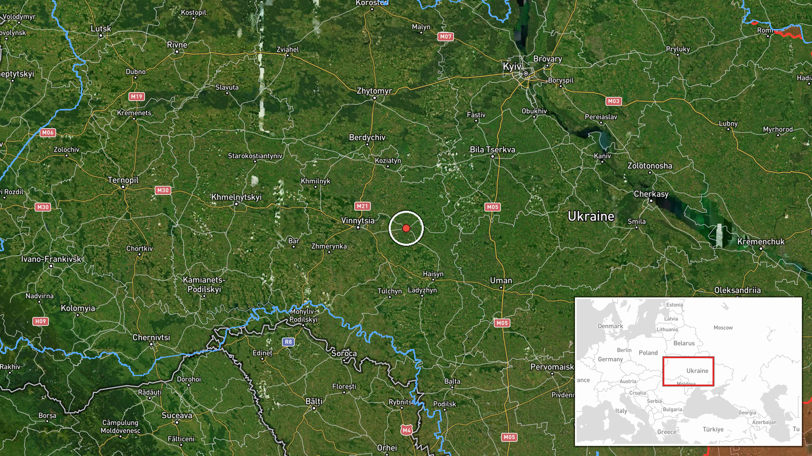
The location is recorded at settlement level for Lypovets, Ukraine, with high location confidence, at approximately 49.23 N, 29.06 E. The town lies in Vinnytsia Oblast in central-west Ukraine, an area of farmland, small towns, and river valleys. Nearby, the related events cluster around Illintsi, Voronovytsya, and Pogrebyshche within the same oblast. The point refers to a town rather than a specific facility, so no particular site is implied.
Related events nearby
- Ukrainian air monitoring: 2+ Russian jet-powered Shahed (Geran-3) drones from Vinnytsia Oblast toward Lypovets2026-10-16 01:27 UTC · Drone Transit · Lypovets, Ukraine
- Ukrainian air monitoring: 1 Russian jet-powered Shahed (Geran-3) drone heading toward Vinnytsia Oblast, destin2026-10-15 12:14 UTC · Drone Transit · Pogrebyshche, Vinnytsia Oblast, Ukraine
- Ukrainian air monitoring: 1 Russian jet-powered Shahed (Geran-3) drone from Odesa Oblast toward Vinnytsia Obla2026-10-15 17:01 UTC · Drone Transit · Vinnytsia Oblast, Ukraine
- Ukrainian air monitoring: 1 Russian jet-powered Shahed (Geran-3) drone from Kirovohrad Oblast toward Vinnytsia2026-10-15 08:58 UTC · Drone Transit · Vinnytsia Oblast, Ukraine
- Ukrainian air monitoring: jet-powered Shahed (Geran-3) drones tracked over western Kirovohrad Oblast, heading 2026-10-16 01:16 UTC · Drone Transit · Vinnytsia, Ukraine
▶ View this event on the live map

Intel Mapper aggregates open-source reports from monitored Telegram and X channels, geolocates them, cross-checks duplicates across sources and assigns a confidence score. Entries are updated as new confirmations arrive. Read how we verify events.