Ukrainian air monitoring reports one unidentified drone heading toward Korosten, Zhytomyr Oblast
What happened
Ukrainian air monitoring reported a single unmanned aerial vehicle heading toward Korosten, a city in northern Zhytomyr Oblast, at 17:01 UTC on 16 October 2026. The source is a brief Ukrainian-language post on the Telegram channel @kpszsu, which in translation reads roughly as 'Zhytomyr region: UAV toward Korosten.' The post does not name a drone type, a launch origin, or any impact. The English summary labels the aircraft a Russian Shahed-type drone, an attribution that reflects the aggregator's classification rather than wording in the original message. No strikes, damage, or casualties are described, and the post is a transit notice rather than a confirmed impact record.
Context and assessment
Korosten is a rail junction and industrial hub in northern Zhytomyr Oblast, close to the border with Kyiv Oblast and the forested Polissia region. Its rail links and position on routes between Kyiv and western Ukraine make it a recurring point of interest for air monitoring, although the source material does not state why this drone was heading there. The related reports from the same day show a sustained pattern. Between 01:13 and 03:54 UTC, monitoring posts recorded one drone and then groups of two or more jet-powered Geran-3 type drones moving from Zhytomyr Oblast toward Korosten. A further drone was reported passing northern Zhytomyr Oblast heading west at 02:56, and another from Kyiv Oblast was logged at 05:08. The 17:01 event is the latest in this series. The repeated headings toward Korosten and the mix of single and multi-drone waves may indicate a sequence of transit flights along a corridor, or an effort to probe air defense coverage in the area. That reading is inference from timing and wording, not confirmed intent. The data cannot establish whether these reports describe the same aircraft or separate launches.
Sources and confidence
The report rests on a single source: the @kpszsu Telegram channel, which is widely identified as the Ukrainian Air Force's monitoring account. No independent outlet, radar feed, or second channel in the data corroborates this specific report, so cross-confirmation is absent. The confidence score of 8.0 reflects the channel's official-looking origin and its consistency with a series of same-day reports, but it is tempered by the terse wording and the lack of independent confirmation. The score would rise with a second independent source or a follow-up official statement. It would fall if the track were revised or retracted, or if later reporting identified a different aircraft type or showed the object left the area.
Location
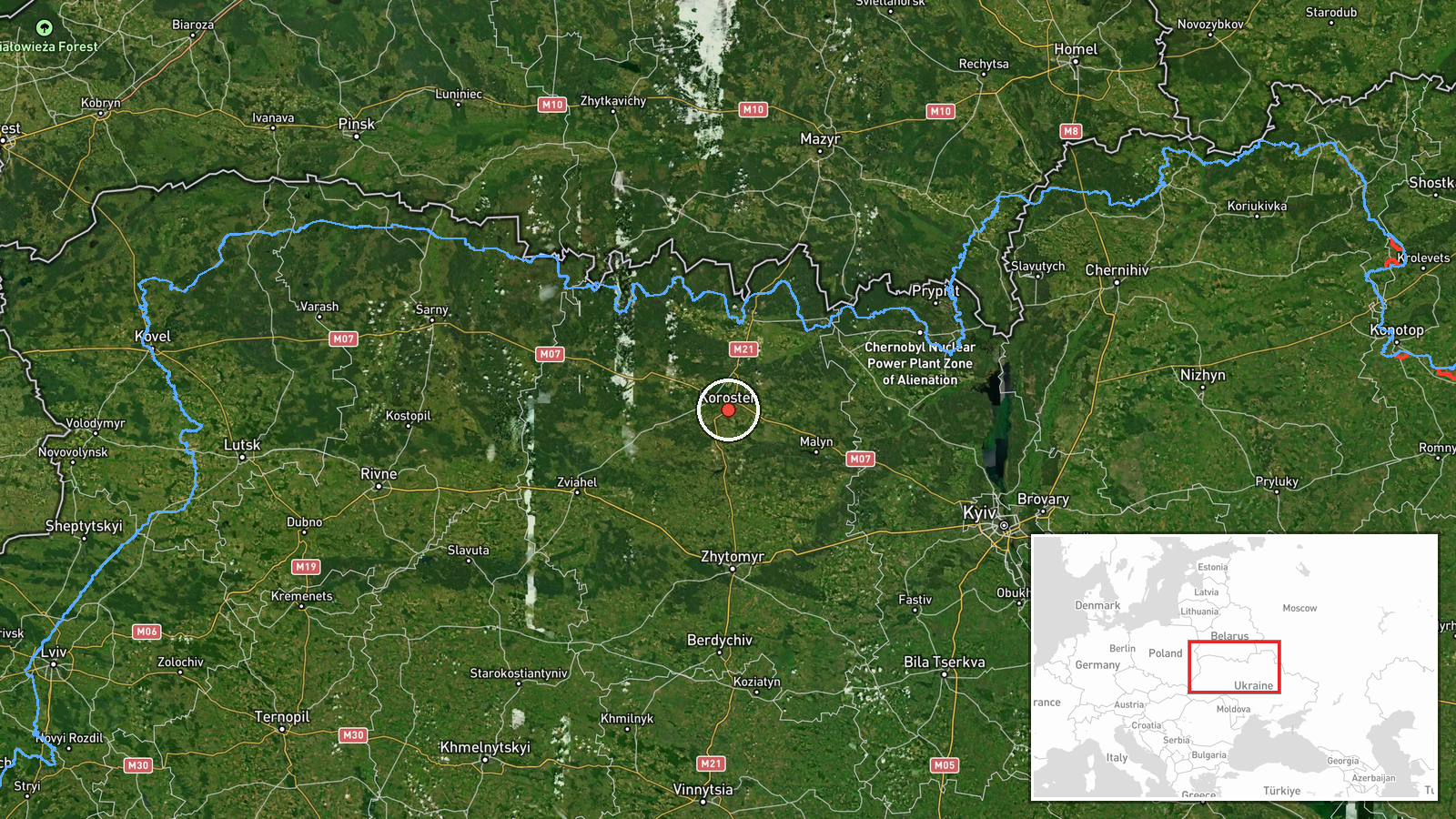
The coordinates place the event at the centre of Korosten, a settlement-level match with high location confidence, so the pin marks the town rather than any specific facility. Korosten lies in northern Zhytomyr Oblast within the Polissia lowlands, where forest, marshland and river valleys are common. The town is a rail hub, and the area-level precision means the event should be read as a regional report rather than a target-specific one.
Related events nearby
- Ukrainian air monitoring: 1 Russian jet-powered Shahed (Geran-3) drone from Zhytomyr Oblast toward Korosten; 12026-10-16 03:54 UTC · Drone Transit · Korosten, Ukraine
- Ukrainian air monitoring: 2+ Russian jet-powered Shahed (Geran-3) drones from Zhytomyr Oblast toward Korosten.2026-10-16 02:37 UTC · Drone Transit · Korosten, Ukraine
- Ukrainian air monitoring: 1 Russian jet-powered Shahed (Geran-3) drone heading toward Korosten.2026-10-16 01:13 UTC · Drone Transit · Korosten, Ukraine
- Ukrainian air monitoring: 1 Russian jet-powered Shahed (Geran-3) drone from Kyiv Oblast toward northern Zhytom2026-10-16 05:08 UTC · Drone Transit · northern Zhytomyr Oblast, Ukraine
- Ukrainian air monitoring: 2+ Russian jet-powered Shahed (Geran-3) drones passing northern Zhytomyr Oblast, hea2026-10-16 02:56 UTC · Drone Transit · northern Zhytomyr Oblast, Ukraine
▶ View this event on the live map

Intel Mapper aggregates open-source reports from monitored Telegram and X channels, geolocates them, cross-checks duplicates across sources and assigns a confidence score. Entries are updated as new confirmations arrive. Read how we verify events.