Russian Shahed-type drone reported passing Chopovychi, Zhytomyr Oblast, heading west
What happened
Ukrainian air monitoring reported one Russian Shahed-type drone passing near Chopovychi on 17 October 2026 at about 07:56 UTC, travelling in a westerly direction. The report, published on the Telegram channel @kpszsu, uses the wording 'Повз Чоповичі у західному напрямку', which translates roughly as 'past Chopovychi in the western direction.' The post does not describe impact, damage, casualties, or detonation, and it does not identify a target. The event is logged as a drone transit rather than a strike. Its timing and direction place it within a series of drone sightings across Zhytomyr Oblast that morning, several of which were recorded moving toward Korosten and Malyn.
Context and assessment
Chopovychi lies in the Korosten area of Zhytomyr Oblast, a region that sits on the main approach corridors from northern Ukraine toward Kyiv and the central part of the country. Korosten is a significant railway junction, which gives the area logistical importance beyond its size. The related reports from the same day show a pattern of single drones entering Zhytomyr Oblast from the north and east, then being tracked toward Korosten and Malyn. Some of these reports describe the jet-powered Geran-3 variant, while others describe standard Shahed-type airframes without specifying a model. The Chopovychi report fits this sequence: it places a drone on a westward track through the same general zone of monitoring. Operationally, a steady stream of single drones moving through a corridor may indicate route probing, distraction of air defence, or simply the regular flow of long-range drones toward targets further west. Single transit reports alone cannot establish which of these purposes applies, and the available data does not show the drone's final destination or whether it was engaged.
Sources and confidence
The event rests on one source: a Telegram post from the @kpszsu channel, which carries Ukrainian air monitoring reports and has been used for drone tracking in past events. No independent outlet, radar feed, or second channel is listed as confirming the sighting, so cross-confirmation is absent. The confidence score of 8.0 reflects a credible official-style channel with a precise location and a clear, unambiguous report, offset by the single-source basis. Confidence would rise with corroboration from a second monitoring channel or regional military administration, or with a matching report of wreckage or interception. It would fall if the channel issued a correction or if later reporting contradicted the track.
Location
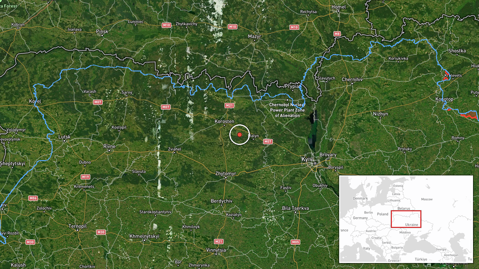
The location is given as Chopovychi at settlement precision, with coordinates of approximately 50.83 N and 28.95 E, and the location confidence is recorded as high. The point is a village-level placement rather than a specific facility or grid reference, which suits a monitoring report that names a settlement the drone passed. The area is rural and low-lying, lying in the wooded and farmland terrain typical of northern Zhytomyr Oblast. Korosten and Malyn, both named in related reports, are nearby settlements that help frame the track.
Related events nearby
- Ukrainian air monitoring: 1 Russian Shahed-type drone from northern Kyiv Oblast toward northern Zhytomyr Oblas2026-10-17 08:24 UTC · Drone Transit · northern Zhytomyr Oblast, Ukraine
- Ukrainian air monitoring: 1 Russian Shahed-type drone from northern Kyiv Oblast toward northern Zhytomyr Oblas2026-10-17 06:49 UTC · Drone Transit · northern Zhytomyr Oblast, Ukraine
- Ukrainian air monitoring: 1 Russian jet-powered Shahed (Geran-3) drone from Zhytomyr Oblast toward Malyn.2026-10-17 07:52 UTC · Drone Transit · Malyn, Ukraine
- Ukrainian air monitoring: 1 Russian Shahed-type drone from Zhytomyr Oblast toward Korosten.2026-10-17 06:24 UTC · Drone Transit · Korosten, Ukraine
- Ukrainian air monitoring: 1 Russian jet-powered Shahed (Geran-3) drone from Zhytomyr Oblast toward Korosten.2026-10-17 01:23 UTC · Drone Transit · Korosten, Ukraine
▶ View this event on the live map

Intel Mapper aggregates open-source reports from monitored Telegram and X channels, geolocates them, cross-checks duplicates across sources and assigns a confidence score. Entries are updated as new confirmations arrive. Read how we verify events.