Ukrainian air monitoring reports one Russian Shahed-type drone heading toward Kharkiv
What happened
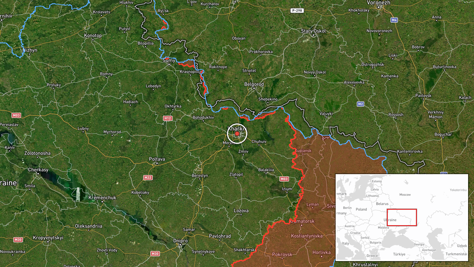
On 17 October 2026 at about 08:56 UTC, a Telegram channel tracked as @kpszsu reported one Russian Shahed-type drone heading toward Kharkiv from the north. The report's wording describes the contact as a strike UAV approaching the city, and the entry is categorized as a drone transit, meaning a single airborne track reported in flight rather than a confirmed impact. The post was published in Ukrainian and carries no independent detail on the drone's altitude, speed, or intended target. The event is recorded at the settlement level for Kharkiv city, and the original summary is a brief air-alert style notice with no follow-up casualty or damage information attached at the time of logging.
Context and assessment
Kharkiv has been a recurring target in this period, and the related entries show a sequence of activity over roughly fifteen hours. Between 18:35 and 19:22 UTC on 16 October, three separate reports described one to two or more Russian Banderol mini cruise missiles heading toward the city, indicating repeated missile tracks rather than a single event. Early on 17 October, two Shahed-type drone transits were logged, first at 06:48 UTC heading toward Kharkiv and then at 07:38 UTC from northern Kharkiv Oblast toward the city. The single drone at 08:56 UTC therefore continues a pattern of small, staggered airborne tracks converging on the same urban area. Operationally, such spacing may reflect continued probing, rolling launches, or sustained pressure on air defence in the northern approaches, though the data alone cannot establish intent. Kharkiv's proximity to the Russian border, within a few tens of kilometres, shortens flight times and limits warning windows, which is one reason repeated transit reports tend to cluster there.
Sources and confidence
The entry rests on a single Telegram channel, @kpszsu, which is widely associated with Ukrainian air monitoring and air alert reporting. No second channel, official statement, or wire service independently confirms this specific track in the data provided. The confidence score of 8.0 reflects a credible and specialised source with a consistent reporting pattern alongside the related entries, but it stops short of the top range because the report is unconfirmed by a second source and no outcome has been recorded. Confidence would rise with corroboration from another monitoring channel, official air force reporting, or local Kharkiv authorities, or with a recorded impact location. It would fall if later reporting withdraws the track or reclassifies it as a different object.
Location
The location is assigned at settlement precision to Kharkiv, Ukraine, at approximately 49.99 N, 36.23 E, which is the city centre rather than a specific facility. The source named the city as the destination, so the coordinates represent the target area and not a confirmed point of flight or impact. Kharkiv lies in northeastern Ukraine, near the Russian border, on relatively flat terrain crossed by the Lopan and Kharkiv rivers. Its dense urban layout, with many residential and industrial districts, is the setting in which drone and missile tracks heading toward the city are usually reported.
Related events nearby
- Ukrainian air monitoring: 1 Russian Shahed-type drone from northern Kharkiv Oblast toward Kharkiv.2026-10-17 07:38 UTC · Drone Transit · Kharkiv, Ukraine
- Ukrainian air monitoring: 1 Russian Shahed-type drone heading toward Kharkiv.2026-10-17 06:48 UTC · Drone Transit · Kharkiv, Ukraine
- Ukrainian air monitoring: 2+ Russian Banderol mini cruise missiles heading toward Kharkiv.2026-10-16 19:22 UTC · Cruise Missile · Kharkiv, Ukraine
- Ukrainian air monitoring: 1 Russian Banderol mini cruise missile heading toward Kharkiv.2026-10-16 19:17 UTC · Cruise Missile · Kharkiv, Ukraine
- Ukrainian air monitoring: 1 Russian Banderol mini cruise missile heading toward Kharkiv.2026-10-16 18:35 UTC · Cruise Missile · Kharkiv, Ukraine
▶ View this event on the live map

Intel Mapper aggregates open-source reports from monitored Telegram and X channels, geolocates them, cross-checks duplicates across sources and assigns a confidence score. Entries are updated as new confirmations arrive. Read how we verify events.