Ukrainian Air Force reports one Shahed-type drone heading toward Konotop, Sumy Oblast
What happened
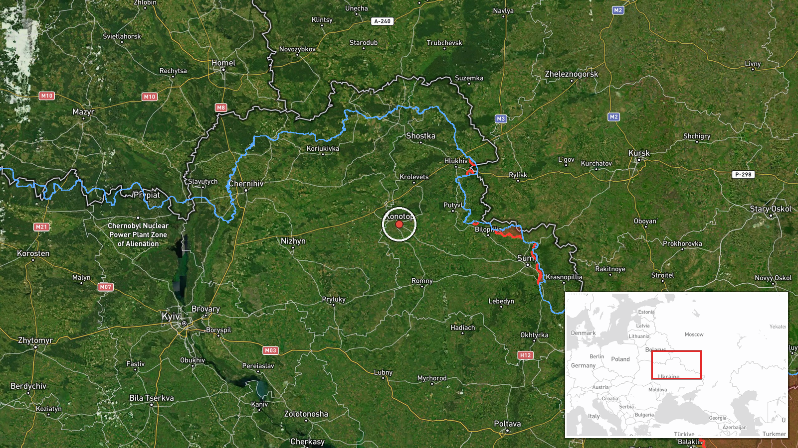
Ukraine's Air Force, via its Telegram channel @kpszsu, reported on 17 October 2026 at 15:29 UTC that one Russian Shahed-type strike drone was heading toward Konotop, a city in Sumy Oblast in northeastern Ukraine. The original Ukrainian-language post, which reads roughly as 'strike UAV toward Konotop from the east,' describes a drone approaching from the east rather than confirming any impact. The item is an air-monitoring alert, not a report of damage, casualties, or interception. It was posted as a single item with no independent confirmation at the time of recording. Earlier the same day, the monitoring feed logged several other threats across the Chernihiv and Sumy border belt, including cruise missile alerts toward Konotop itself.
Context and assessment
Konotop lies close to the Russian border and sits on the Seym River along transport routes that connect northeastern Ukraine with the wider Sumy and Chernihiv regions, which helps explain why it appears often in air alerts. The related events from the same day show a dense sequence. A Shahed-type drone was logged toward Baturyn in the early hours, another was seen passing Nova heading west in the morning, and then a Banderol mini cruise missile was tracked toward Baturyn at 11:45 UTC. Within minutes a Banderol was logged toward Konotop at 11:53, and another was tracked from Chernihiv Oblast toward Borzna at 11:58. Taken together, the pattern suggests that multiple threats were moving across a northern corridor in overlapping waves, with different settlements receiving alerts in quick succession. Operationally, such clustering may indicate sustained probing of air defenses, strike packages routed along the border axis, or an effort to stretch warning and interception resources. The alerts themselves do not identify intended targets, so any inference about infrastructure or military objectives remains speculative.
Sources and confidence
The alert rests on a single Telegram channel, @kpszsu, which is the Ukrainian Air Force's official monitoring feed and has a generally consistent record for threat warnings. The confidence score of 8.0 reflects that institutional origin and the fact that the same day's alerts form a coherent pattern. It is held below the maximum because this specific item has no cross-confirmation from another outlet, no impact or wreckage report, and no statement from local authorities. Confidence would rise with corroboration from regional officials, reports of interception or impact in Konotop, or independent video or imagery. It would fall if the alert were updated, withdrawn, or contradicted by subsequent official reporting on the drone's heading.
Location
The location is recorded at settlement precision, with coordinates placed at the city of Konotop rather than at any specific facility, which is why the location confidence is rated high. Konotop is in Sumy Oblast in northeastern Ukraine, near the Russian border. The Seym River runs through the city, and the surrounding terrain is largely flat agricultural and wooded countryside typical of the region. Because the point marks the whole settlement, it does not indicate where the drone was located at any given moment.
Related events nearby
- Ukrainian air monitoring: 1 Russian Banderol mini cruise missile heading toward Konotop.2026-10-17 11:53 UTC · Cruise Missile · Konotop, Ukraine
- Ukrainian air monitoring: 1 Russian Banderol mini cruise missile heading toward Baturyn.2026-10-17 11:45 UTC · Cruise Missile · Baturyn, Ukraine
- Ukrainian air monitoring: 1 Russian Shahed-type drone heading toward Baturyn.2026-10-17 02:21 UTC · Drone Transit · Baturyn, Ukraine
- Ukrainian air monitoring: 1 Russian Shahed-type drone passing Nova, heading west.2026-10-17 08:38 UTC · Drone Transit · Nova, Ukraine
- Ukrainian air monitoring: 1 Russian Banderol mini cruise missile from Chernihiv Oblast toward Borzna.2026-10-17 11:58 UTC · Cruise Missile · Borzna, Ukraine
▶ View this event on the live map

Intel Mapper aggregates open-source reports from monitored Telegram and X channels, geolocates them, cross-checks duplicates across sources and assigns a confidence score. Entries are updated as new confirmations arrive. Read how we verify events.