Shahed-type drone reported over Black Sea heading north toward Odesa-Mykolaiv border
What happened
Ukraine's Air Force monitoring channel on Telegram, @kpszsu, reported on 19 October 2026 at 19:24 UTC that a Russian Shahed-type drone was passing over the Black Sea on a northern heading along the boundary of Odesa and Mykolaiv oblasts. The one-line summary describes a single drone, but the original Ukrainian wording refers to 'ударні БпЛА', meaning strike unmanned aerial vehicles in the plural, so the exact number is not settled by the text alone. The post gives no impact location, no damage reports, and no casualty information, and it does not identify a launch site. The event is recorded as a transit, meaning the aircraft was tracked in flight rather than observed striking a target. Attribution to Russia rests on the drone-type classification in the channel's post.
Context and assessment
Shahed-type drones, the Geran series in Russian designation, are long-range one-way attack drones that Russia has used since 2022 against Ukrainian cities, energy infrastructure, and Black Sea port areas. The Odesa and Mykolaiv regions host ports that handle much of Ukraine's grain and other seaborne exports, which gives the southwestern coast strategic weight beyond its population. A drone tracked over open water before turning north could be following a route that reduces early detection from coastal radar, or it could be repositioning toward inland targets. A northern course along the regional boundary may point toward Mykolaiv or deeper into central territory, but the report does not specify a destination, and a single track cannot confirm intent. The dataset contains no related events, so this report cannot be placed in a recent sequence of attacks from the materials available. Any assessment of a wider campaign would need additional tracking reports from the same corridor.
Sources and confidence
The report comes from a single channel, @kpszsu, which is the official Ukrainian Air Force monitoring account and is widely used for real-time air alerts. No independent channel in the data corroborates the track, and no related events are linked. The confidence score of 8.0 reflects an official-origin source, a high-confidence location, and a clear drone-type classification, offset by the single-source basis and the mismatch between the plural original wording and the singular summary. Confidence would rise with independent tracking data, regional air alert records, or later reports of interception or impact in Odesa or Mykolaiv. It would fall if the count were corrected downward or if the track were revised.
Location
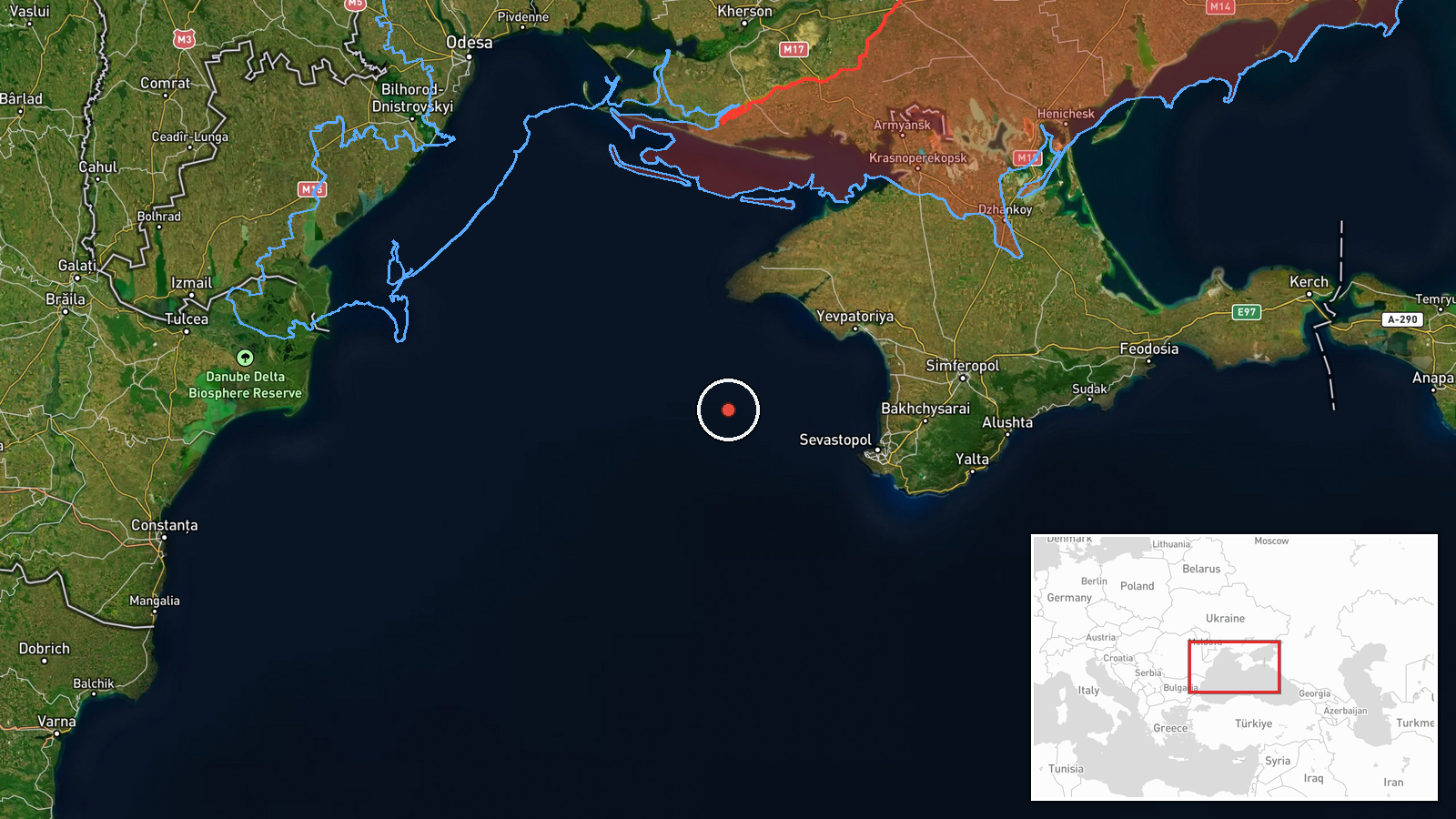
The coordinates, 44.8 N and 32.5 E, fall over open water in the northwestern Black Sea, roughly half a degree south of the Tarkhankut peninsula at Crimea's western tip. The point is an approximate reference for the sea area rather than a settlement, so the geo_precision label of settlement does not fit the marker, though the high location confidence reflects that the track is over water. The region lies between the Crimean coast to the east and the Odesa coastline to the northwest, with the Mykolaiv area inland to the north.
▶ View this event on the live map

Intel Mapper aggregates open-source reports from monitored Telegram and X channels, geolocates them, cross-checks duplicates across sources and assigns a confidence score. Entries are updated as new confirmations arrive. Read how we verify events.