Russian Geran-3 jet drone reported transiting Volyn Oblast westward near Kolky, Ukraine
What happened
Ukraine's Air Force official Telegram channel, @kpszsu, reported at 04:47 UTC on 20 October 2026 that a single Russian jet-powered Shahed, identified in the English summary as a Geran-3, was passing near Kolky in Volyn Oblast and moving west. The original Ukrainian-language post describes a reactive UAV rather than an impact, and it contains no information about damage, casualties or an intended target. The alert is one of five transit reports logged between 00:06 and 03:05 UTC that night, covering movements past Stepan, toward Lutsk and from Rivne Oblast into Volyn. The wording is terse and describes overflight, not a strike on a specific location.
Context and assessment
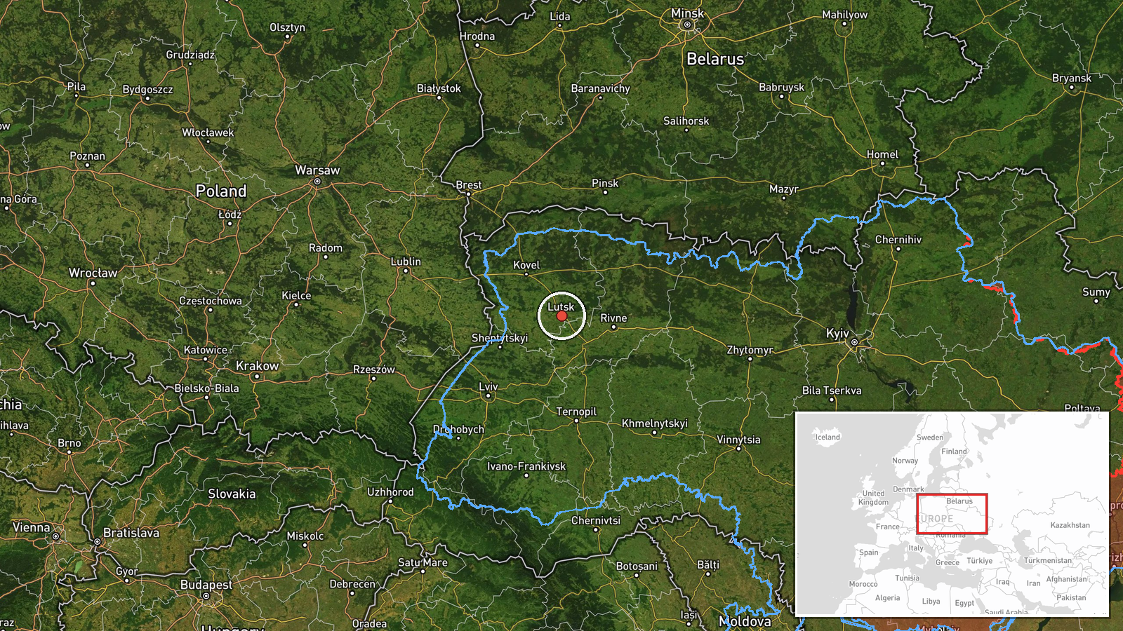
Volyn lies in northwestern Ukraine and borders Belarus to the north and Poland to the west, so a drone heading west through the oblast is on a corridor that leads toward the western frontier region. Lutsk, the oblast capital, appears in two of the related alerts, and the transit from Rivne Oblast suggests a route crossing several oblasts in succession rather than aimed at one point. Over roughly three hours the channel logged five single-drone transit alerts, which fits a pattern of individual jet-powered and Shahed-type drones flying long, low-visibility routes rather than a concentrated salvo. Operationally, such sequences may indicate that launches are being routed through western Ukraine to stretch air defense coverage, to probe radar and interceptor posture in the west, or to hold western targets at risk. The data cannot distinguish among these explanations, and transit alerts do not reveal intended aim points, so any inference about purpose should remain provisional.
Sources and confidence
All information comes from a single channel, @kpszsu, the Ukrainian Air Force's official Telegram account, which also issued the related alerts in this sequence. No independent outlet, radar dataset, regional official statement or foreign monitoring report appears in the record. The confidence score of 8.0 reflects the channel's institutional authority and consistent alert format, offset by single-source status and the lack of corroboration. Confidence would rise with reports from Volyn regional authorities, neighboring-country monitoring or wreckage findings, and would fall if the channel revised or retracted the alert. The record is not marked as corrected.
Location
The coordinates, 50.75 and 25.33, are approximate and place the point at region level for Volyn Oblast rather than at Kolky itself, which is why location confidence is low. The settlement name comes from the Ukrainian post, while the geocoder assigned an oblast-level position. The setting is northwestern Ukraine, a largely flat to gently rolling lowland with forest and wetland, grading northward toward the Belarusian border. Kolky is a small settlement in the oblast, and Lutsk, the regional centre, appears in nearby alerts.
Related events nearby
- Ukrainian air monitoring: 1 Russian Shahed-type drone passing Stepan, heading toward Volyn Oblast.2026-10-20 03:05 UTC · Drone Transit · Volyn Oblast, Ukraine
- Ukrainian air monitoring: 1 Russian jet-powered Shahed (Geran-3) drone heading toward Lutsk.2026-10-20 02:29 UTC · Drone Transit · Lutsk, Ukraine
- Ukrainian air monitoring: 1 Russian jet-powered Shahed (Geran-3) drone from Rivne Oblast toward Volyn Oblast.2026-10-20 01:16 UTC · Drone Transit · Volyn Oblast, Ukraine
- Ukrainian air monitoring: 1 Russian jet-powered Shahed (Geran-3) drone heading toward Lutsk.2026-10-20 00:12 UTC · Drone Transit · Lutsk, Ukraine
- Ukrainian air monitoring: 1 Russian jet-powered Shahed (Geran-3) drone passing Stepan, heading toward Volyn Ob2026-10-20 00:06 UTC · Drone Transit · Volyn Oblast, Ukraine
▶ View this event on the live map

Intel Mapper aggregates open-source reports from monitored Telegram and X channels, geolocates them, cross-checks duplicates across sources and assigns a confidence score. Entries are updated as new confirmations arrive. Read how we verify events.