Single Russian jet-powered Shahed drone reported transiting Chornobyl zone toward Zhytomyr Oblast
What happened
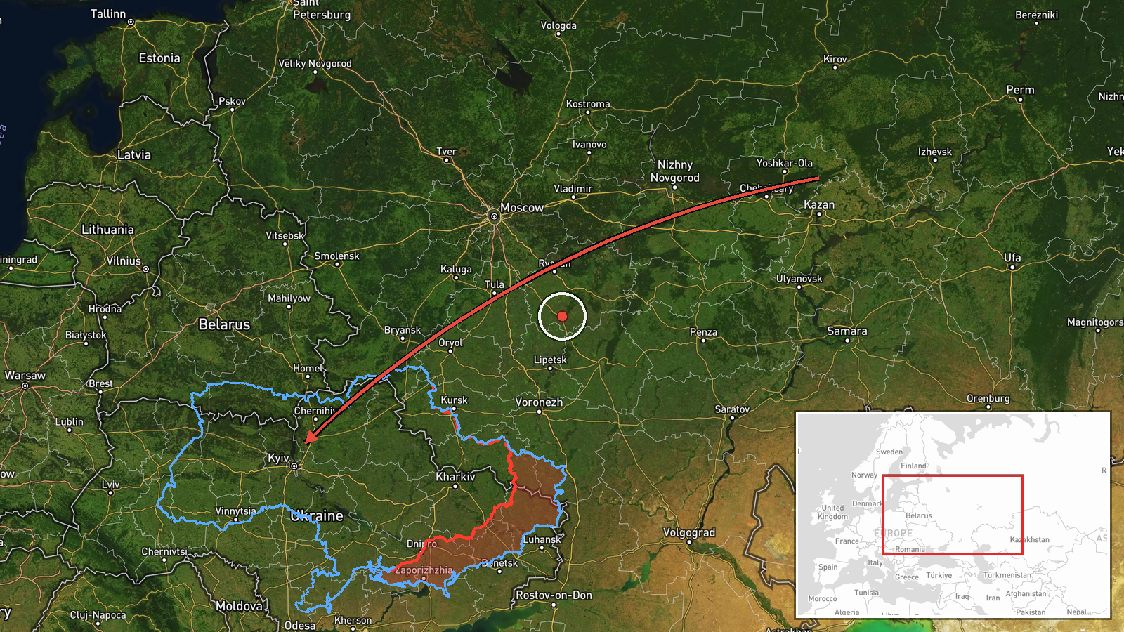
Ukrainian air monitoring channel Telegram (@kpszsu), the Ukrainian Air Force's monitoring account, reported on 20 October 2026 at about 12:16 UTC that one Russian jet-powered Shahed (Geran-3) drone was passing through the Chornobyl Exclusion Zone on a course toward Zhytomyr Oblast. The original Ukrainian-language post describes it as a jet-type UAV moving through the exclusion zone toward the Zhytomyr region. The report names no impact, target or damage. The event is recorded as a drone transit rather than a confirmed strike, and it relies on a single channel's wording of the heading and location.
Context and assessment
The transit sits within a sustained run of similar reports on the same day. Monitoring posts logged Shahed-type drones at 00:40, 04:44, 07:29, 08:13 (a group of two or more drones moving from Kyiv Oblast toward Zhytomyr Oblast) and 12:18 (a drone heading toward Zhytomyr city), giving a pattern of repeated overflights along a northwest-to-west corridor through Kyiv and Zhytomyr oblasts. Such sequences usually indicate drones being routed through northern Ukraine toward targets further west or being tracked as they approach populated areas, and the repeated use of the exclusion zone as a flight path is consistent with the terrain offering fewer air-defence interceptions. Geran-3 is the jet-powered variant of the Shahed family, generally faster and harder to intercept than the piston-engined Geran-2, which makes route reporting operationally useful for air defence. Whether this particular drone was headed for a specific target is not stated, and the data does not show the outcome of the flight. The pattern points to ongoing long-range drone activity rather than a single isolated incident.
Sources and confidence
The event rests on one channel, the Telegram account @kpszsu, which is an official Ukrainian air-monitoring feed. No independent outlet or second monitoring source is listed in the data, so cross-confirmation is absent. The confidence score of 8.0 reflects a credible official source with specific, time-stamped wording, offset by the lack of corroboration and the absence of any reported impact. Confidence would rise with corroboration from another air-monitoring source, regional military administration statements, or geolocated imagery of the drone's route. It would fall if later updates contradicted the heading or if the drone were reported shot down or diverted elsewhere.
Location
The location is recorded only at region level, Zhytomyr Oblast, with low location confidence. The coordinates (50.25 N, 28.66 E) are approximate and do not correspond to a specific settlement or facility. The report itself refers to the Chornobyl Exclusion Zone, which lies in northern Ukraine on the border with Belarus, between the Pripyat river floodplain and forested land. The zone is largely uninhabited and heavily wooded, and Zhytomyr city lies to its west, so the drone's course crossed mostly sparse terrain before approaching the oblast's populated areas.
Related events nearby
- Ukrainian air monitoring: 1 Russian jet-powered Shahed (Geran-3) drone heading toward Zhytomyr.2026-10-20 12:18 UTC · Drone Transit · Zhytomyr, Ukraine
- Ukrainian air monitoring: 2+ Russian jet-powered Shahed (Geran-3) drones from Kyiv Oblast toward Zhytomyr Obla2026-10-20 08:13 UTC · Drone Transit · Zhytomyr Oblast, Ukraine
- Ukrainian air monitoring: 1 Russian jet-powered Shahed (Geran-3) drone passing Chornobyl Exclusion Zone, headi2026-10-20 07:29 UTC · Drone Transit · Zhytomyr Oblast, Ukraine
- Ukrainian air monitoring: 1 Russian jet-powered Shahed (Geran-3) drone passing Kozyatyn, heading toward Zhytom2026-10-20 04:44 UTC · Drone Transit · Zhytomyr Oblast, Ukraine
- Ukrainian air monitoring: 1 Russian Shahed-type drone passing Piskivka, heading toward Zhytomyr Oblast.2026-10-20 00:40 UTC · Drone Transit · Zhytomyr Oblast, Ukraine
▶ View this event on the live map

Intel Mapper aggregates open-source reports from monitored Telegram and X channels, geolocates them, cross-checks duplicates across sources and assigns a confidence score. Entries are updated as new confirmations arrive. Read how we verify events.