Jet-powered Shahed-type drone reported heading west past Lutsk, Volyn Oblast, Ukraine
What happened
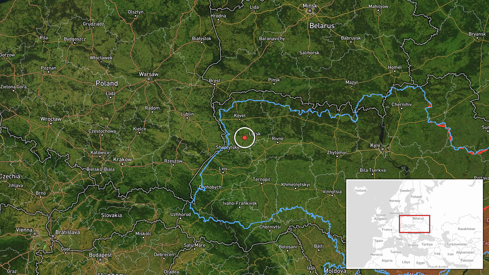
Ukraine's Air Force monitoring channel on Telegram, @kpszsu, reported at 19:07 UTC on 21 October 2026 that one jet-powered Russian Shahed-type drone, described in the channel's wording as a Geran-3, was passing west of Lutsk and heading west. The original Ukrainian post reads 'Реактивний БпЛА на заході від Луцька, курс на захід', meaning a jet-powered unmanned aerial vehicle west of Lutsk on a westerly course. The post gives only a directional description. It names no village, impact point or damage assessment. The report is a transit notice rather than a strike report, and it does not say whether the drone was intercepted, lost, or continued beyond the area. The location is a broad zone west of the city, not a confirmed position. It rests on a single channel.
Context and assessment
Lutsk is the administrative centre of Volyn Oblast in northwestern Ukraine, a region that sits within a short distance of the Polish border and serves as a transit corridor for road, rail and air links. Earlier reports on the same day describe a pattern of drones moving through the area. At 02:17 UTC one Geran-3 was reported passing Kolky and heading toward Lutsk, and a minute later the channel reported two or more drones heading toward the city. At 04:10 a drone was reported passing Zarichne, heading west. Later, at 16:06 and 16:14, single drones were reported moving from western Rivne Oblast toward Volyn Oblast. Taken together, these reports suggest a sustained, multi-hour sequence of Shahed-family drones crossing the northwest rather than a single isolated track. Westbound tracks in this zone may indicate drones routed deeper into western Ukraine or passing through toward other objectives. The reports alone do not establish the intended target, and the most that can be said is that the pattern is consistent with long-range strike or transit activity across the region.
Sources and confidence
The report comes from one Telegram channel, @kpszsu, which is the Ukrainian Air Force's monitoring account. The dataset records no independent cross-confirmation from another outlet, regional authority or open-source tracker. The confidence score of 8.0 reflects the channel's official character and its consistent use of standard air-monitoring language, but it is held below the top of the scale by the single-source basis and the low location confidence. The score would rise with corroboration from other Air Force posts, regional military administration statements, or reports of debris or impacts in the area. It would fall if the channel issued a correction, or if later reports placed the drone outside the stated zone.
Location
The location is approximate and recorded at region precision. It was derived from the directional phrase 'west of Lutsk' and placed at about 50.75 N, 24.90 E, roughly a few tens of kilometres west of the city centre. No settlement, facility or grid reference was given. The setting is the Volhynian plain, a largely flat to gently rolling landscape of farmland, forest belts and wetlands. Lutsk lies on the Styr River, and the broader Polesia lowlands extend to the north.
Related events nearby
- Ukrainian air monitoring: 1 Russian jet-powered Shahed (Geran-3) drone from western Rivne Oblast toward Volyn 2026-10-21 16:14 UTC · Drone Transit · Volyn Oblast, Ukraine
- Ukrainian air monitoring: 1 Russian jet-powered Shahed (Geran-3) drone from western Rivne Oblast toward Volyn 2026-10-21 16:06 UTC · Drone Transit · Volyn Oblast, Ukraine
- Ukrainian air monitoring: 2+ Russian jet-powered Shahed (Geran-3) drones heading toward Lutsk.2026-10-21 02:18 UTC · Drone Transit · Lutsk, Ukraine
- Ukrainian air monitoring: 1 Russian jet-powered Shahed (Geran-3) drone passing Kolky, heading toward Lutsk.2026-10-21 02:17 UTC · Drone Transit · Lutsk, Ukraine
- Ukrainian air monitoring: 1 Russian jet-powered Shahed (Geran-3) drone passing Zarichne, heading west.2026-10-21 04:10 UTC · Drone Transit · Zarichne, Ukraine
▶ View this event on the live map

Intel Mapper aggregates open-source reports from monitored Telegram and X channels, geolocates them, cross-checks duplicates across sources and assigns a confidence score. Entries are updated as new confirmations arrive. Read how we verify events.