Geran-3 drone reported on course for Ananyiv, Odesa Oblast, per Ukrainian air monitoring
What happened
Ukrainian air monitoring, as relayed by the Telegram channel @kpszsu, reported on 22 October 2026 at 08:55 UTC that a single Russian jet-powered Shahed, designated Geran-3, was heading toward Ananyiv in Odesa Oblast. The original Ukrainian-language post, which says a jet-type UAV was on a course toward Ananyiv, is brief and gives no impact, damage, or casualty information. The report describes a transit warning rather than a confirmed strike, so the drone's eventual fate, whether it was shot down, diverted, or continued elsewhere, is not stated in the source. The post names Russia as the launching side, consistent with the standard framing of such air-alert messages.
Context and assessment
Ananyiv sits in southwestern Ukraine within Odesa Oblast, a region that lies between the Black Sea port cluster and the Dniester basin. Its significance in this report lies less in the town itself than in the route. Ukrainian air monitoring channels typically issue these alerts when a drone is tracked on a heading, and the wording does not confirm a target. The related events show a dense pattern of single Geran-3 transit reports over the preceding roughly 24 hours. One was logged over Raukhivka in Odesa Oblast on 21 October, while Ladyzhyn in Vinnytsia Oblast accounted for several reports, including one on 21 October at 13:30 and another on 22 October at 07:17 UTC. A further report placed a drone from Vinnytsia Oblast toward Haysyn on the evening of 21 October. Taken together, the sequence suggests drones moving through multiple oblasts along separate or overlapping corridors rather than a single concentrated salvo. Operationally, this may indicate route probing, distributed launches intended to stretch air defence attention, or simply routine tracking of individual airframes. Each reading fits the data, and the available sources do not settle which applies.
Sources and confidence
Only one channel is cited: the Telegram account @kpszsu, which publishes Ukrainian air-monitoring alerts. No second outlet, wire service, or official statement in the supplied data repeats or contradicts the warning, so the event is single-sourced. The confidence score of 8.0 reflects a clear, time-stamped alert from a channel that regularly carries such reports, and a pattern consistent with related alerts. It is held below the top range by the lack of independent confirmation and the absence of any reported outcome. Confidence would rise with corroboration from another monitoring body or a regional military administration statement, and would fall if the alert were retracted or later reporting placed the drone elsewhere.
Location
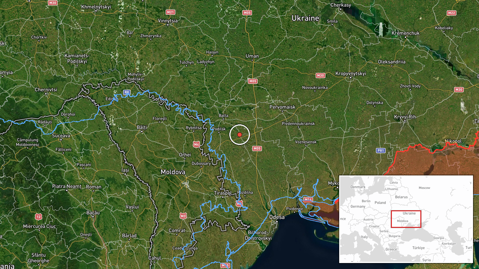
The coordinates correspond to the settlement of Ananyiv, tagged at settlement precision with high location confidence. The town lies in Odesa Oblast in southwestern Ukraine, in gently rolling steppe that slopes toward the Dniester river and the Moldovan border to the southwest. The area is characterised by farmland, river valleys and scattered settlements, with the Dniester basin as the main nearby hydrological feature. Because the report refers to a heading rather than a point of impact, the marker shows the destination named in the alert, not a confirmed incident site.
Related events nearby
- Ukrainian air monitoring: 1 Russian jet-powered Shahed (Geran-3) drone from Odesa Oblast toward Raukhivka.2026-10-21 09:46 UTC · Drone Transit · Raukhivka, Ukraine
- Ukrainian air monitoring: 1 Russian jet-powered Shahed (Geran-3) drone from Vinnytsia Oblast toward Ladyzhyn.2026-10-22 07:17 UTC · Drone Transit · Ladyzhyn, Ukraine
- Ukrainian air monitoring: 1 Russian jet-powered Shahed (Geran-3) drone heading toward Ladyzhyn.2026-10-21 15:23 UTC · Drone Transit · Ladyzhyn, Ukraine
- Ukrainian air monitoring: 1 Russian jet-powered Shahed (Geran-3) drone heading toward Ladyzhyn.2026-10-21 13:30 UTC · Drone Transit · Ladyzhyn, Ukraine
- Ukrainian air monitoring: 1 Russian jet-powered Shahed (Geran-3) drone from Vinnytsia Oblast toward Haysyn.2026-10-21 19:06 UTC · Drone Transit · Haysyn, Ukraine
▶ View this event on the live map

Intel Mapper aggregates open-source reports from monitored Telegram and X channels, geolocates them, cross-checks duplicates across sources and assigns a confidence score. Entries are updated as new confirmations arrive. Read how we verify events.