Ukrainian air monitoring reports one Russian glide bomb heading toward northeastern Sumy Oblast
What happened
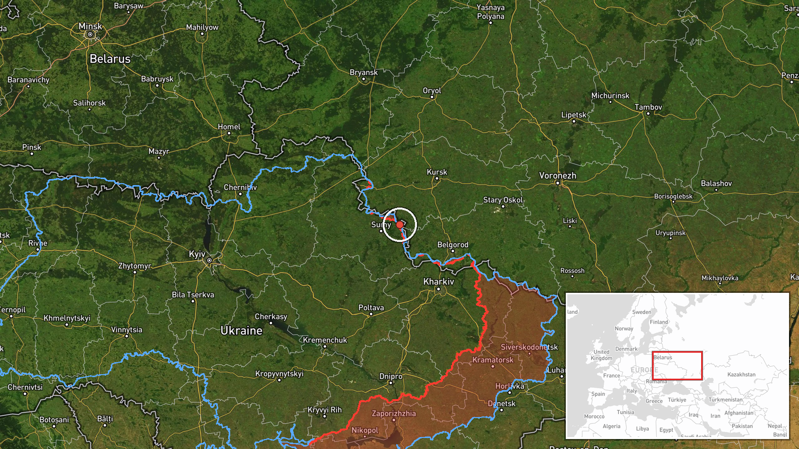
Ukraine's air monitoring channel on Telegram, @kpszsu, reported at 11:01 UTC on 23 October 2026 that one Russian guided glide bomb, known as a KAB, was heading toward northeastern Sumy Oblast. The original Ukrainian post is brief, roughly reading 'KABs toward the northeast of Sumy region!', and it names no settlement, target, or impact. The report is an advance warning of an inbound munition rather than confirmation of a strike, and no casualties or damage are described. Russia is named as the actor based on the standard framing of such alerts. Because the post gives only a region, the event is recorded at regional level with low location confidence.
Context and assessment
Northeastern Sumy Oblast borders Russia and has been a recurring area of cross-border fire and ground pressure, so an alert here fits a broader pattern rather than an isolated event. The same day's related reports show a dense sequence across the Sumy and Kharkiv border zone. Early on, a Shahed-type drone was reported heading toward Sumy at 00:19. At 05:02, Russian artillery reportedly shelled seven Sumy Oblast settlements, and airstrikes reportedly hit Lužky and Khotin, with no casualty figures given. At 05:03, Russian forces reportedly attacked twice near Ulanove and Korchakivka on the Northern Slobozhanskyi axis and tried to advance near several nearby villages. Later, Shahed-type drones were reported heading toward Hlukhiv at 07:43 and jet-powered Geran-3 drones toward Kharkiv at 07:52. Operationally, the combination suggests a sustained effort combining aerial, artillery and ground pressure. Guided glide bombs are usually released by aircraft at standoff distance, so their appearance may point to tactical aviation working near the front, possibly against positions, logistics or movement near the border. Air Force alerts describe inbound flight paths and do not confirm targets, so these readings remain hypotheses.
Sources and confidence
Only one channel, @kpszsu on Telegram, is recorded for this event, and no second outlet in the data independently confirms the alert. The confidence score of 8.0 reflects the official-looking origin of the post and its rapid timing, but it is held below the top range because the post is a single-source, short warning that names no target and carries no impact report. Confidence would rise with corroboration from Ukrainian military or regional authorities, or with reports of an actual impact in the area. It would fall if no strike is later reported, if the alert is revised, or if later monitoring shows the munition was diverted or intercepted.
Location
The coordinates, 51.01479 and 35.25788, are assigned at region precision and do not mark a settlement, facility or confirmed impact point. They are an approximate central position for northeastern Sumy Oblast, derived from the regional label in the alert. The region lies along the Russian border, with Kursk and Bryansk oblasts to the north and east, and is largely flat to gently rolling terrain with river valleys. Hlukhiv, named in a nearby drone alert, lies farther west, so the exact target could be well away from the plotted point.
Related events nearby
- Ukrainian air monitoring: 1 Russian Shahed-type drone heading toward Sumy.2026-10-23 00:19 UTC · Drone Transit · Sumy, Ukraine
- Russian forces attacked twice near Ulanove and Korchakivka on the Northern Slobozhanskyi axis and tried to adv2026-10-23 05:03 UTC · Combat · Ulanove, Ukraine
- Russian artillery shelled seven Sumy Oblast settlements, and airstrikes hit Lužky and Khotin; no casualty figu2026-10-23 05:02 UTC · Artillery · Lužky, Sumy Oblast, Ukraine
- Ukrainian air monitoring: 1 Russian Shahed-type drone from Sumy Oblast toward Hlukhiv; 1 Russian Shahed-type d2026-10-23 07:43 UTC · Drone Transit · Hlukhiv, Ukraine
- Ukrainian air monitoring: 2+ Russian jet-powered Shahed (Geran-3) drones heading toward Kharkiv.2026-10-23 07:52 UTC · Drone Transit · Kharkiv, Ukraine
▶ View this event on the live map

Intel Mapper aggregates open-source reports from monitored Telegram and X channels, geolocates them, cross-checks duplicates across sources and assigns a confidence score. Entries are updated as new confirmations arrive. Read how we verify events.