Ukrainian drone strike hits Nizhnekamsk oil refinery in Tatarstan
What happened
A Ukrainian unmanned aerial system struck the Nizhnekamsk oil refinery (NPZ) in Tatarstan, Russia on September 13, 2026, according to a Telegram channel posting. The report includes drone camera footage purportedly showing the moment of impact on the refinery complex. The attack occurred in the early morning hours local time. No damage assessment or casualty figures were provided in the available report.
Context and assessment
The Nizhnekamsk refinery is a major Russian petroleum processing facility located roughly 1,200 kilometers east of the front lines in Ukraine. Strikes on Russian oil infrastructure have formed part of Ukraine's strategy to degrade Moscow's war economy and reduce refined fuel supplies. Such attacks on distant targets reflect Ukrainian efforts to extend pressure beyond the conventional battlefield, though the refinery's distance from fighting and robust Russian air defenses make penetration challenging. The reported success, if confirmed, would add to a pattern of deep-strike operations against energy targets.
Sources and confidence
Single-source reporting from Telegram channel @supernova_plus, with visual evidence claimed via drone camera feed. No independent confirmation from Russian officials, open-source imagery analysis, or secondary channels currently available. Confidence score of 6.0 reflects the drone footage authenticity and channel reputation balanced against single-source limitation. Cross-confirmation through satellite imagery, Russian statements, or multiple independent sources would substantially raise confidence.
Location
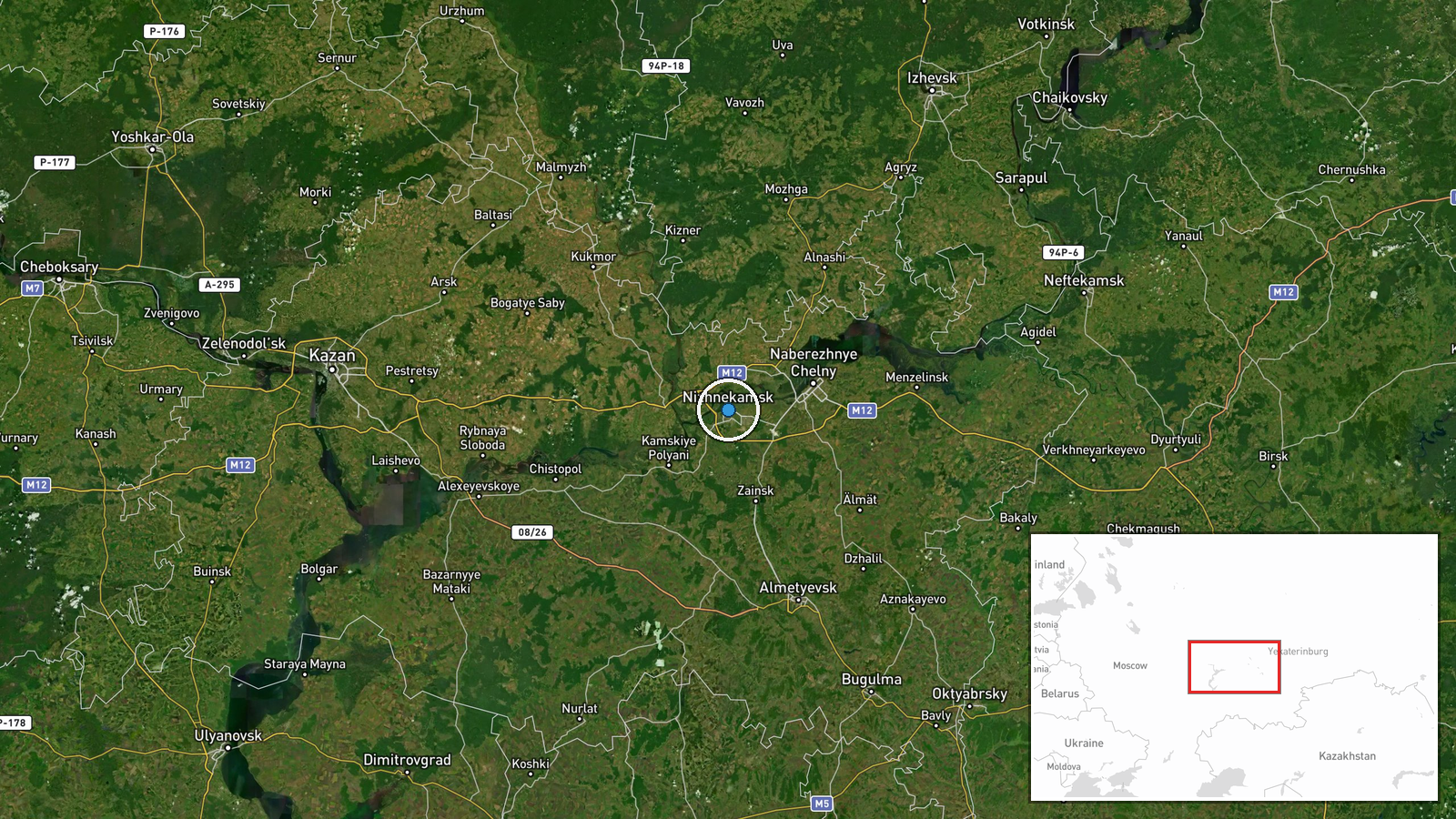
Nizhnekamsk, a city of approximately 240,000 in the Republic of Tatarstan, lies along the Kama River in the Volga region of western Russia. The refinery complex is situated at the settlement level (55.64°N, 51.82°E), approximately 1,200 kilometers northeast of active combat zones in eastern Ukraine, deep within Russian territory and near civilian population centers.
▶ View this event on the live map
Intel Mapper aggregates open-source reports from monitored Telegram and X channels, geolocates them, cross-checks duplicates across sources and assigns a confidence score. Entries are updated as new confirmations arrive. Read how we verify events.