Single Telegram channel reports attack on Millerovo airfield in Russia's Rostov Oblast
What happened
A Telegram channel, @supernova_plus, reported that Millerovo airfield in Rostov Oblast, Russia, had been attacked. The post was dated 16 October 2026 at 23:35 UTC, and the event is logged at the airfield's coordinates. The original text is brief and in Russian. Roughly translated, it says the airfield was attacked and asks readers to share footage if they can. The wording reads as a forwarded tip submission, which suggests the poster did not offer firsthand confirmation. The text names no weapon type, no extent of damage, and no responsible party. The platform's labels of 'Explosion' and 'Ukraine' as actor reflect the channel's framing and the desk's categorisation, not independent verification. Nothing in the available material establishes casualties, aircraft losses, or operational effects.
Context and assessment
Millerovo sits in southern Rostov Oblast, close to the Ukrainian border, and its airfield has long been associated with Russian military aviation according to widely available background. Airfields near the front are a recurring category of target in the Ukraine war, both because they host aircraft and support equipment and because strikes at range can be used to signal reach. Any attack there would therefore be significant if confirmed, though its importance depends on what was actually hit, which the report does not say. No related events are linked to this entry on the map, so it cannot be placed within a documented sequence of strikes in the same area. The absence of linked events may reflect a lack of reporting rather than a lack of activity. If further reports of explosions, air defence activity, or base-related disruption emerge from the Millerovo area in the coming days, they could indicate a broader pattern. Until then, the event is best read as an isolated, unverified claim about a strategically located military site.
Sources and confidence
The event rests on one Telegram channel, @supernova_plus, with no cross-confirmation from other outlets, official statements, or independent imagery in the data provided. The confidence score of 6.0 reflects this single-source status, which is enough to record the claim but not enough to treat it as established. Confidence would rise with geolocated or time-stamped footage, reporting from established wire services, or statements from Russian regional authorities or Ukrainian officials. It would fall if the footage is shown to be older or from another location, or if the channel is found to recycle unverified material.
Location
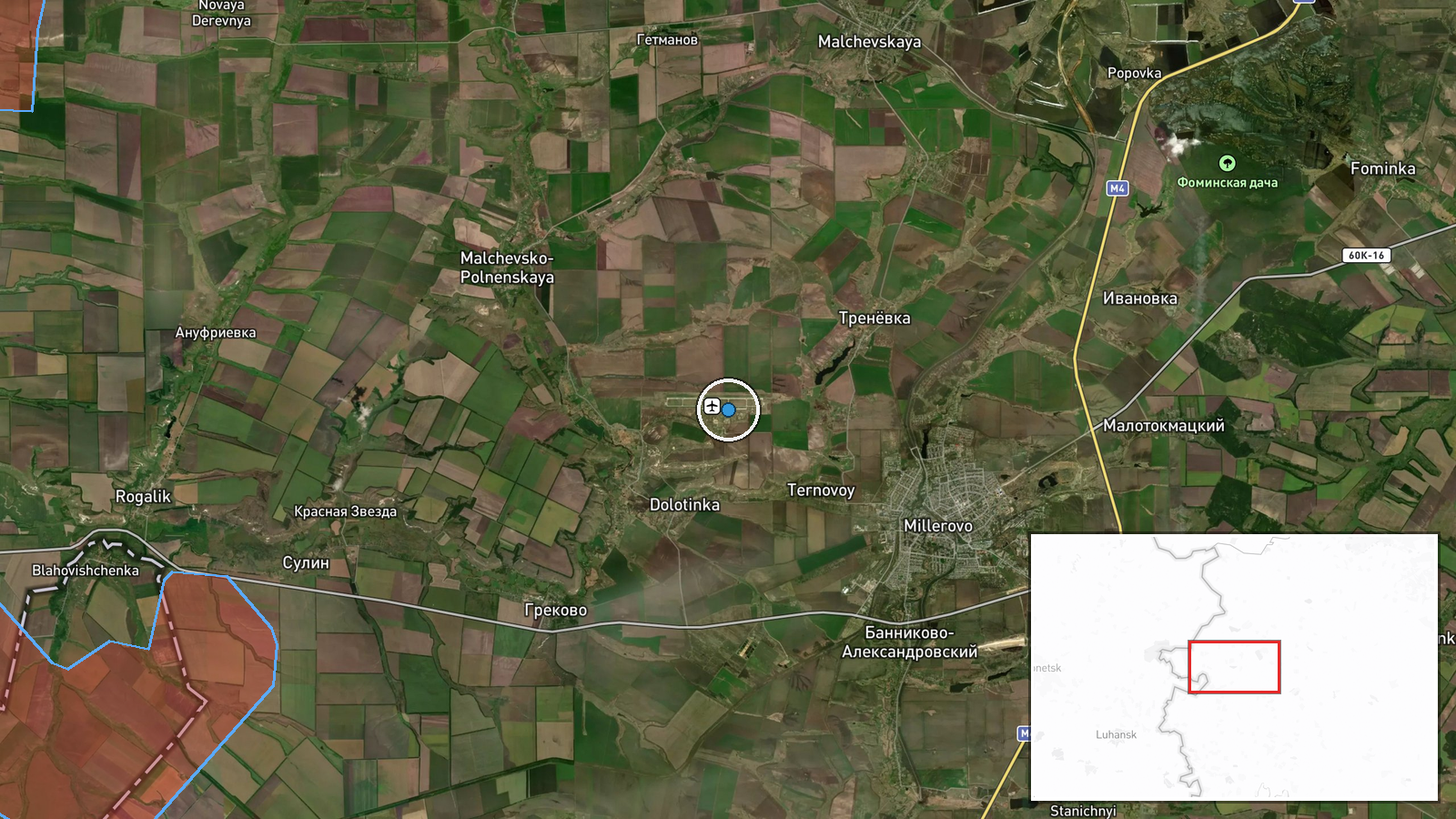
The coordinates are listed as exact at 48.95222 N, 40.30222 E, and the location confidence is recorded as normal, meaning the airfield's position is well established. Millerovo is a town in southern Rostov Oblast, set on open steppe terrain near the Ukrainian border. The surrounding area is largely agricultural, with road and rail links that make the town a regional transport point.
▶ View this event on the live map

Intel Mapper aggregates open-source reports from monitored Telegram and X channels, geolocates them, cross-checks duplicates across sources and assigns a confidence score. Entries are updated as new confirmations arrive. Read how we verify events.