Two Shahed-variant drones tracked transiting from Slavutych toward Kyiv region
What happened
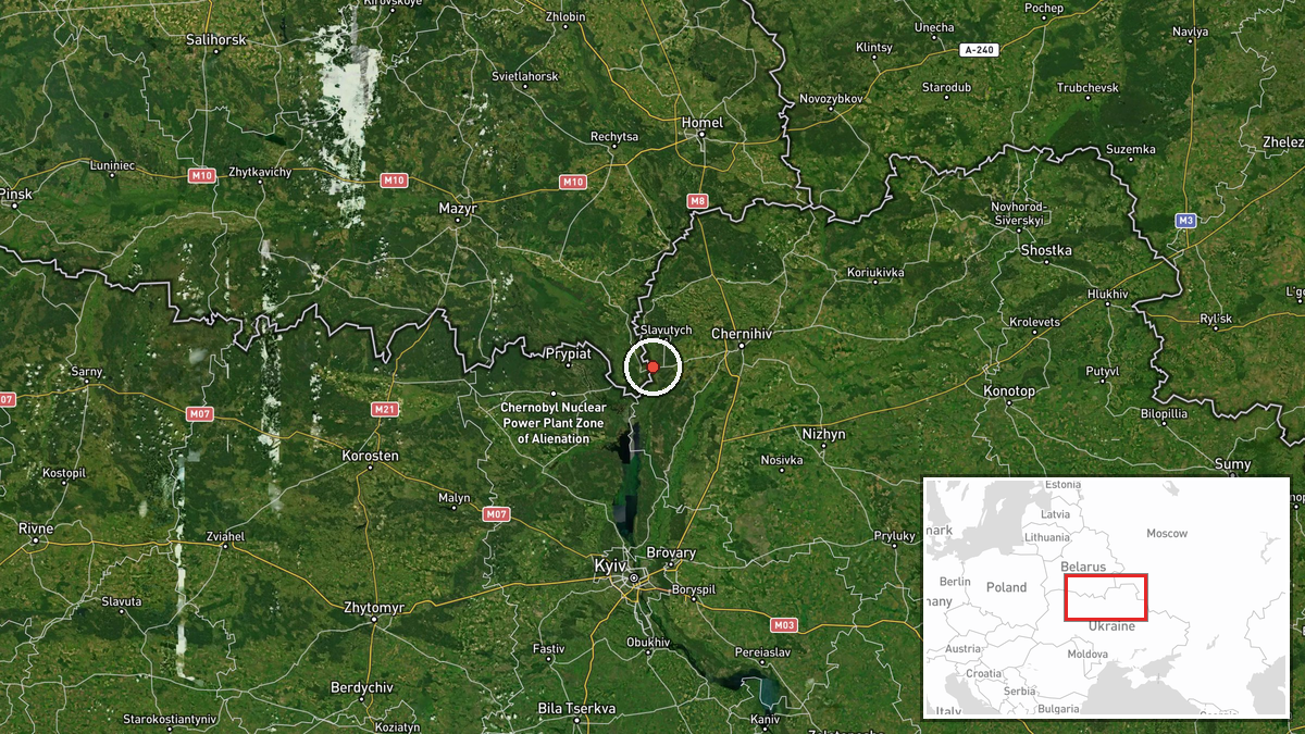
Two reactive jet-powered unmanned aerial vehicles (Shahed-136 variants) were detected in flight from Slavutych in Chernihiv Oblast heading southwest toward Kyiv region on 31 August at 02:36 UTC, according to Telegram channel @war_monitor. The drones were identified through reconnaissance tracking as they transited across northern Ukraine. The report does not specify whether the aircraft were intercepted, reached their intended targets, or the nature of any potential targets in Kyiv region.
Context and assessment
Slavutych lies approximately 30 kilometres north of Kyiv and sits near the Ukrainian-Belarusian border, making it a natural transit point for Russian drone strikes originating from Bryansk and other Russian launch areas. The detection fits an intense pattern of Shahed-variant drone activity documented over 31 August, with multiple waves—totalling at least 15 tracked aircraft—transiting through Chernihiv and Kyiv oblasts during the same 24-hour window. This appears consistent with a coordinated Russian drone campaign targeting Kyiv and surrounding infrastructure. Repeated use of the Slavutych corridor suggests Russia has established a reliable ingress route despite Ukrainian air defences.
Sources and confidence
Single source: Telegram channel @war_monitor, a widely-used open-source intelligence aggregator for Ukrainian air activity. No cross-confirmation from independent channels is noted. Confidence score of 6.0 reflects the single-source reporting and the inherent uncertainty of transit reports without impact confirmation. Score would rise with secondary channel confirmation or Ukrainian air defence acknowledgement; it would fall if subsequent reports contradict the flight path or aircraft count.
Location
Slavutych is a city in northern Chernihiv Oblast, roughly 30 km due north of central Kyiv, situated near the Desna River and approximately 15 km south of the Ukraine-Belarus border. The settlement is a known transit zone for aerial activity moving between Russian territory and Kyiv. The drones' reported heading toward Kyiv region indicates movement along a southwest vector toward Ukraine's capital and surrounding critical infrastructure.
Related events nearby
- Five Russian Shahed-variant kamikaze drones tracked transiting along Ukraine's state border in Chernihiv Oblas2026-08-30 12:39 UTC · Drone Transit · Slavutych, Chernihiv Oblast, Ukraine
- Six Russian reactive-engine UAVs (Shahed variants) tracked transiting from Bryansk Oblast toward Slavutych in 2026-08-30 05:58 UTC · Drone Transit · Slavutych, Chernihiv Oblast, Ukraine
- One Russian reactive-engine UAV (Shahed variant) and six standard Shahed-136 drones tracked in transit over Ch2026-08-30 08:31 UTC · Drone Transit · Chernihiv, Chernihiv Oblast, Ukraine
- Six Russian Shahed-variant reactive-engine kamikaze drones tracked transiting along Ukraine's state border in 2026-08-30 13:08 UTC · Drone Transit · Chernihiv Oblast border sector, Ukraine
- Russian reactive-engine UAVs (Shahed-variant) tracked transiting over Kyiv Oblast: 2 near Krushynka, 1 near Pr2026-08-30 10:11 UTC · Drone Transit · Kyiv Oblast, Ukraine
▶ View this event on the live map
Intel Mapper aggregates open-source reports from monitored Telegram and X channels, geolocates them, cross-checks duplicates across sources and assigns a confidence score. Entries are updated as new confirmations arrive. Read how we verify events.