Russian cruise missile strikes Chornomorsk port area in Odesa Oblast
What happened
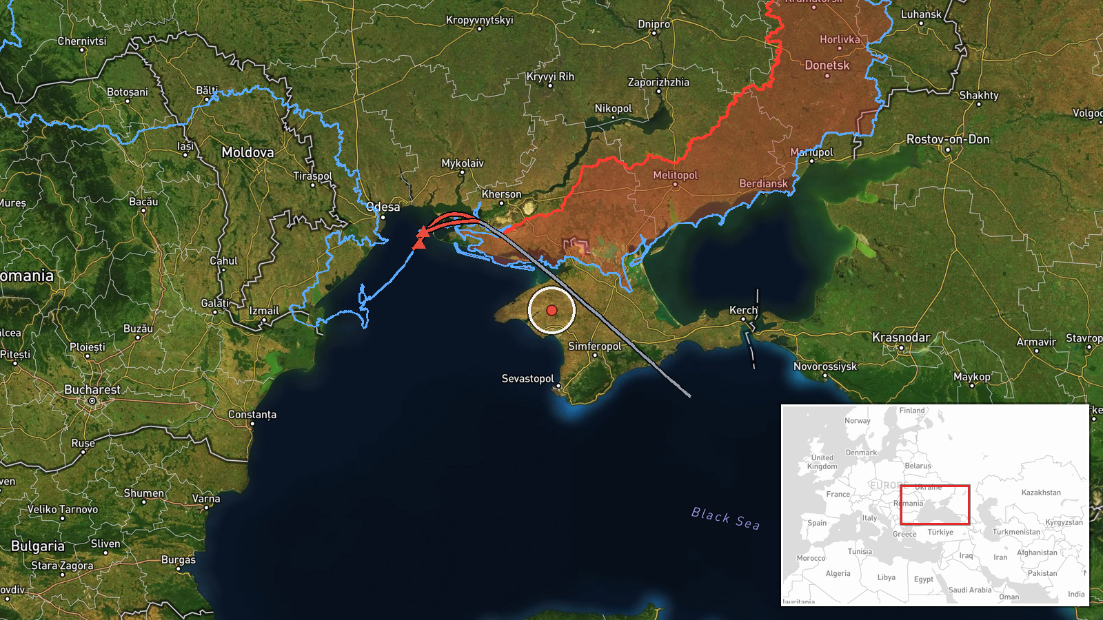
Russian forces reportedly launched a Kh-31 cruise missile targeting the port facility at Chornomorsk and the nearby village of Lymanka in Odesa Oblast on September 4 at 02:04 UTC. The missile was part of a multi-missile strike originating from the Black Sea. The report comes from a Ukrainian air monitoring channel and represents a single strike in what the source characterizes as a broader sequential attack pattern.
Context and assessment
Chornomorsk is a critical Ukrainian port on the northwestern Black Sea coast, roughly 40 kilometers south of Odesa city. It has been a recurring target of Russian strikes aimed at degrading Ukrainian maritime trade and logistical capacity. The attack follows a detected transit of a Russian Shahed-variant drone through the same region on September 3, suggesting a coordinated pressure campaign against Odesa Oblast's infrastructure. The use of anti-radiation missiles like the Kh-31 may indicate targeting of air defense systems protecting the port, a pattern consistent with Russian efforts to degrade Ukrainian defensive capabilities in the southern theater.
Sources and confidence
Reported by Telegram channel @war_monitor, a Ukrainian air monitoring source. Single-source reporting limits confidence. Cross-confirmation from independent sources would strengthen assessment. Confidence score of 6.0 reflects the source's track record in air monitoring but the absence of corroborating reports. Impact assessment or damage confirmation would raise confidence; additional missile strikes in the sequence remaining unconfirmed would lower it.
Location
Chornomorsk settlement, Odesa Oblast, situated on Ukraine's Black Sea coast approximately 40 kilometers south of Odesa city. The port is the second-largest in Ukraine and lies near Lymanka village to the north. Precise coordinates place the report at the port facility itself. The location sits within range of Russian Black Sea Fleet assets based in Crimea and the eastern Black Sea.
Related events nearby
- One Russian reactive (jet-powered) Shahed-variant kamikaze drone detected transiting toward Usatove, Odesa Obl2026-09-04 23:16 UTC · Drone Transit · Usatove, Odesa Oblast, Ukraine
- Russian forces targeted trucks near a depot and logistics complex in Odesa Oblast. Attack struck supply infras2026-09-04 23:26 UTC · Artillery · Odesa Oblast, Ukraine
▶ View this event on the live map
Intel Mapper aggregates open-source reports from monitored Telegram and X channels, geolocates them, cross-checks duplicates across sources and assigns a confidence score. Entries are updated as new confirmations arrive. Read how we verify events.