Russia fires cruise missiles toward Dnipro amid second drone transit alert
What happened
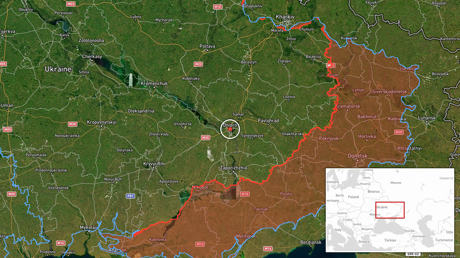
Russian forces reportedly launched two cruise missiles, identified as Kh-31 or UMPC-5 variants, on a trajectory toward Dnipro city on September 4 at 06:51 UTC. The strike followed a second drone transit alert for the same target. Ukrainian air defense was reported to be responding to the incoming attack. The report originated from a Telegram monitoring channel focused on conflict developments.
Context and assessment
Dnipro, the fourth-largest city in Ukraine and capital of Dnipropetrovsk Oblast, has been a recurring target for Russian strikes throughout the conflict due to its industrial base, transport infrastructure, and strategic location in central-eastern Ukraine. The reported use of Kh-31 cruise missiles, typically air-launched anti-ship or precision-strike variants, alongside drone reconnaissance suggests a coordinated targeting approach. A related drone transit alert was reported in the same oblast on September 3, indicating sustained Russian reconnaissance and strike activity in the region. The pattern suggests Russian forces are attempting to maintain pressure on Ukrainian-held territory through layered drone and cruise missile operations.
Sources and confidence
Reported solely by Telegram channel @war_monitor, a monitoring account focused on conflict activity. No cross-confirmation from official Ukrainian sources or independent verification channels has been identified. The confidence score of 6.0 reflects the single-source reporting and typical verification delays for ongoing strikes. Confirmation from Ukrainian officials or secondary sources would raise confidence; absence of follow-up reporting from established conflict monitoring networks would lower it.
Location
Dnipro city, located in Dnipropetrovsk Oblast in central-eastern Ukraine at approximately 48.47°N, 35.04°E. The city straddles the Dnieper River and serves as a major transport and industrial hub. Nearby infrastructure includes rail yards, power generation facilities, and manufacturing sites typical of Soviet-era industrial centers.
Related events nearby
- Ukrainian air monitoring detected 1 Russian Shahed-136 reactive drone transiting from Hubynykhy toward Magdaly2026-09-03 08:29 UTC · Drone Transit · Magdalynivka, Dnipropetrovsk Oblast, Ukraine
▶ View this event on the live map
Intel Mapper aggregates open-source reports from monitored Telegram and X channels, geolocates them, cross-checks duplicates across sources and assigns a confidence score. Entries are updated as new confirmations arrive. Read how we verify events.