Four Russian Shahed-136 drones detected transiting Balakliia sector in Kharkiv Oblast
What happened
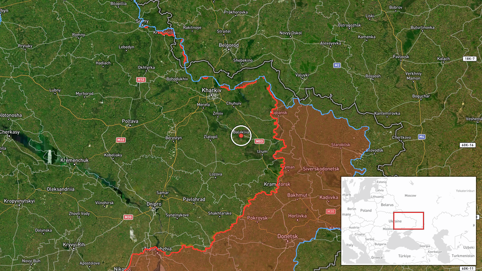
Four Russian Geran-2 (Shahed-136) kamikaze drones were detected in flight passing through the Balakliia sector of Kharkiv Oblast on the evening of 4 September 2026. According to Telegram channel @war_monitor, the drones were heading toward designated targets at the time of reporting. No impact or interception was reported in the available information. The detection occurred amid a broader pattern of Russian drone operations across Ukraine's eastern and central regions.
Context and assessment
Balakliia, a town in central Kharkiv Oblast approximately 170 kilometres east of Kharkiv city, lies in a strategically contested area along established drone transit corridors. The detection aligns with documented Russian air operations on 4 September, which reportedly included thousands of kamikaze drone sorties and scores of airstrikes across Ukraine's eastern front. Concurrent drone transits were detected in neighbouring Dnipropetrovsk Oblast the same evening, suggesting a coordinated or sustained campaign. Ukrainian forces have reportedly been striking Russian drone manufacturing and launch facilities, potentially prompting operational adjustments in Russian attack patterns.
Sources and confidence
Single source: Telegram channel @war_monitor. No corroboration from Ukrainian military official channels or additional OSINT monitors noted in available data. Confidence score of 6.0 reflects single-source reporting with high location precision but absence of cross-confirmation. Confidence would increase with verification from Ukraine's air defence command or secondary independent sources; it would decrease if the transit could not be independently located.
Location
Balakliia settlement, Kharkiv Oblast, northeastern Ukraine (49.45°N, 36.84°E). The town sits roughly 85 kilometres northeast of Kharkiv city in relatively open terrain. Geographic precision is settlement-level with high confidence. The area lies in a known corridor for Russian drone transits toward central and western Ukrainian targets.
Related events nearby
- Russian cruise missile (Banderol/KR) transit detected over Kharkiv Oblast in direction of Zmiyiv. Ukrainian ai2026-09-05 19:56 UTC · UAS Strike · Kharkiv Oblast, Ukraine (general sector)
- Russian Banderol cruise missile detected transiting over Kharkiv Oblast toward Bezlyudivka. Ukrainian air defe2026-09-05 20:48 UTC · UAS Strike · Bezlyudivka, Kharkiv Oblast, Ukraine
- Russia struck Kamet-Steel plant in Kamenske using North Korean KN-23 ballistic missiles. After losing Azovstal2026-09-05 05:46 UTC · Combat · Kupiansk, Kharkiv Oblast, Ukraine or Pokrovsk, Don
- Ukrainian General Staff operational summary (22:00 Sept 5): 209 combat clashes across all fronts. Russia condu2026-09-05 19:06 UTC · Statement · Eastern Ukraine (Multiple Fronts)
- One Russian reactive (jet-powered) Shahed-variant kamikaze drone detected transiting from Dobroslav toward Zho2026-09-04 23:11 UTC · Drone Transit · Zhovte, Odesa Oblast, Ukraine
▶ View this event on the live map
Intel Mapper aggregates open-source reports from monitored Telegram and X channels, geolocates them, cross-checks duplicates across sources and assigns a confidence score. Entries are updated as new confirmations arrive. Read how we verify events.