Three Russian Shahed drones transit Chernihiv Oblast toward Kyiv
What happened
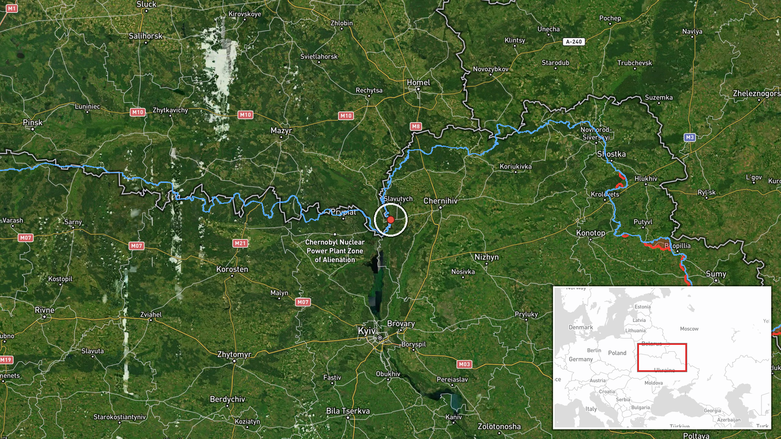
Ukrainian monitoring reported three Russian Shahed-136 kamikaze drones transiting over Slavutych in Chernihiv Oblast on September 5 at approximately 12:29 UTC, reportedly heading toward Kyiv Oblast. The drones were described as reactive jet-powered variants. The report came via Ukrainian Telegram channel @war_monitor and indicates continuation of Russia's ongoing aerial campaign against Ukrainian territory.
Context and assessment
Slavutych lies in northern Chernihiv Oblast, approximately 30 kilometers south of Belarus and roughly 100 kilometers north of Kyiv. This transit corridor has been a recurring route for Russian drone operations, as reported in adjacent events showing similar Shahed transits from Kozeletsk on September 4. The sighting occurs amid an intensified Russian drone campaign, including a reported strike on SBU headquarters in central Kyiv on September 4 and statements by Ukrainian leadership characterizing recent strikes as retaliation for U.S. diplomatic engagement. Ukraine's General Staff announced abandonment of a unilateral ceasefire on September 5 after Russia continued operations, suggesting sustained Russian pressure despite diplomatic overtures.
Sources and confidence
Single-source report from @war_monitor Telegram channel. No cross-confirmation from other Ukrainian air defense or monitoring channels provided in available data. Confidence score of 6.0 reflects typical reliability of operational reporting from established Ukrainian monitoring accounts but limited redundancy. Confirmation from additional Ukrainian military or SBU sources would strengthen confidence; evidence of actual strikes in Kyiv Oblast would validate the reported trajectory.
Location
Slavutych, a settlement in Chernihiv Oblast near the closed Chornobyl Nuclear Power Station exclusion zone, located at approximately 51.40°N, 30.66°E. The town sits in northern Ukraine roughly 100 kilometers north-northeast of central Kyiv, positioned along a known transit corridor for Russian aerial operations originating from Belarusian airspace and Russian territory.
Related events nearby
- Two Russian reactive (jet-powered) Shahed-variant kamikaze drones detected transiting from Kozeletsk toward Ve2026-09-04 18:22 UTC · Drone Transit · Velyka Dymerka, Kyiv Oblast, Ukraine
- Ukrainian air monitoring reports all-clear for Kyiv region. No new drone launches detected; previous air alert2026-09-04 19:19 UTC · Siren · Kyiv Oblast, Ukraine
- Russian drone struck Ukraine's Security Service (SBU) central headquarters on Volodymyrska Street in central K2026-09-04 13:24 UTC · UAS Strike · SBU Headquarters, Volodymyrska Street, Kyiv, Ukrai
- Kremlin announces Putin ordered three-day pause in airstrikes on Kyiv during preparations for arrival of U.S. 2026-09-05 12:45 UTC · Statement · Kyiv, Ukraine
- President Zelensky states Russian strikes on Kyiv airports are retaliatory responses to U.S. diplomatic visits2026-09-05 09:09 UTC · Statement · Kyiv, Ukraine
▶ View this event on the live map
Intel Mapper aggregates open-source reports from monitored Telegram and X channels, geolocates them, cross-checks duplicates across sources and assigns a confidence score. Entries are updated as new confirmations arrive. Read how we verify events.