Russian Shahed drones tracked over Poltava Oblast heading toward regional center
What happened
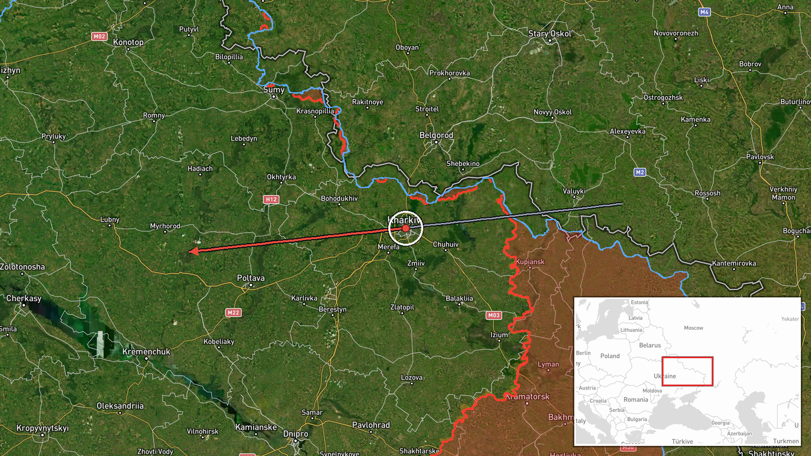
Ukrainian air monitoring detected two reactive jet-propelled unmanned aerial vehicles, identified as Shahed variants and referred to colloquially as 'Бандероль' courier drones, transiting over Poltava Oblast on September 6 at approximately 12:29 UTC. The drones were tracked in flight from Kharkiv region with trajectory toward Poltava city. The report comes from Ukrainian air defense monitoring channels tracking incoming aircraft.
Context and assessment
Poltava Oblast, located in central Ukraine, has been subject to repeated Russian drone operations over recent days as part of a sustained campaign. Related air monitoring reports from September 5 document similar transit patterns across northern Ukrainian airspace, including detections near Lubny in the same oblast and multiple Banderol-variant cruise missiles tracked over Chernihiv and Sumy oblasts. The concentration of such reports suggests a coordinated attack pattern targeting infrastructure or military positions across central and northern Ukraine. Poltava city itself hosts significant logistics and administrative facilities, making it a plausible target for such operations.
Sources and confidence
Reported by @war_monitor Telegram channel. Single-source reporting limits independent verification; confidence score of 6.0 reflects reliance on one channel without confirmed cross-reporting from other Ukrainian air defense monitoring accounts. Confidence would increase with corroboration from official Ukrainian defense statements or multiple independent monitoring channels; it would decrease if subsequent reports contradicted the reported trajectory or drone type.
Location
Khorol settlement area, Poltava Oblast, determined by Ukrainian air monitoring coordinates and settlement-level precision. Located approximately 90 kilometers south-southwest of the regional center of Poltava city. The settlement sits in the Poltava steppe region with open terrain typical of central Ukraine, offering limited natural air defense obstacles.
Related events nearby
- Ukrainian General Staff operational briefing (00:00 07.09.26): Strategic aviation inactive; singular UAVs over2026-09-06 21:01 UTC · Statement · Ukraine
▶ View this event on the live map
Intel Mapper aggregates open-source reports from monitored Telegram and X channels, geolocates them, cross-checks duplicates across sources and assigns a confidence score. Entries are updated as new confirmations arrive. Read how we verify events.