Russian Shahed-136 drones detected transiting Smila sector during overnight strike campaign
What happened
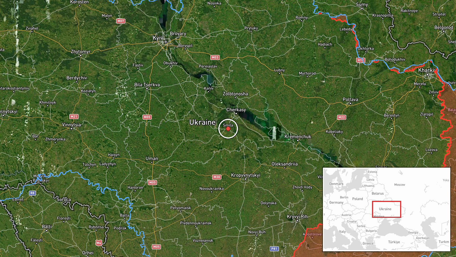
Ukrainian air-raid monitoring detected Russian jet-powered Shahed-136 drones in the Smila sector of Cherkasy Oblast on 8 September at 03:52 UTC. The drones were reported in transit as part of an ongoing Russian drone campaign targeting the Kyiv region. The detection came during a broader overnight strike operation involving multiple drone and cruise missile groups moving through Cherkasy Oblast.
Context and assessment
The Smila sector sits along a known corridor for Russian drone and missile approach routes toward Kyiv, approximately 150 kilometers south of the capital. This detection fits a sustained pattern: within hours, Ukrainian monitoring reported cruise missile groups transiting the same oblast from Zolotonosha toward Cherkasy, and earlier Shahed-136 drones detected near Kagarlyky and Boryspil heading toward Vasylkiv sector. The repeated use of this approach vector via Cherkasy Oblast suggests Russian strike planners continue to route significant volumes of munitions through this region to bypass or overwhelm air defenses closer to the capital. The concentration of activity within a short timeframe indicates a coordinated multi-vector strike.
Sources and confidence
Single source: Telegram channel @war_monitor, which reports direct Ukrainian air-raid monitoring data. No cross-confirmation from independent sources provided. Confidence score of 6.0 reflects reliable reporting chain but single-source limitation. Corroboration from concurrent events in the same region and timeframe moderately supports the detection pattern. Score would rise with independent confirmation; score would lower if subsequent reporting contradicts the detection or reveals monitoring error.
Location
Smila sector, Cherkasy Oblast, central Ukraine. Determined by Ukrainian air-raid reporting as sector-level precision rather than specific facility or settlement. Smila town lies at approximately 49.2°N, 31.9°E in a predominantly rural agricultural region of central Cherkasy Oblast, roughly 150 kilometers south-southeast of Kyiv city center along established approach corridors.
Related events nearby
- Ukrainian air-raid monitoring detected 2 groups of Russian cruise missiles transiting from Zolotonosha toward 2026-09-08 01:46 UTC · Cruise Missile · En route: Zolotonosha → Cherkasy, Cherkasy Oblast,
- Ukrainian air-raid monitoring reports 2 Russian jet-powered Shahed-136 drones (reaktivy) detected transiting f2026-09-08 00:01 UTC · Drone Transit · Kagarlyky, Kyiv Oblast, Ukraine
▶ View this event on the live map
Intel Mapper aggregates open-source reports from monitored Telegram and X channels, geolocates them, cross-checks duplicates across sources and assigns a confidence score. Entries are updated as new confirmations arrive. Read how we verify events.