Russian Shahed-136 drone tracked toward Poltava Oblast settlement
What happened
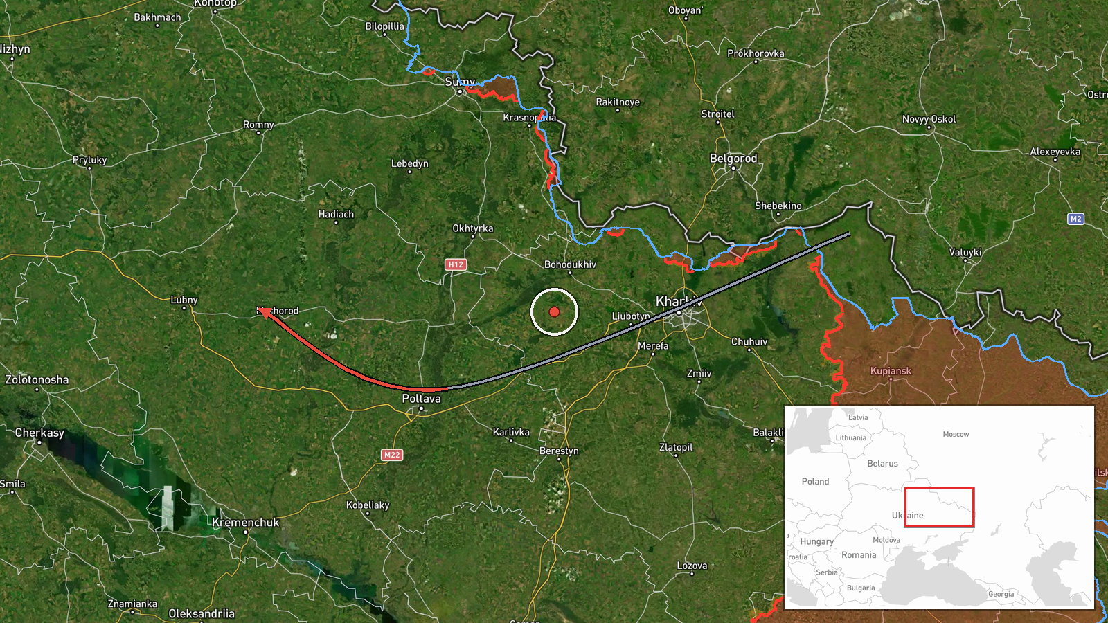
Ukrainian air defense reportedly detected one Shahed-136 (jet-powered kamikaze drone) in flight from Poltava westward toward Luhny, a settlement in Poltava Oblast, on 9 September at approximately 12:22 UTC. The report, posted to Telegram channel @war_monitor, indicated ongoing Ukrainian air defense monitoring of the drone's transit. No impact assessment or air defense engagement outcome was provided in the initial report.
Context and assessment
Poltava Oblast, located in central-eastern Ukraine roughly 350 kilometers from Russian territory, has been subject to sustained drone operations throughout 2026. The westward flight path from Poltava toward Luhny suggests either a terminal approach to a target in or beyond the settlement or continued transiting to a more distant objective. This detection follows a reported Russian strike on a Ukrainian FP-2 UAV launch facility in Kyiv Oblast hours earlier, potentially indicating a pattern of reciprocal strikes against drone-related infrastructure and logistical nodes. Russian long-range drone operations in this region typically target energy facilities, military installations, or transport infrastructure; the specific target rationale remains unclear from available reporting.
Sources and confidence
Single-source report from Telegram channel @war_monitor, a Ukrainian open-source intelligence aggregator. No cross-confirmation from independent Ukrainian official channels or international observers noted. Confidence score of 6.0 reflects plausible reporting and consistent with known Shahed-136 operational patterns, but lack of corroborating sources and absence of outcome data limit certainty. Confirmation by Ukrainian air force or SES statements would increase confidence; independent third-party verification unavailable.
Location
Luhny is a small rural settlement in Poltava Oblast, central Ukraine, positioned at approximately 50.01°N, 33.00°E. The settlement lies roughly 40 kilometers west-southwest of Poltava city in an agricultural region. The reported origin, Poltava city itself, lies further east. This area contains dispersed civilian and military infrastructure typical of central Ukrainian territory.
Related events nearby
- Russian Geran-2 kamikaze drone struck a Ukrainian FP-2 UAV launch facility. The attack targeted Ukrainian dron2026-09-09 00:37 UTC · UAS Strike · FP-2 UAV Launch Site, Kyiv Oblast, Ukraine
▶ View this event on the live map
Intel Mapper aggregates open-source reports from monitored Telegram and X channels, geolocates them, cross-checks duplicates across sources and assigns a confidence score. Entries are updated as new confirmations arrive. Read how we verify events.