Russian Shahed drone detected transiting over Mykolaiv; air raid alert issued
What happened
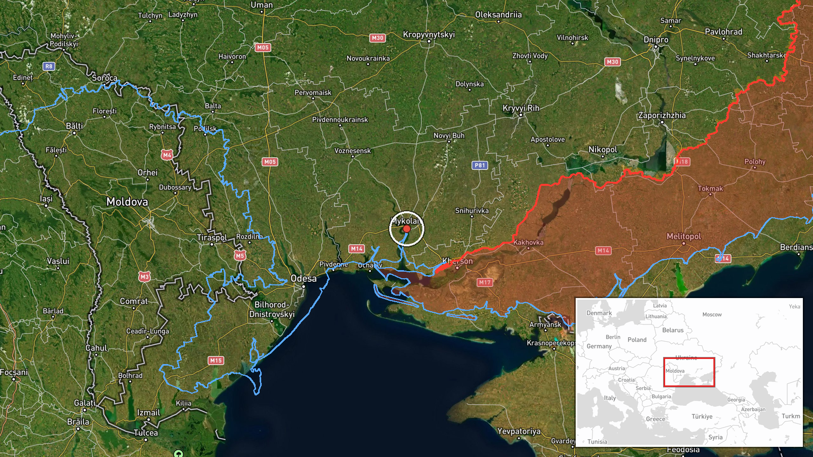
A single Russian Shahed-136 reactive drone was detected in flight over Mykolaiv city on the morning of September 13 at 06:48 UTC, prompting an air raid alert. The report, issued via Telegram channel @war_monitor, describes the drone as transiting rather than actively attacking. No immediate strike or damage has been reported in connection with this sighting.
Context and assessment
Mykolaiv, located in southern Ukraine roughly 130 kilometers east of Odesa, remains under periodic Russian drone and missile pressure. This sighting occurs within a pattern of sustained Russian unmanned aerial activity across the Black Sea region and southern Ukrainian cities. On the same date, four Shahed-136 drones were detected transiting toward Odesa, and hours earlier an FPV drone reportedly struck a bus in nearby Kherson. The detection of individual drones in transit, rather than coordinated salvos, may reflect fragmented attack scheduling or losses in Russian drone inventory, though single-drone sightings can also indicate routing through multiple flight corridors.
Sources and confidence
Single source: Telegram channel @war_monitor, a widely monitored open-source intelligence feed covering Ukrainian air defense activity. Confidence score of 6.0 reflects confirmation limited to one channel; no corroborating reports from Ukrainian air defense or independent monitors noted. Score would increase with secondary confirmation from official Ukrainian sources or multiple independent channels; would decrease if the drone's actual target or outcome contradicted the transit assessment.
Location
Mykolaiv city center, Mykolaiv Oblast, southern Ukraine, determined at settlement-level precision (coordinates 46.97°N, 31.99°E). The city sits on the Southern Bug River approximately 130 kilometers inland from the Black Sea coast and serves as a regional administrative hub. Geographic precision is classified as high confidence based on the city's distinct location and established reporting protocols.
Related events nearby
- Russian FPV-Kamikaze drone struck a bus in Kherson city, Ukraine. Attack details and casualty figures pending 2026-09-13 00:20 UTC · FPV Drone · Kherson, Kherson Oblast, Ukraine
- Russia claims to have struck a cargo vessel carrying Ukrainian military ammunition at the Port of Odesa. Vesse2026-09-12 15:29 UTC · Cargo Ship · Odesa Port, Odesa Oblast, Ukraine
- Eight Russian Shahed-136/Geran-2 (reactive/jet-powered) drones detected in transit toward Odesa district from 2026-09-13 02:40 UTC · Drone Transit · Odesa, Odesa Oblast, Ukraine
▶ View this event on the live map
Intel Mapper aggregates open-source reports from monitored Telegram and X channels, geolocates them, cross-checks duplicates across sources and assigns a confidence score. Entries are updated as new confirmations arrive. Read how we verify events.