Russian jet-powered drone detected transiting Boryspil District, Kyiv Oblast
What happened
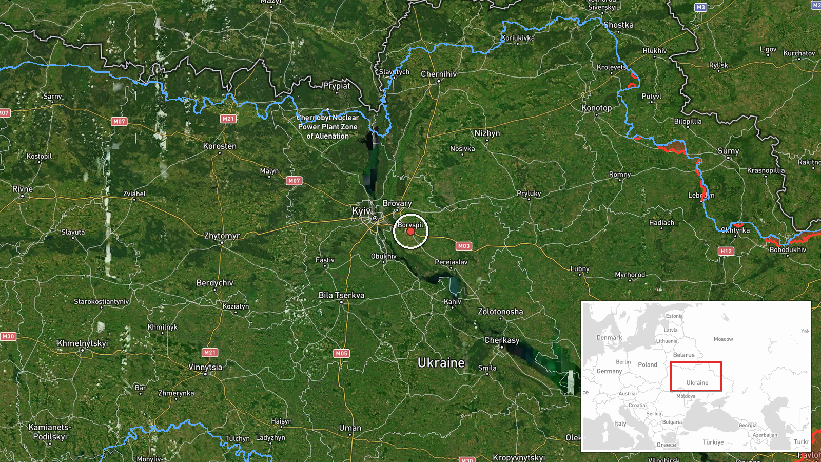
A Russian reactive (jet-powered) drone was detected in Boryspil District, Kyiv Oblast on September 14 at 06:05 UTC. The drone was in transit with no impact reported. According to the Telegram channel @war_monitor, the sighting was logged as one reactive drone passing through the region. Boryspil District lies southeast of Kyiv city proper and contains Boryspil Airport, a major civil aviation hub.
Context and assessment
The detection occurs amid an established pattern of Russian drone incursions into the Kyiv region. On September 13, Ukrainian air defenses issued ballistic missile threat warnings for Kyiv and Kyiv Oblast, with assessments noting low drone threat levels at that time. However, subsequent reports document continued transit of Shahed-variant reactive drones over Kyiv districts, including Demiivka and Teremky on the same date. These transits suggest Russian drone operations are maintaining pressure on Ukrainian airspace around the capital, though most appear to be reconnaissance or transit routes rather than targeting strikes on the city itself.
Sources and confidence
Single source: Telegram channel @war_monitor. No cross-confirmation from Ukrainian air defense or official statements included in the event data. Confidence score of 6.0 reflects limited source corroboration. Cross-confirmation from air raid alerts or Defense Ministry statements would increase confidence; clarification of final drone destination would strengthen assessment.
Location
Boryspil District, located approximately 35 kilometers southeast of central Kyiv in Kyiv Oblast. The district contains Boryspil Airport (also Zhuliany Airport), one of Ukraine's principal civil aviation facilities. Coordinates place the detection in the immediate airport vicinity, suggesting either approach corridors or airspace transits over critical infrastructure.
Related events nearby
- Air raid siren alert issued for Lukyanovka district, Kyiv. Reactive/jet-engine drone (Shahed variant) detected2026-09-13 19:42 UTC · Siren · Nova Zabudova, Kyiv, Ukraine
- Commander-in-Chief of Ukrainian Armed Forces Mikhaylo Drapaty commemorates Tank Forces Day. He emphasizes the 2026-09-14 04:31 UTC · Statement · Kyiv, Ukraine
- Ukraine issues ballistic missile threat warning for Kyiv and Kyiv Oblast over next several days. Strategic avi2026-09-13 18:35 UTC · Siren · Kyiv, Ukraine
- Russian reactive/jet-engine drone (Shahed variant) detected transiting over Teremky district, Kyiv, as part of2026-09-13 19:42 UTC · Drone Transit · Demiivka, Kyiv, Ukraine
- Russian mobile air defense group shot down a Ukrainian An-196 Lutyi long-range reconnaissance drone.2026-09-13 19:00 UTC · Drone Shootdown · Eastern Ukraine
▶ View this event on the live map
Intel Mapper aggregates open-source reports from monitored Telegram and X channels, geolocates them, cross-checks duplicates across sources and assigns a confidence score. Entries are updated as new confirmations arrive. Read how we verify events.