Three Russian reactive drones transiting toward Slavutych, Chernihiv Oblast
What happened
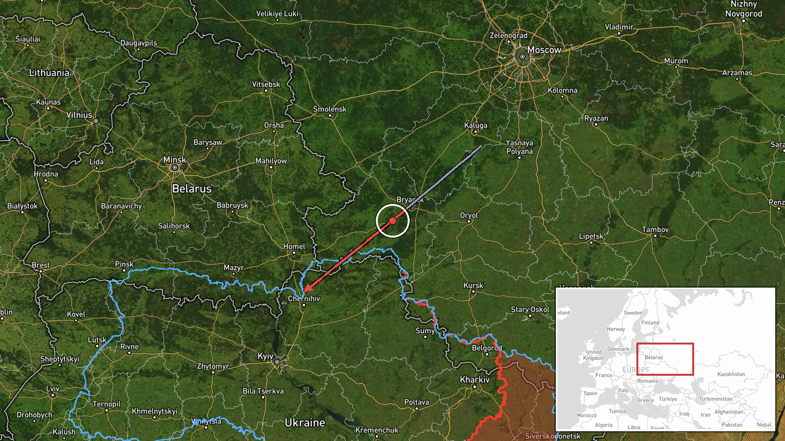
Three Russian reactive (jet-powered) drones were detected flying from Bryansk Oblast toward Slavutych in Chernihiv Oblast on 14 September at 06:05 UTC. The report, issued by Kyiv-region reconnaissance via Telegram, describes the drones as still in transit with no impact yet reported. Reactive drones typically refer to loitering munitions or cruise-type unmanned systems powered by jet engines, as distinct from quadcopter variants.
Context and assessment
Slavutych lies northeast of Kyiv near the Pripyat River and serves as the administrative center for the Chornobyl nuclear power plant zone. The settlement has periodic significance as a logistical hub and potential transit corridor. This detection follows sustained Russian drone operations reported across Kyiv Oblast on 13 September, including sightings of Shahed-variant reactive drones and ballistic missile threat warnings. The pattern suggests continued Russian pressure on northern Ukraine via stand-off systems, though the effectiveness and scale remain unclear from available reports.
Sources and confidence
Single source: Telegram channel @war_monitor (Kyiv-region reconnaissance). No cross-confirmation from independent verification or Ukrainian air defense statements yet reported. Confidence score of 6.0 reflects typical single-channel reporting; confirmation via official Ukrainian air force or SBU statements, or impact assessment, would strengthen confidence. Geotagging or secondary observation would also validate.
Location
Slavutych is a settlement in northern Chernihiv Oblast at approximately 51.40°N, 30.66°E. It lies roughly 50 kilometers northeast of Kyiv and within 20 kilometers of the Chornobyl exclusion zone. The town sits on the Pripyat River's eastern floodplain in relatively open terrain, making it visible to Russian air operations originating from Bryansk.
Related events nearby
- Russian mobile air defense group shot down a Ukrainian An-196 Lutyi long-range reconnaissance drone.2026-09-13 19:00 UTC · Drone Shootdown · Eastern Ukraine
- Air raid siren alert issued for Lukyanovka district, Kyiv. Reactive/jet-engine drone (Shahed variant) detected2026-09-13 19:42 UTC · Siren · Nova Zabudova, Kyiv, Ukraine
- Ukraine issues ballistic missile threat warning for Kyiv and Kyiv Oblast over next several days. Strategic avi2026-09-13 18:35 UTC · Siren · Kyiv, Ukraine
- Commander-in-Chief of Ukrainian Armed Forces Mikhaylo Drapaty commemorates Tank Forces Day. He emphasizes the 2026-09-14 04:31 UTC · Statement · Kyiv, Ukraine
- Russian reactive/jet-engine drone (Shahed variant) detected transiting over Teremky district, Kyiv, as part of2026-09-13 19:42 UTC · Drone Transit · Demiivka, Kyiv, Ukraine
▶ View this event on the live map
Intel Mapper aggregates open-source reports from monitored Telegram and X channels, geolocates them, cross-checks duplicates across sources and assigns a confidence score. Entries are updated as new confirmations arrive. Read how we verify events.