Russian Shahed drone detected transiting over Slavutych, Kyiv Oblast
What happened
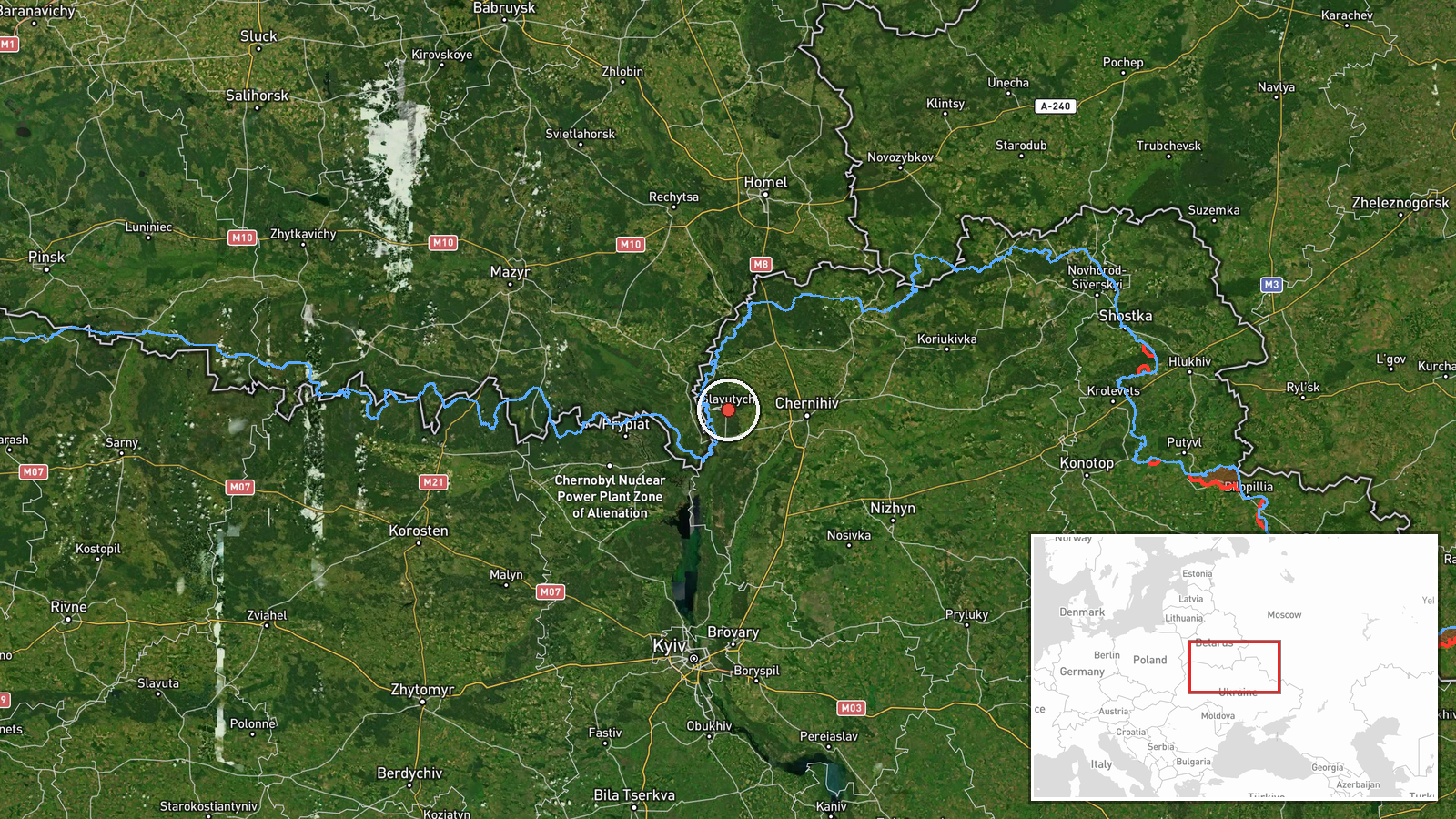
A Russian reconnaissance and attack drone of the Shahed variant, reportedly equipped with jet propulsion, was detected in transit over Slavutych in Kyiv Oblast on 17 September at 13:46 UTC. The sighting was reported via Telegram channel @war_monitor. Slavutych lies approximately 50 kilometers north of Kyiv city. The drone's operational purpose—reconnaissance, attack preparation, or transit to another target—was not specified in the report.
Context and assessment
Slavutych sits near the defunct Chornobyl Nuclear Power Plant and serves as a critical administrative and logistical node for northern Kyiv Oblast. The sighting is consistent with a sustained pattern of Russian drone activity across the Kyiv region documented over the preceding 24 hours. Related reports from 16–17 September indicate multiple Shahed-variant drones transiting through Chernihiv District and Brovary District, with ballistic missile threats also detected from Bryansk and Kursk oblasts. This apparent concentration of air activity suggests either a coordinated reconnaissance campaign ahead of strikes, preparation for attacks on infrastructure or military positions, or routing of munitions toward Kyiv proper. The frequency and proximity of sightings to the capital indicate sustained Russian air pressure.
Sources and confidence
Reported by single Telegram channel @war_monitor with no corroborating cross-source confirmation in available data. Confidence score of 6.0 reflects the single-source basis and lack of independent verification. Confidence would increase with reports from official Ukrainian air defense statements, multiple independent Telegram channels, or satellite imagery. Score would lower if the report were contradicted or retracted.
Location
Slavutych is a named settlement in Kyiv Oblast, located at approximately 51.52°N, 30.76°E, roughly 50 kilometers north-northeast of central Kyiv. The town lies on the Pripyat River and adjacent to the exclusion zone boundary of Chornobyl. Its geographic isolation and proximity to critical infrastructure make it a logical transit corridor for Russian air operations.
Related events nearby
- Seven Russian jet-powered (reactive) Shahed-variant kamikaze drones transiting from Bryansk toward Chernihiv D2026-09-16 16:04 UTC · Drone Transit · Chernihiv District, Chernihiv Oblast, Ukraine
- Russian ballistic missile threat from Bryansk Oblast targeting Kyiv. Kinzhal hypersonic missiles launched from2026-09-16 23:15 UTC · Ballistic Missile · Nizhyn, Chernihiv Oblast, Ukraine
- Four Russian cruise missiles (Shahed/Kalibr-type kamikaze drones, incorrectly labeled 'Banderoль' in source ar2026-09-17 15:37 UTC · Drone Transit · En route: Nizhyn, Chernihiv Oblast → Kyiv Oblast,
- Additional sighting: two Russian jet-powered (reactive) Shahed-variant kamikaze drones transiting toward Brova2026-09-16 21:10 UTC · Drone Transit · Brovary District, Kyiv Oblast, Ukraine
- Russian reconnaissance/attack drone (Shahed variant with jet propulsion) detected in transit over Lukianivka, 2026-09-17 13:39 UTC · Drone Transit · Lukianivka, Podil District, Kyiv, Ukraine
▶ View this event on the live map
Intel Mapper aggregates open-source reports from monitored Telegram and X channels, geolocates them, cross-checks duplicates across sources and assigns a confidence score. Entries are updated as new confirmations arrive. Read how we verify events.