Russian Shahed drone transits over Kyiv's Luk'yanivka neighborhood
What happened
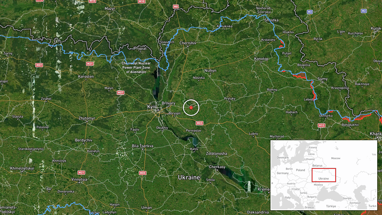
A Russian jet-powered Shahed-variant reconnaissance or attack drone was detected in transit over the Luk'yanivka neighborhood in central Kyiv on September 17 at approximately 18:59 UTC, according to Telegram air raid monitoring channel @war_monitor. The drone was reportedly flying at 1.8 kilometers altitude. The report does not indicate whether air defenses engaged the aircraft or whether it struck any target.
Context and assessment
This sighting represents a continuation of sustained Russian unmanned aerial operations over Kyiv and its suburbs across September 16–17. Related detections within the same period include Shahed transits over the Podil district at higher altitude (2.7 km) and over Brovary District in Kyiv Oblast, as well as confirmed strikes on civilian infrastructure. The pattern suggests Russia is maintaining persistent reconnaissance and attack drone pressure on the capital region, likely probing air defenses and targeting infrastructure. Luk'yanivka, located in central Kyiv's Podil administrative area, is a residential neighborhood with no known military installations, indicating possible surveillance or transit routing toward other targets.
Sources and confidence
Reported solely by Telegram channel @war_monitor, an air raid monitoring service. Single-source reporting limits corroboration; confidence score of 6.0 reflects typical reliability of air raid alert networks but absence of independent confirmation. Score would increase with reports from Ukrainian official channels or air defense statements; would decrease if contradicted by other sources or if the sighting were retracted.
Location
Luk'yanivka neighborhood in Kyiv's Podil district, central city area. Coordinates place the sighting at approximately 50.49°N, 31.38°E. The neighborhood is situated in a built-up urban zone along the Dnieper River's right bank, with residential and commercial infrastructure. No military significance is known to attach to the specific location, suggesting the drone was in transit rather than executing a terminal maneuver.
Related events nearby
- Additional sighting: two Russian jet-powered (reactive) Shahed-variant kamikaze drones transiting toward Brova2026-09-16 21:10 UTC · Drone Transit · Brovary District, Kyiv Oblast, Ukraine
- Russian reconnaissance/attack drone (Shahed variant with jet propulsion) detected in transit over Lukianivka, 2026-09-17 13:39 UTC · Drone Transit · Lukianivka, Podil District, Kyiv, Ukraine
- Russian ballistic missile attack on Kyiv region near 03:00 local time. Ongoing precision strike campaign targe2026-09-16 19:10 UTC · UAS Strike · Kyiv, Kyiv City, Ukraine
- Ukrainian air defense repelled incoming Russian Shahed kamikaze drone attacks over Kyiv and Kyiv Oblast. Multi2026-09-17 02:33 UTC · Siren · Kyiv, Ukraine
- Ukrainian General Staff reports destruction of Russian positions along Oleksandrivskyi direction; commends 82n2026-09-17 14:23 UTC · Statement · Kyiv, Ukraine
▶ View this event on the live map
Intel Mapper aggregates open-source reports from monitored Telegram and X channels, geolocates them, cross-checks duplicates across sources and assigns a confidence score. Entries are updated as new confirmations arrive. Read how we verify events.