Russian Shahed-variant drones tracked toward Odesa Oblast settlement
What happened
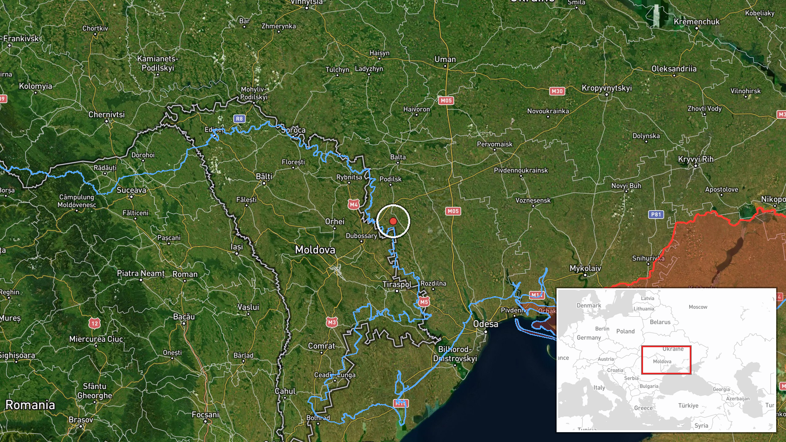
Three UMPB-5 drones, a Shahed-variant reactive-engine unmanned system, were tracked in transit toward Mayaky in Odesa Oblast on 18 September at 00:53 UTC, according to Telegram channel @war_monitor. The report indicates continued Russian drone operations against targets in the region, following similar drone transits observed minutes earlier toward Odesa city proper.
Context and assessment
Mayaky lies in southern Odesa Oblast near the Black Sea coast, an area subject to sustained Russian air and drone operations throughout 2026. The previous night saw Russian missiles strike a 19-storey residential building in Odesa city, injuring three civilians including a child. This drone transit follows a nearly simultaneous report of four Shahed-variant drones headed toward Odesa city at 00:37 UTC on the same date, suggesting a coordinated multi-vector air attack. The concentration of drone activity in rapid succession indicates Russia may be conducting a widespread campaign targeting civilian or military infrastructure across the oblast.
Sources and confidence
Single source from @war_monitor Telegram channel reporting drone transit. No independent cross-confirmation noted in available data. Confidence score of 6.0 reflects single-source reporting on drone tracking, though consistent with contemporaneous reports of similar activity in the same region. Confirmation from multiple independent monitoring channels or Ukrainian air defense statements would strengthen confidence.
Location
Mayaky is a settlement in Odesa Oblast, southern Ukraine, positioned near the Black Sea coastal region at approximately 47.44°N, 29.56°E. The settlement lies within an area subject to regular Russian air operations. Nearby features include the Danube River delta to the south and the coastal plain extending toward the Russian-occupied Crimean Peninsula.
Related events nearby
- Russian missile strike hit a 19-storey residential building in Odesa, injuring 3 people including a child. Par2026-09-17 05:38 UTC · Airstrike · 19-storey apartment building, Odesa, Odesa Oblast,
- Four reactive-engine drones (Shahed variants) tracked in transit toward Odesa city. Ukrainian air raid monitor2026-09-18 00:37 UTC · Drone Transit · Odesa, Odesa Oblast, Ukraine
▶ View this event on the live map
Intel Mapper aggregates open-source reports from monitored Telegram and X channels, geolocates them, cross-checks duplicates across sources and assigns a confidence score. Entries are updated as new confirmations arrive. Read how we verify events.